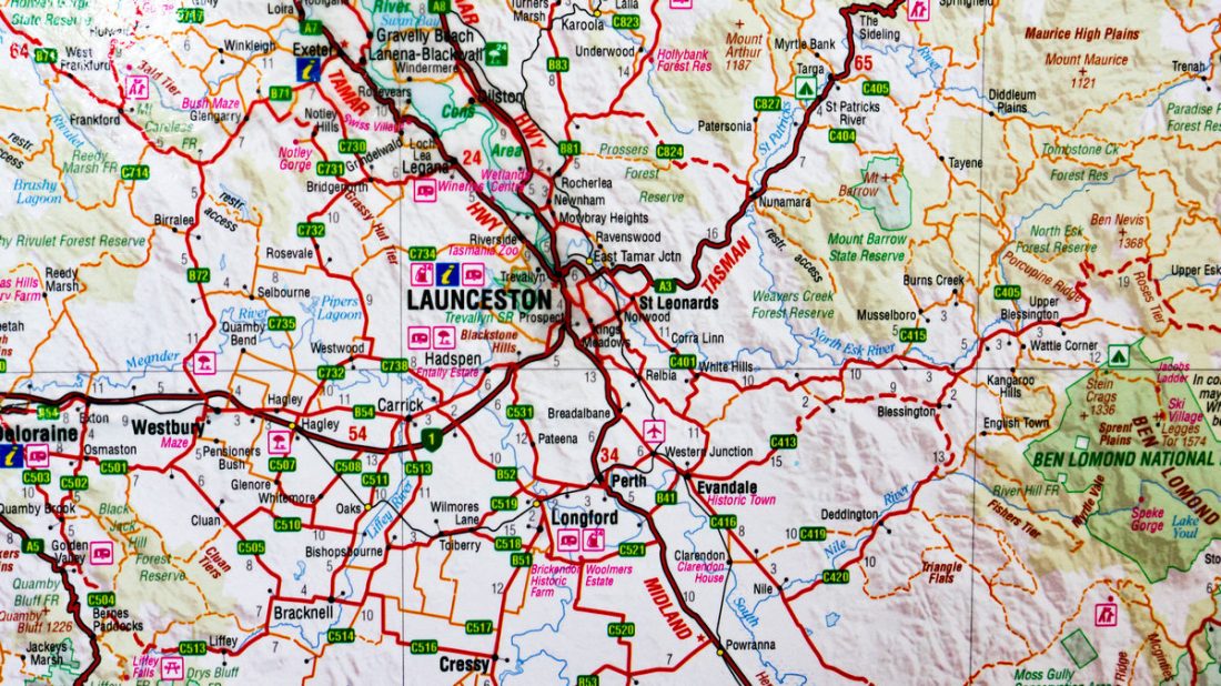
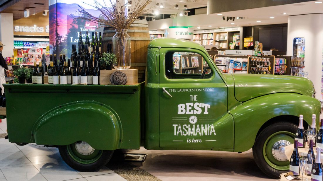
Launceston is a city in the north of Tasmania, Australia at the junction of the North Esk and South Esk rivers where they become the Tamar River (Kanamaluka). Launceston is the second largest city in Tasmania after Hobart and the Thirteenth-largest non-capital city in Australia.
The first inhabitants of the area of Launceston were largely nomadic Aboriginal Tasmanians believed to have been part of the North Midlands Tribe.
The first white visitors did not arrive until 1798, when George Bass and Matthew Flinders were sent to explore the possibility that there was a strait between Australia and Van Diemen’s Land (now Tasmania). They originally landed in Port Dalrymple (the mouth of the Tamar River), 40 kilometres (25 mi) to the north-west of Launceston
The first significant colonial settlement in the region dates from 1804, when the commandant of the British garrison Lt. Col. William Paterson, and his men set up a camp on the current site of George Town. A few weeks later, the settlement was moved across the river to York Town, and a year later was moved to its definitive position where Launceston stands.
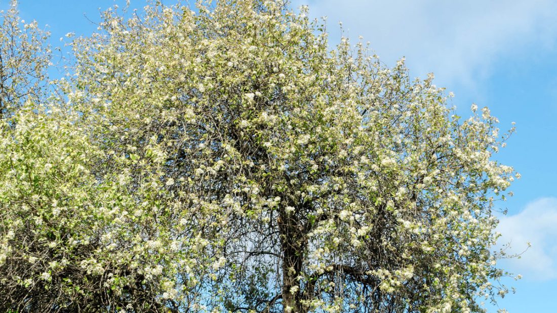
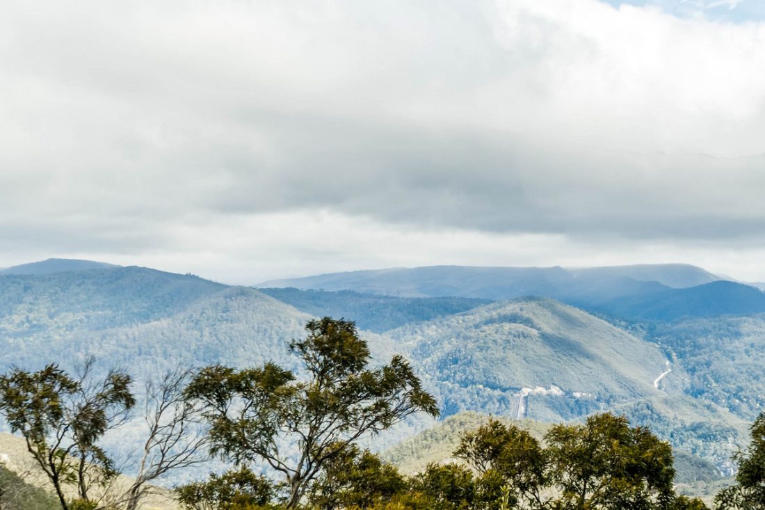
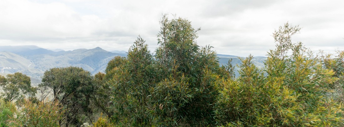
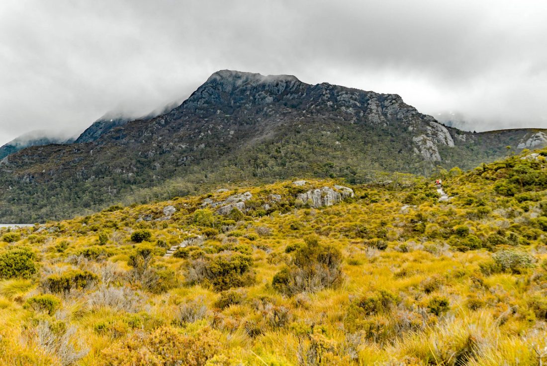
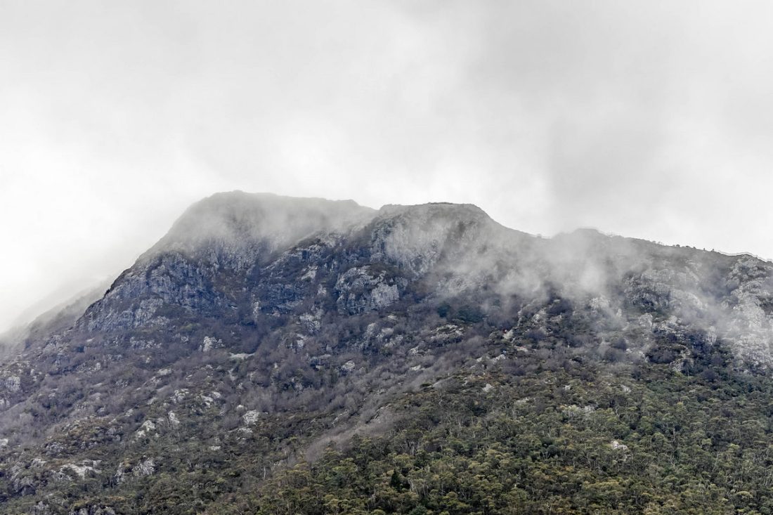
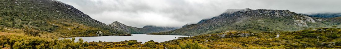
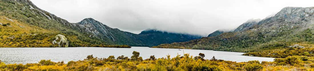
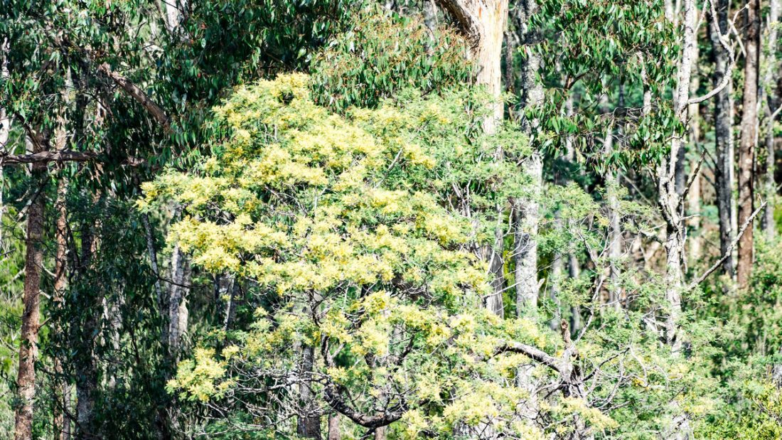
Cradle Mountain
Tauchen Sie ein in die Wälder Tasmaniens und erleben Sie die einsame Wildnis, Wasserfälle, Gletscherseen, der Regenwald, Wildtiere und die einzigartige Schönheit des Cradle Mountain. Der Nationalpark gehört zum UNESCO-Welterbe.
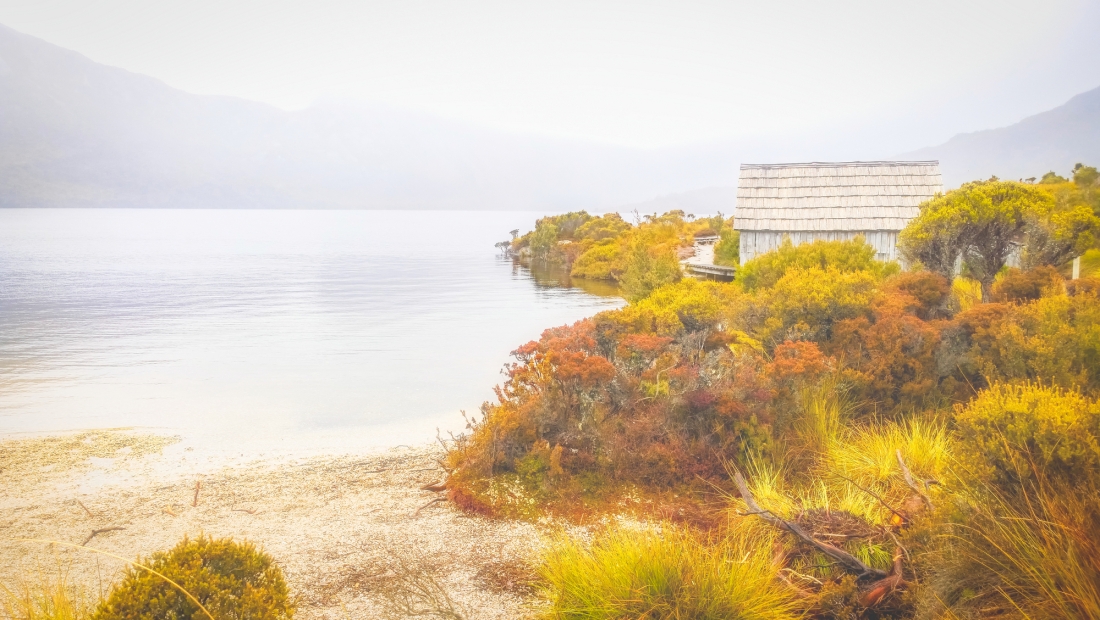
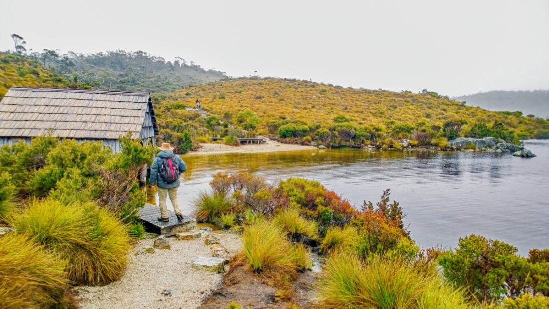
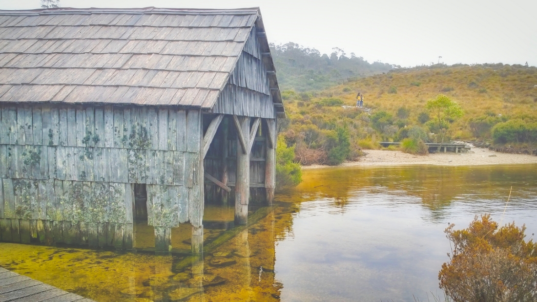
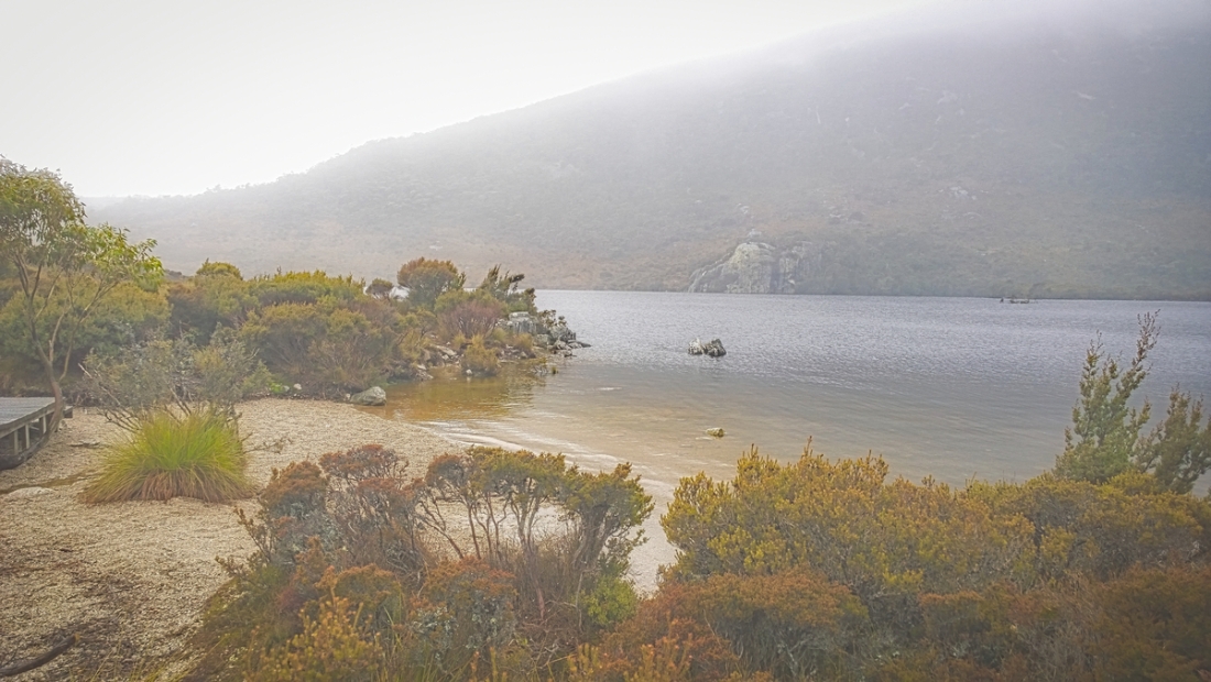
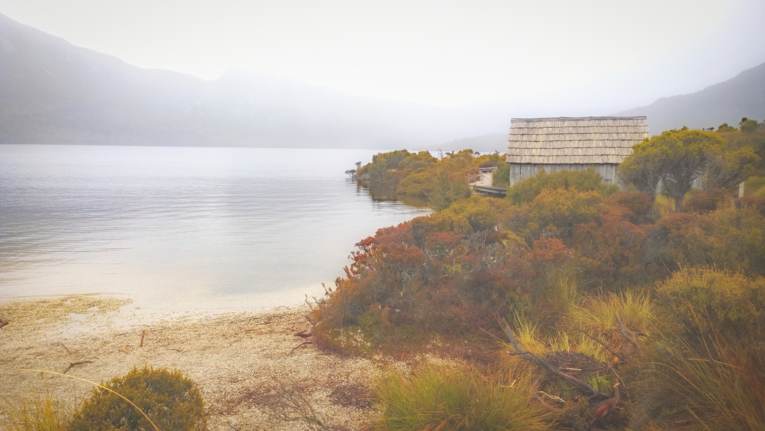
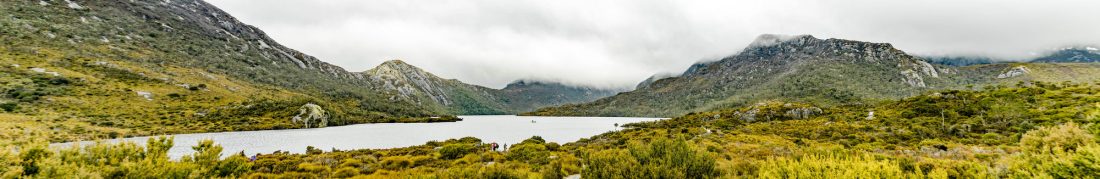
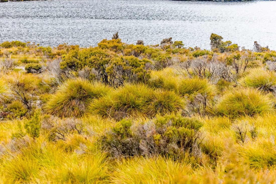
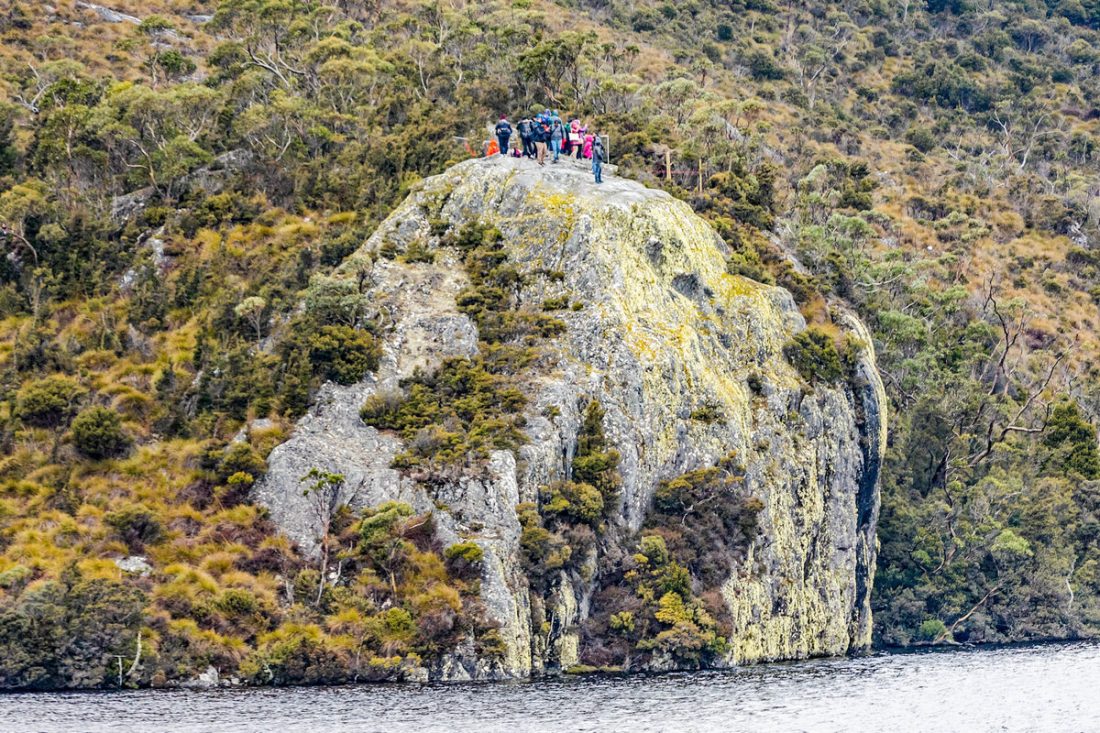
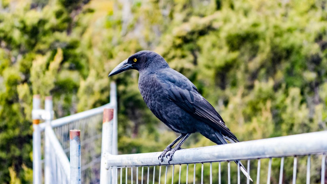
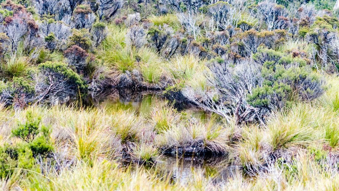
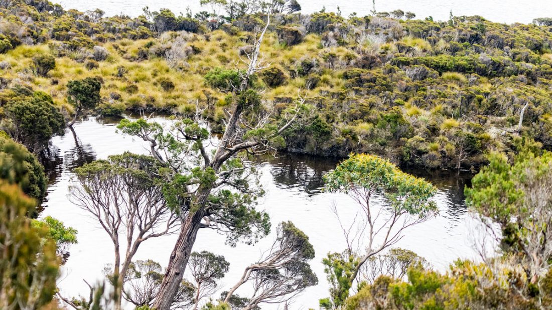
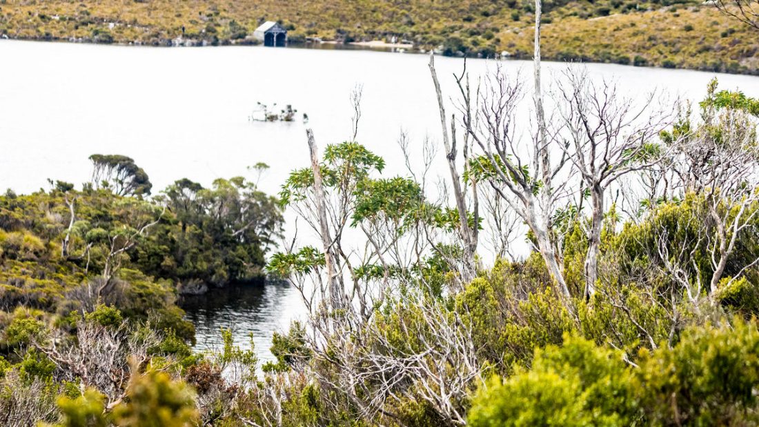
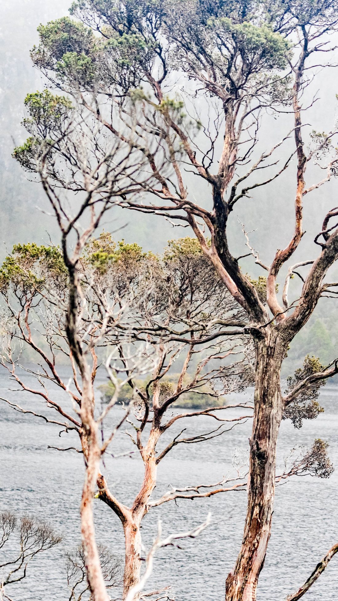
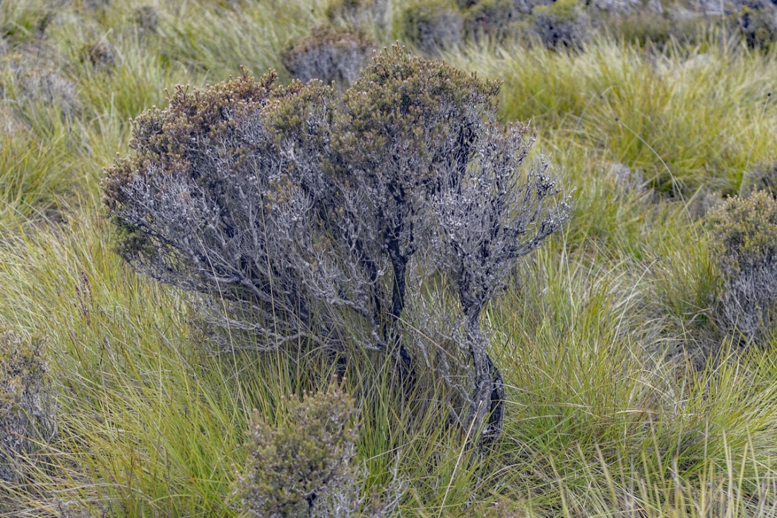
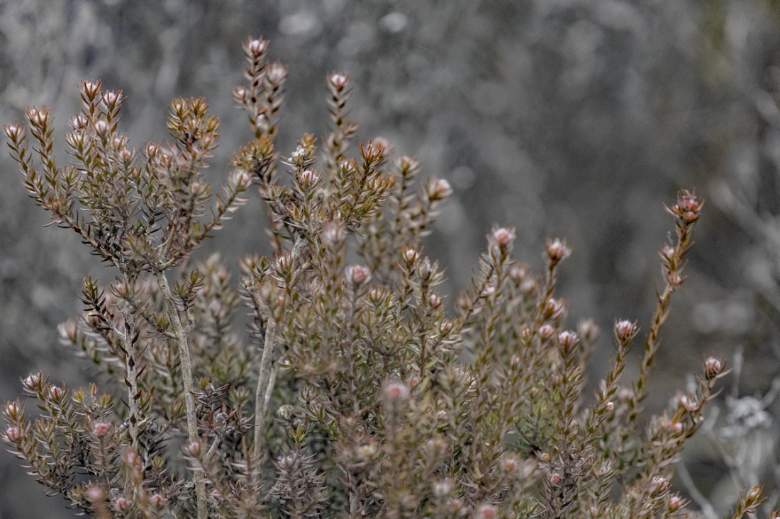
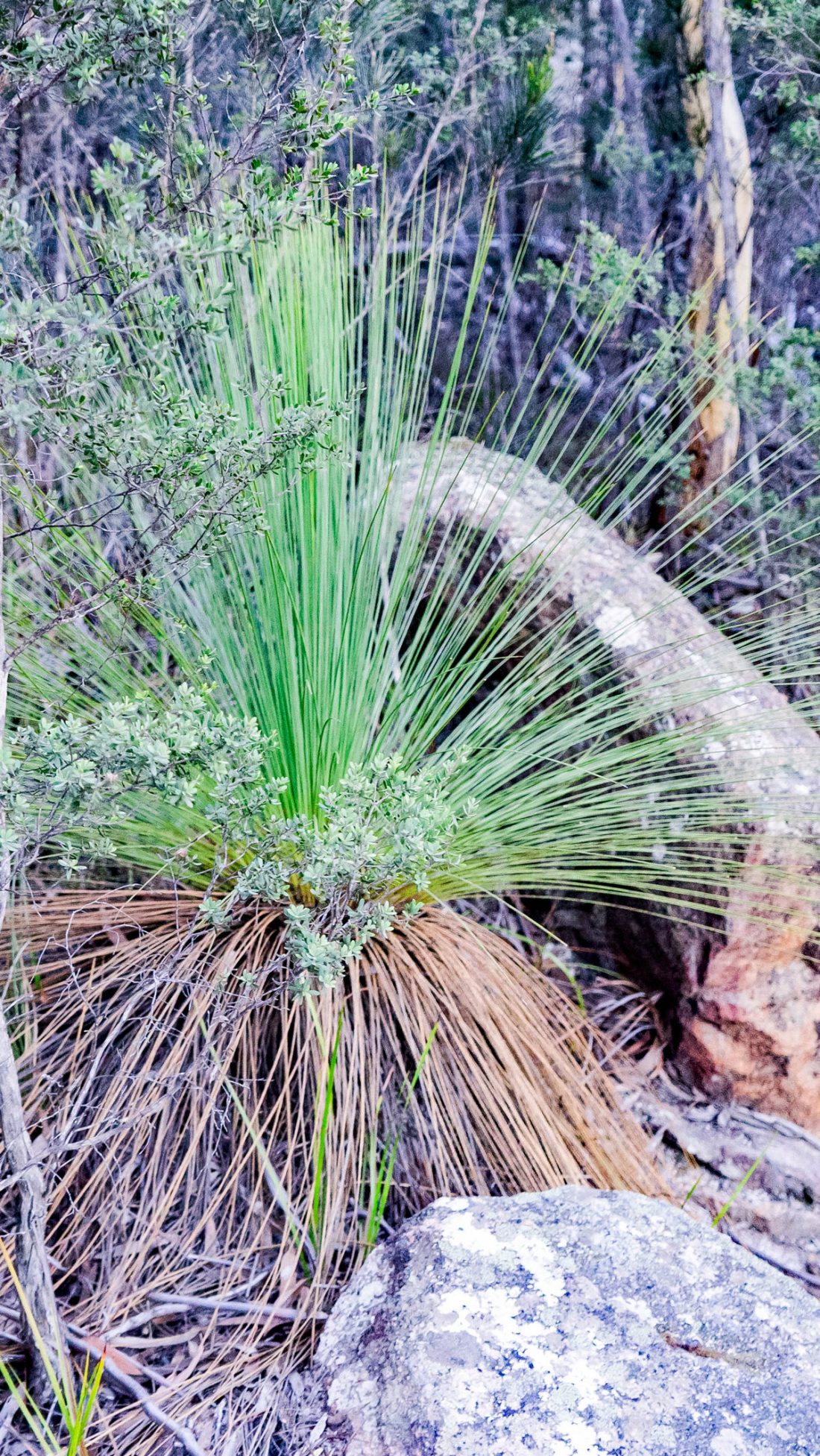
Dove Lake is a corrie lake near Cradle Mountain in the central highlands region of Tasmania, Australia. It lies in the Cradle Mountain-Lake St Clair National Park. The lake is a very popular visitor attraction and is encircled by well maintained walking paths which also lead up onto Cradle Mountain. It was named by prominent local Gustav Weindorfer after an official of the Van Diemen’s Land Company.
Dove Lake
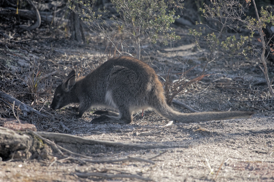
Like several other lakes in the region, Lake Dove was formed by glaciation. The habitat is unique and includes the Tasmanian deciduous beech (Nothofagus gunnii), tussock grasses, snow gums and pencil pines. Among animals wandering the shores of the lake are numerous wombats, echidnas, pademelons and tiger snakes.
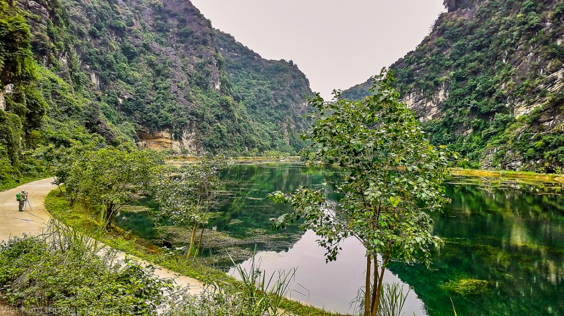
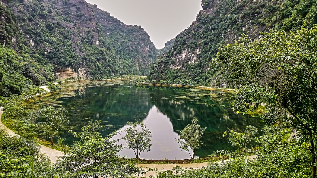
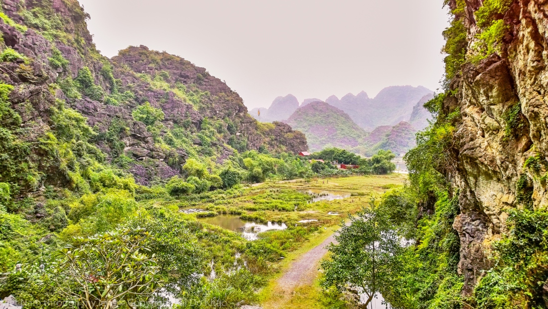
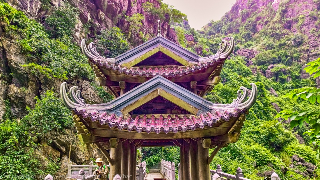
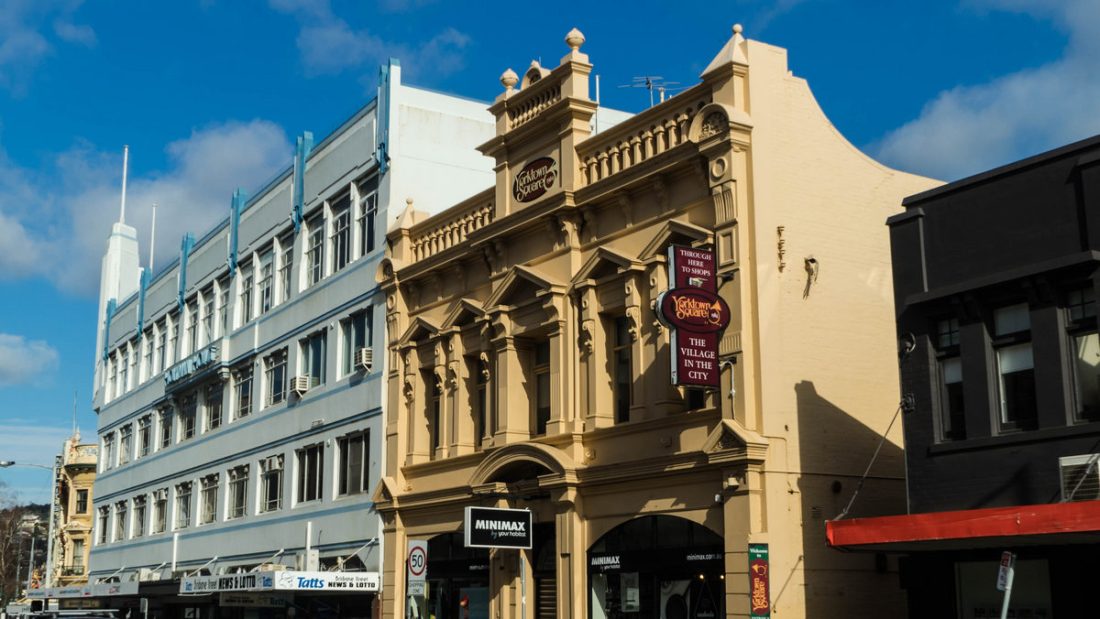
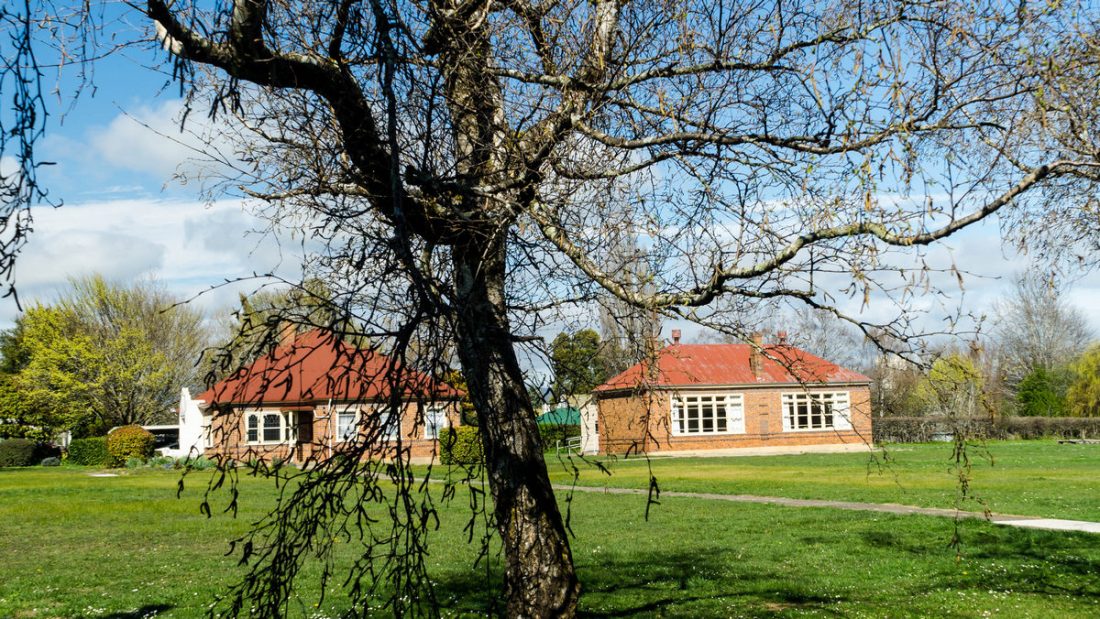
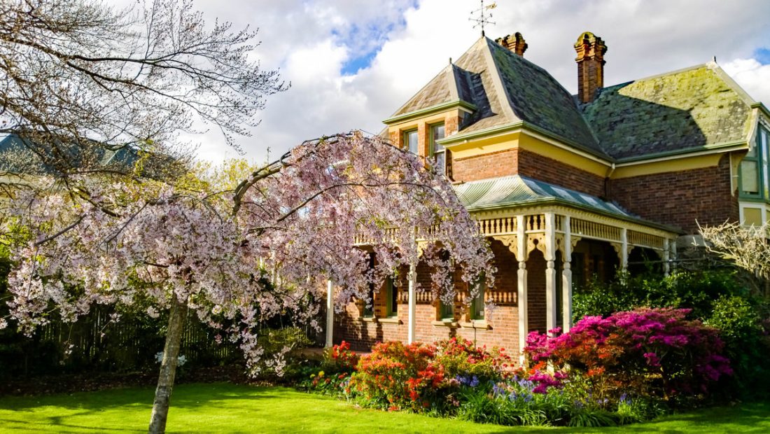
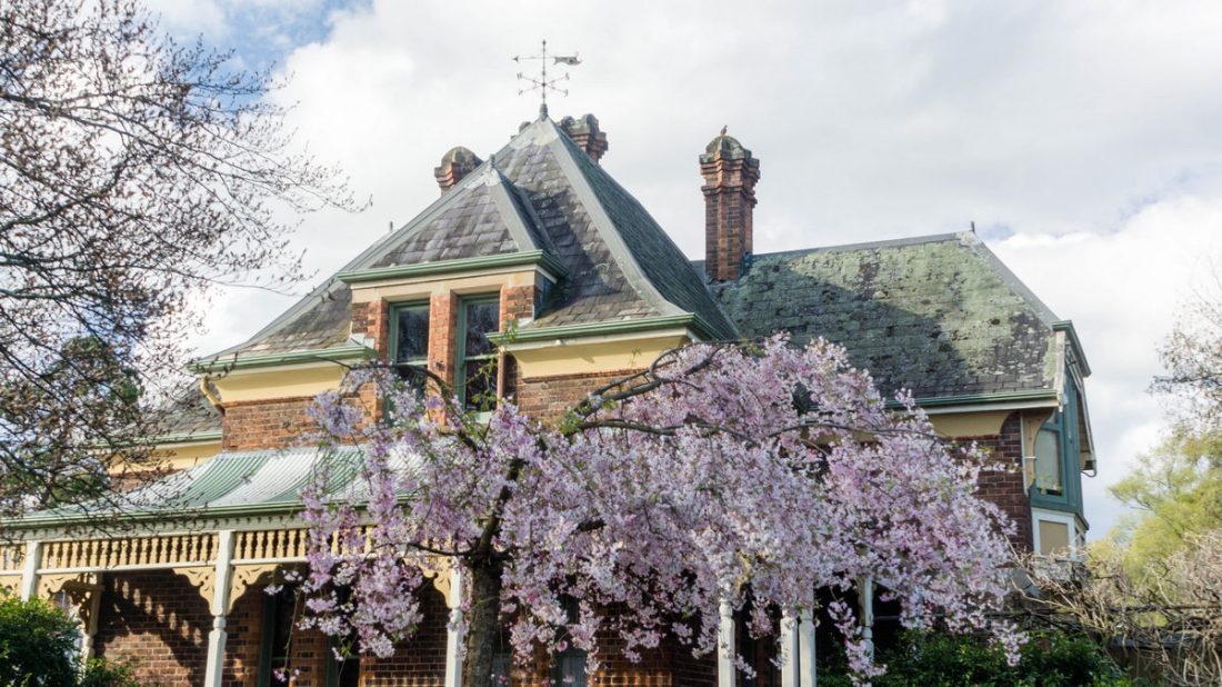
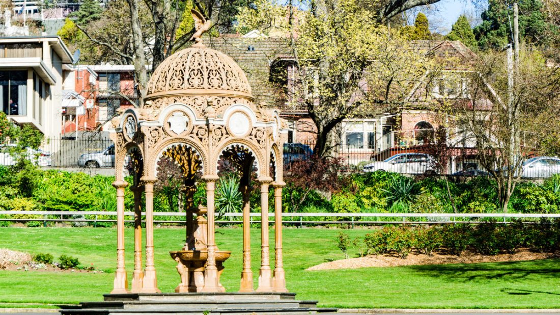
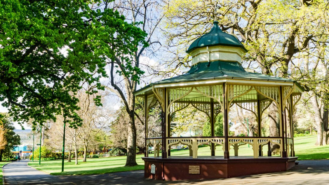
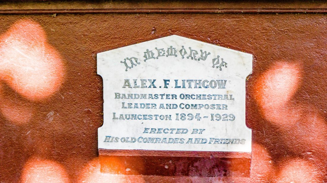
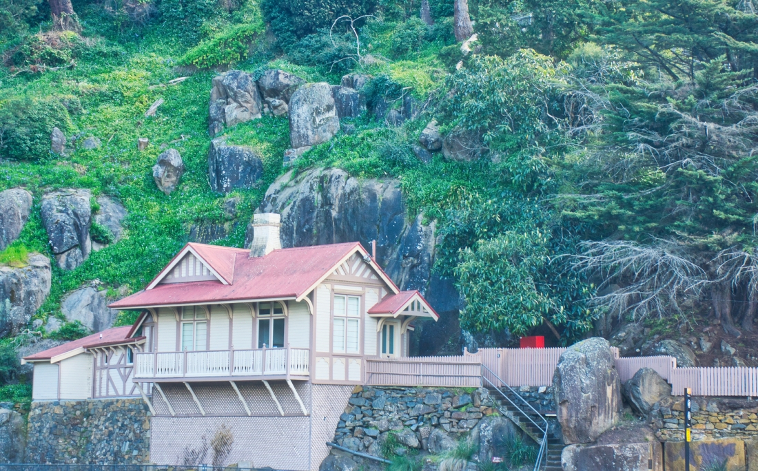
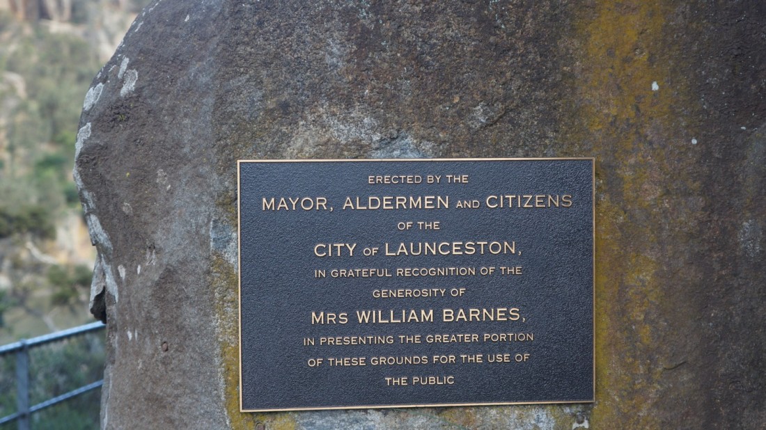
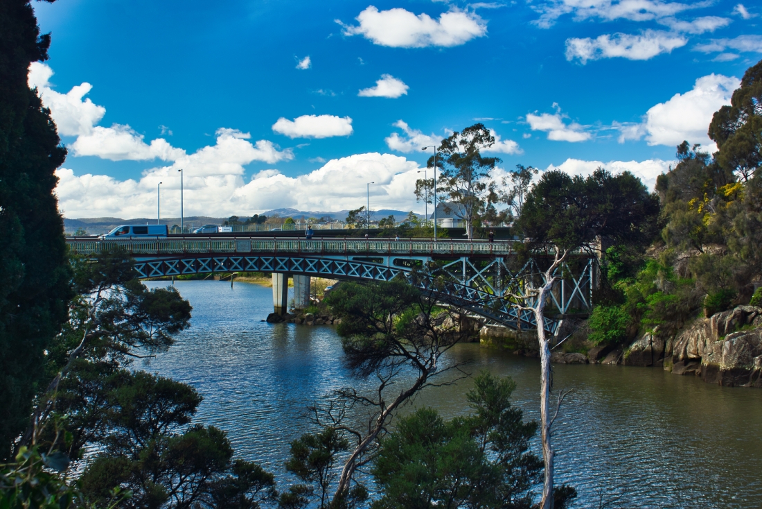
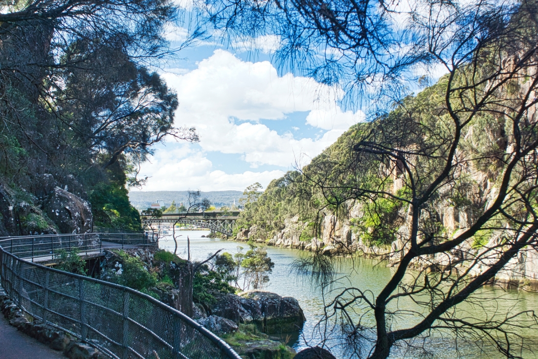
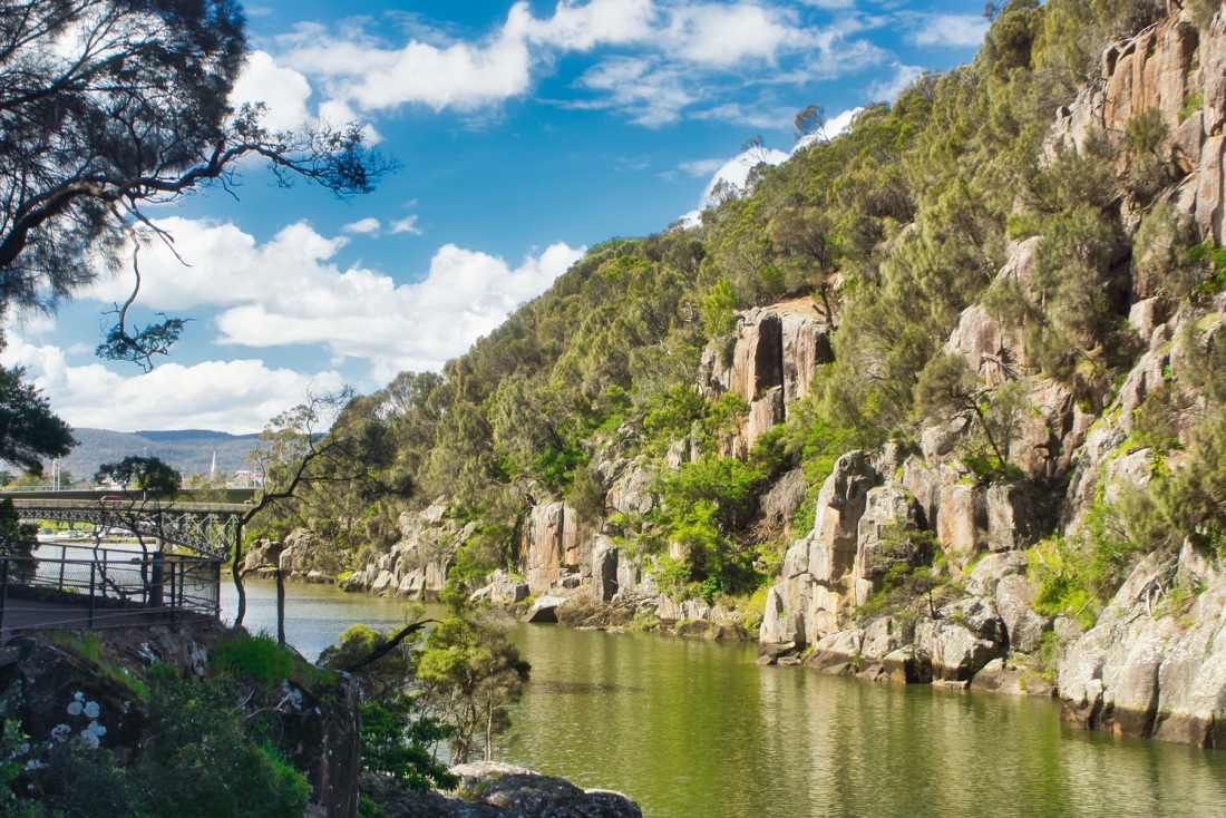
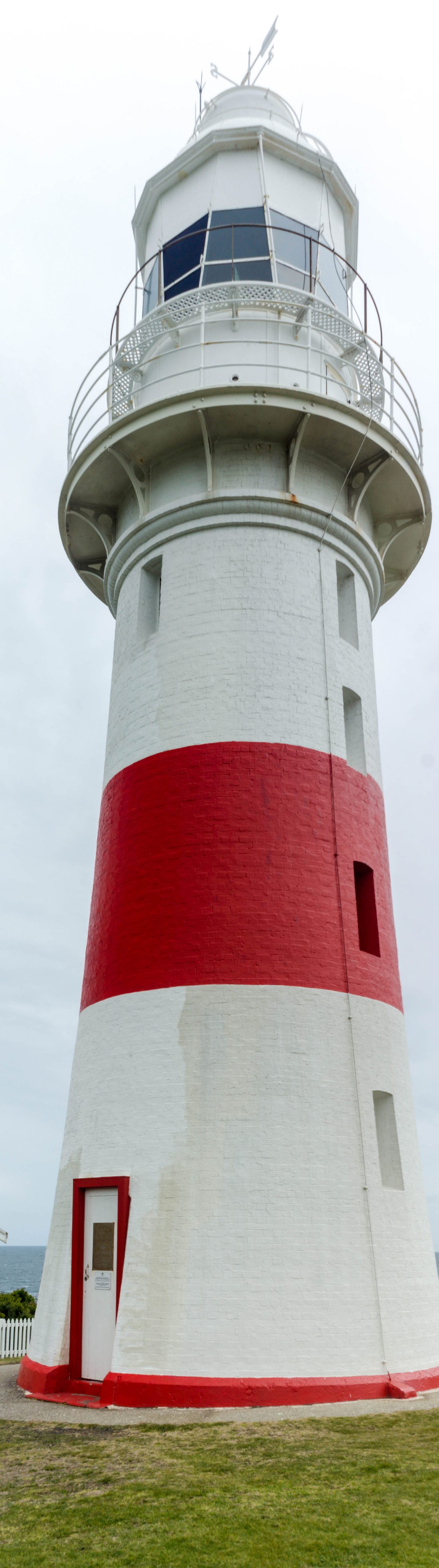
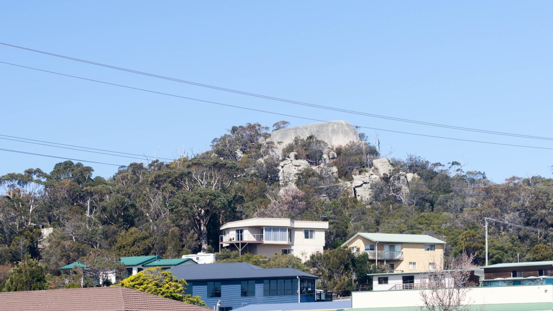
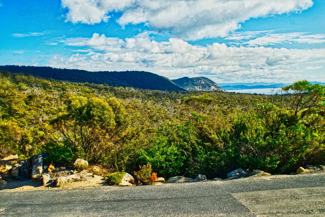
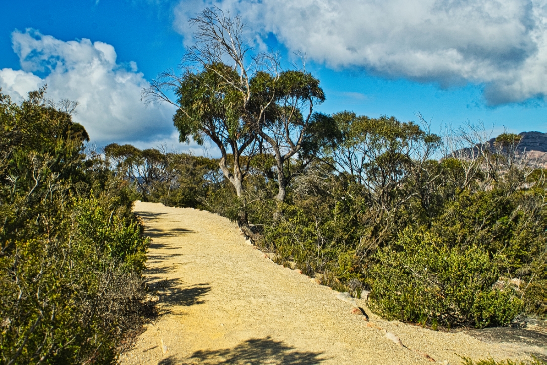
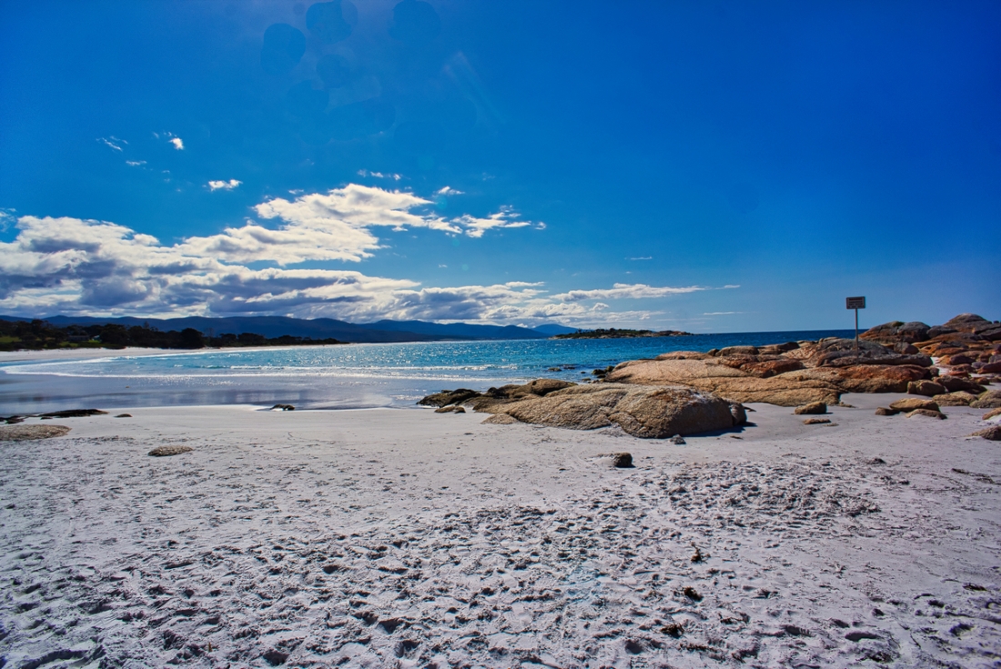
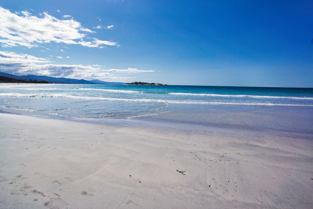
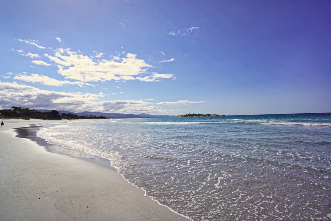
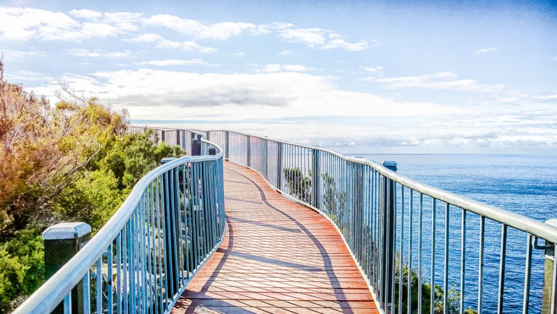
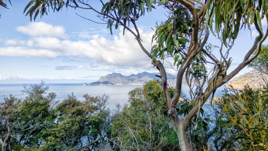
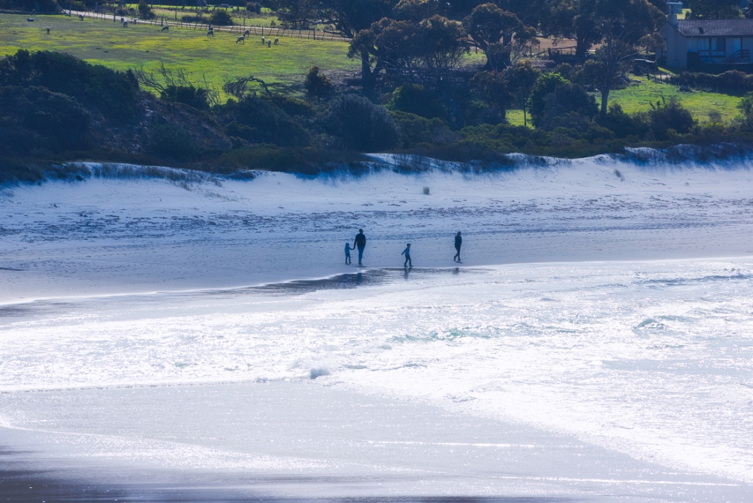
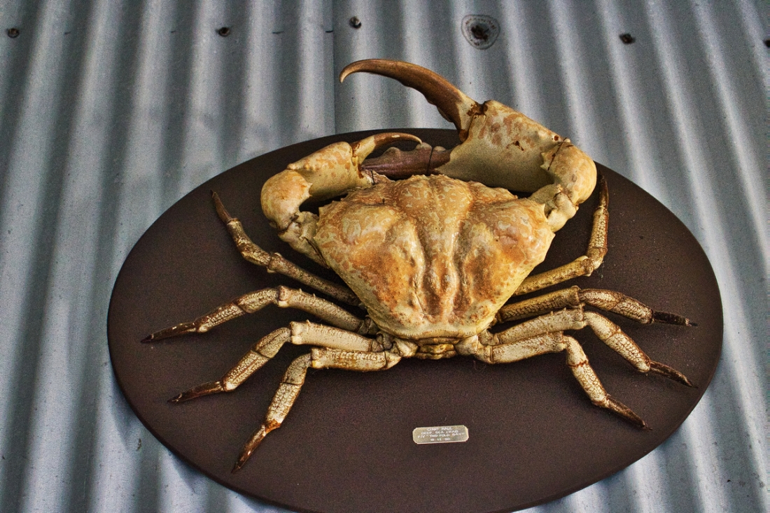
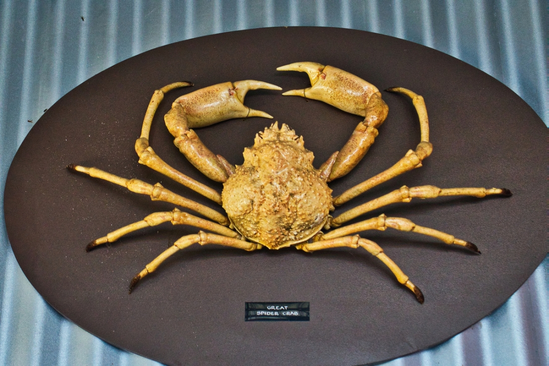
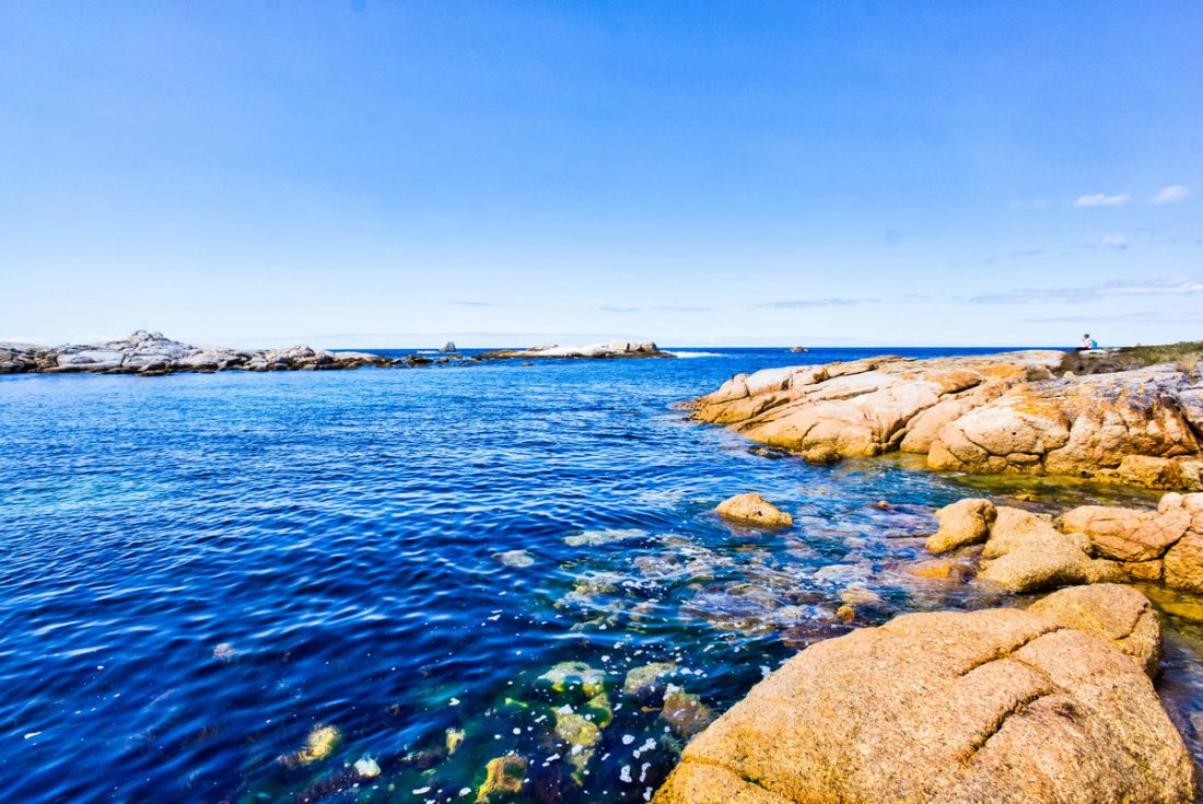
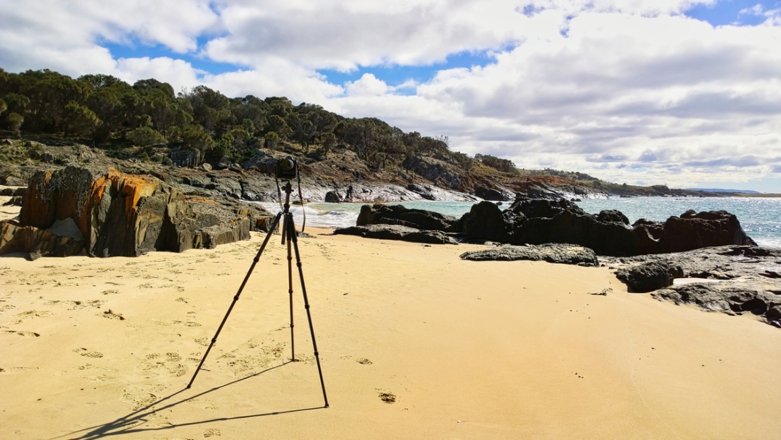
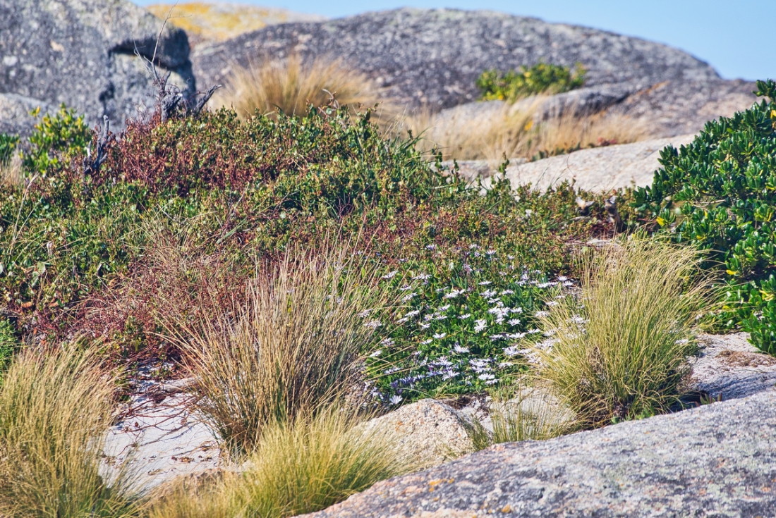
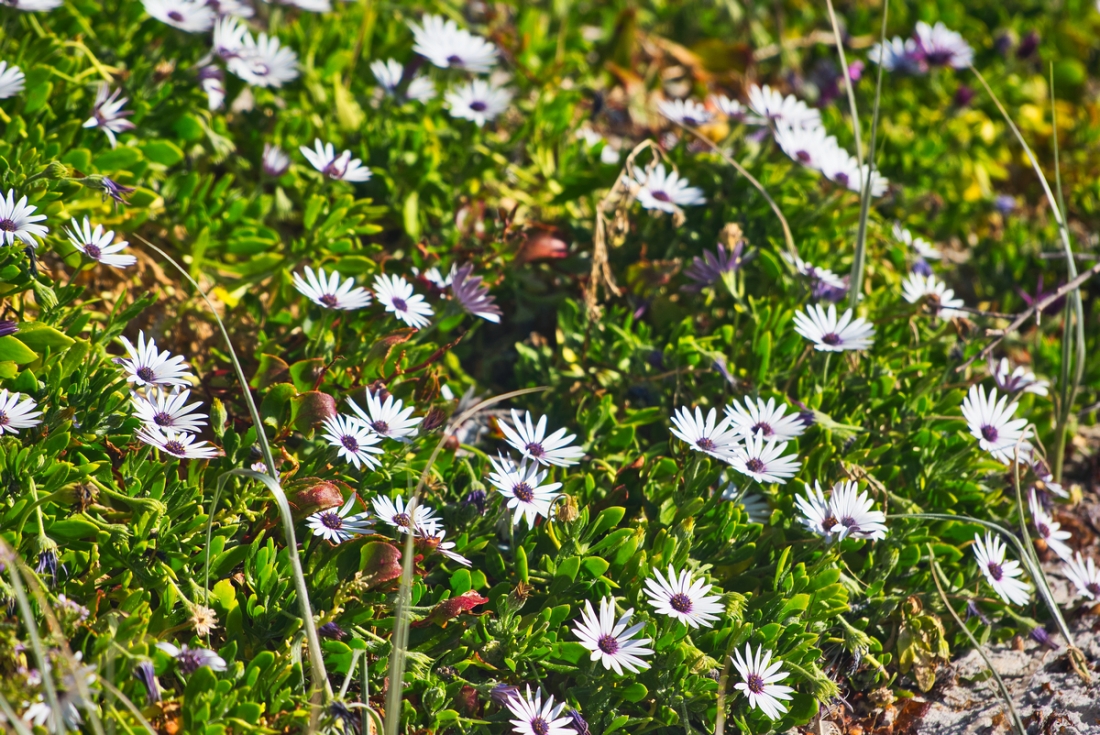
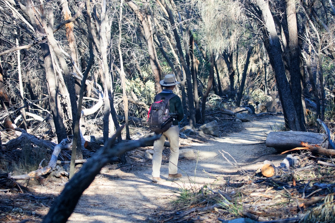
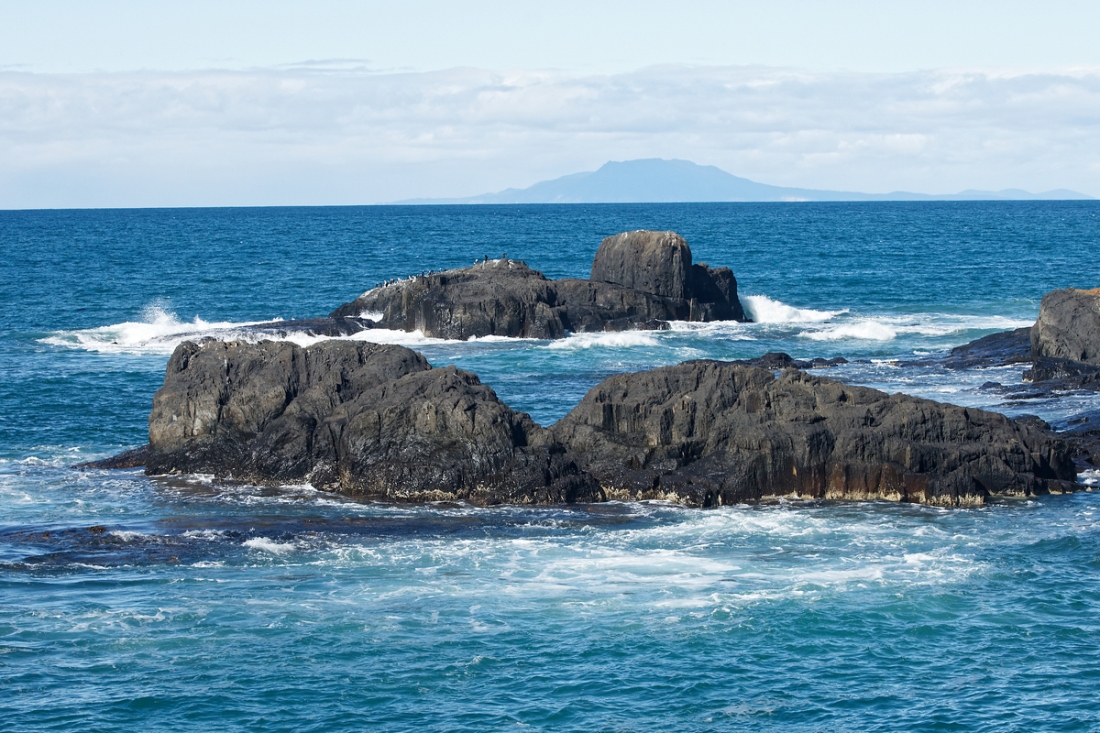
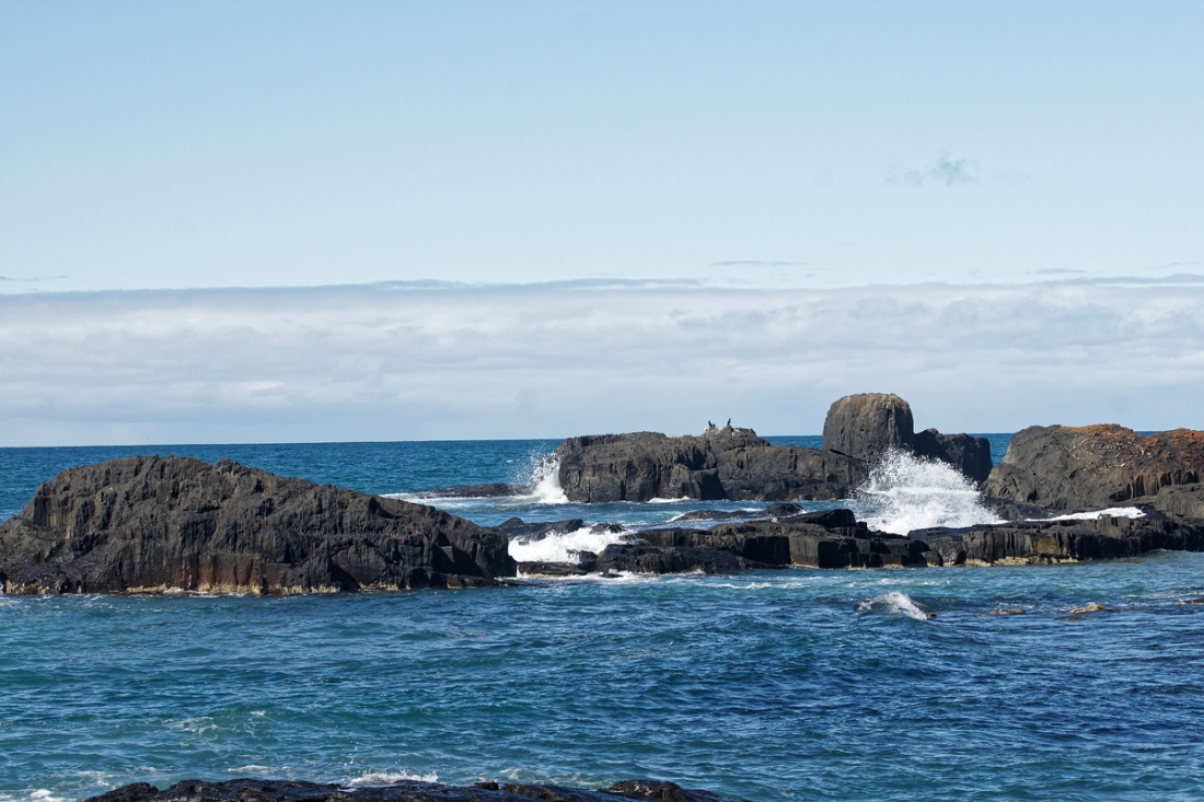
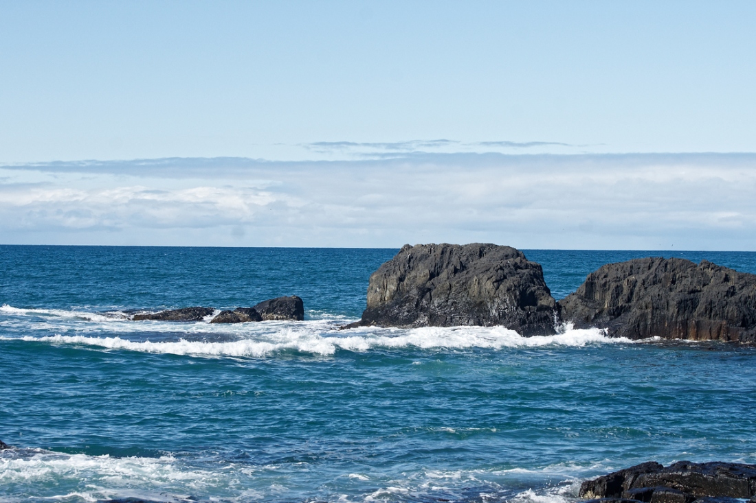
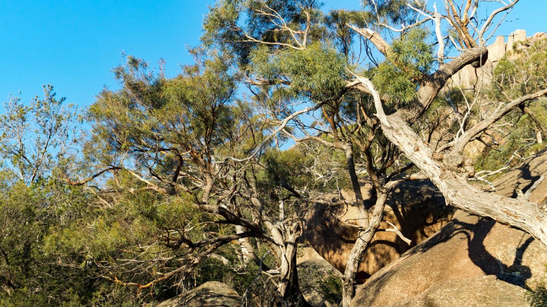
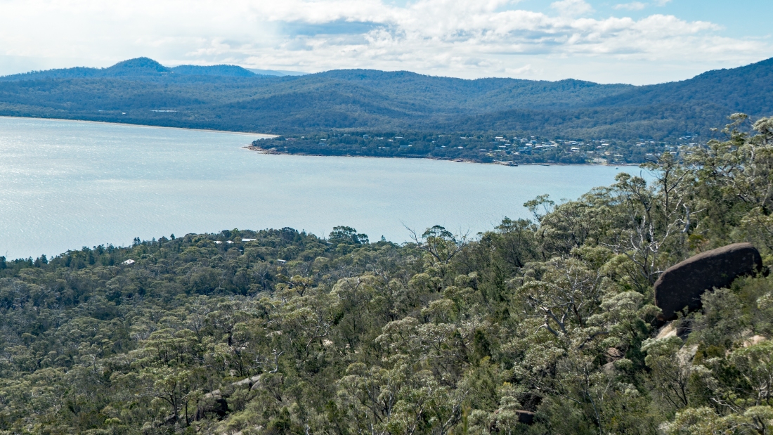
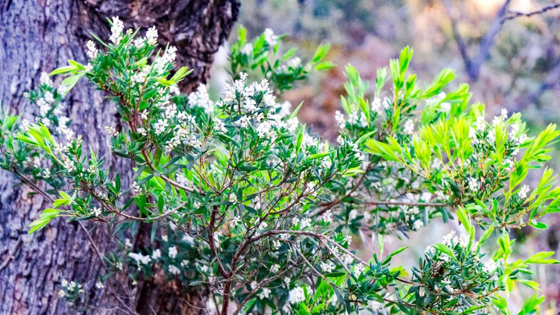
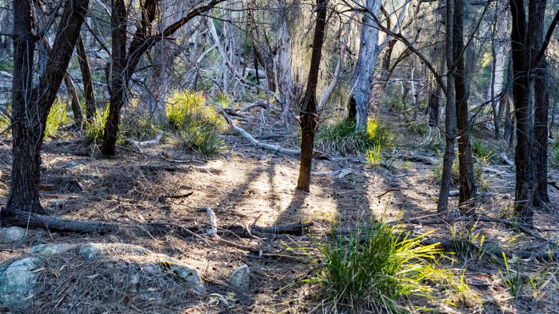
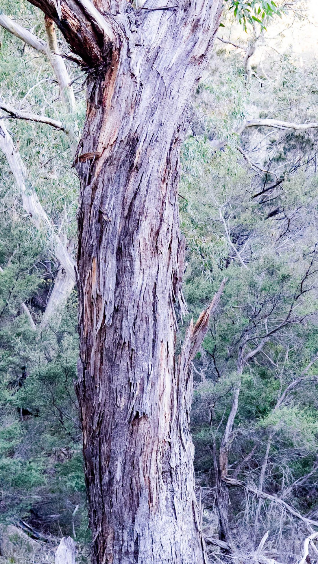
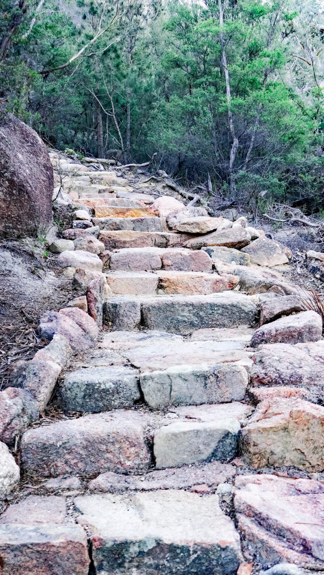
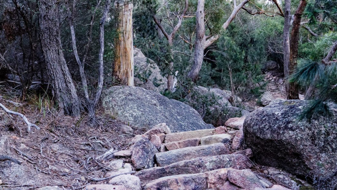
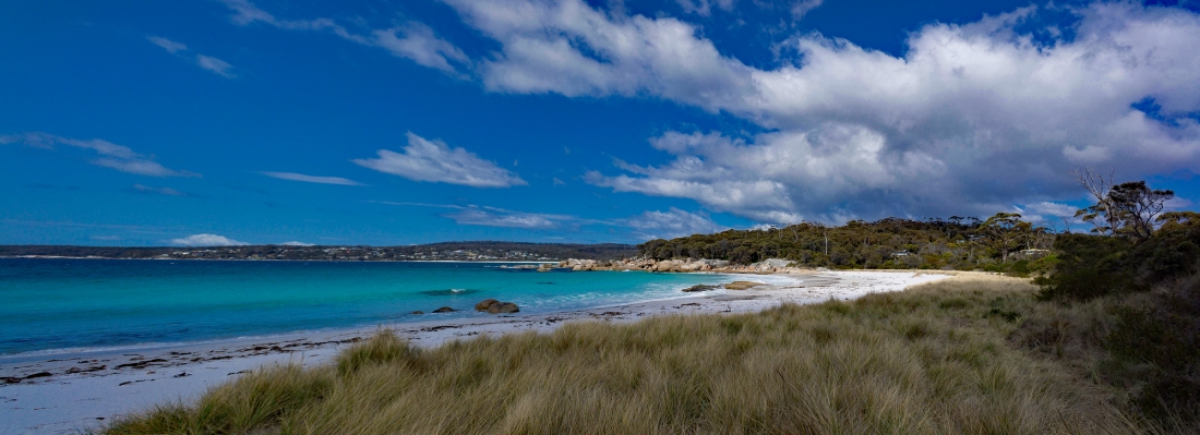
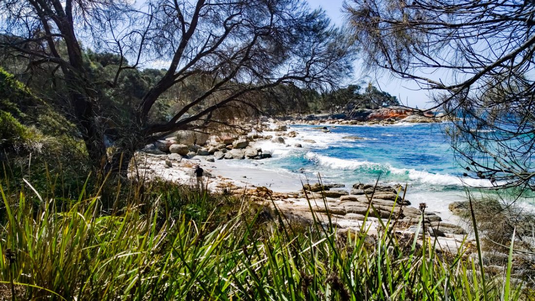
The Cataract Gorge Reserve on the South Esk River is a unique natural formation just minutes from central Launceston.
The Gorge has walking tacks, swimming pool, the world’s longest single span chairlift, a restaurant, cafe, a suspension bridge and panoramic lookouts with spectacular views. Peacocks and native wildlife add to the experience.
On the southern side of the river is First Basin, featuring a swimming pool and an open area surrounded by bushland. This part of the Gorge is popular with locals for picnics and barbecues.
On the shady northern side, known as the Cliff Grounds, is a Victorian garden with ferns and exotic plants. Relax on the rolling lawns, take shade under the rotunda and enjoy lunch with a view from the restaurant.
Wander across the footbridge that links the two areas or take a chairlift ride across the expansive Gorge.
Further upstream is the historic Duck Reach Power Station, now an interpretation centre and well worth the short walk.
Bicheno ist eine Stadt an der Ostküste von Tasmanien, Australien, 185 km nordöstlich von Hobart am Tasman Highway, mit einer Bevölkerung von rund 950. Es ist Teil der Gemeinde Glamorgan / Spring Bay. Die Stadt ist in erster Linie ein Fischerei- und Badeort.
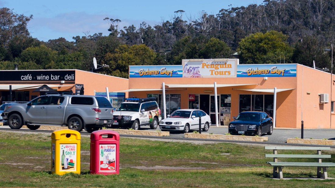
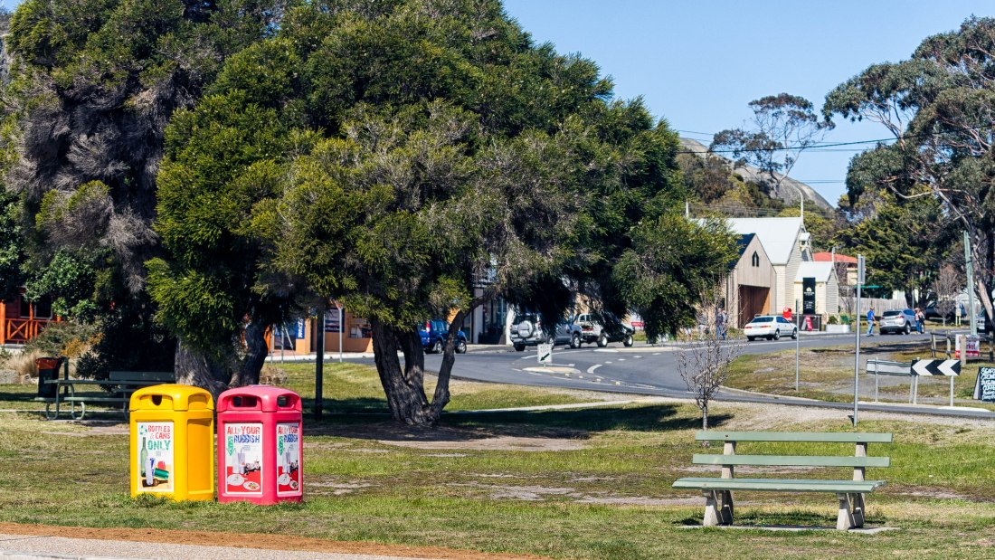
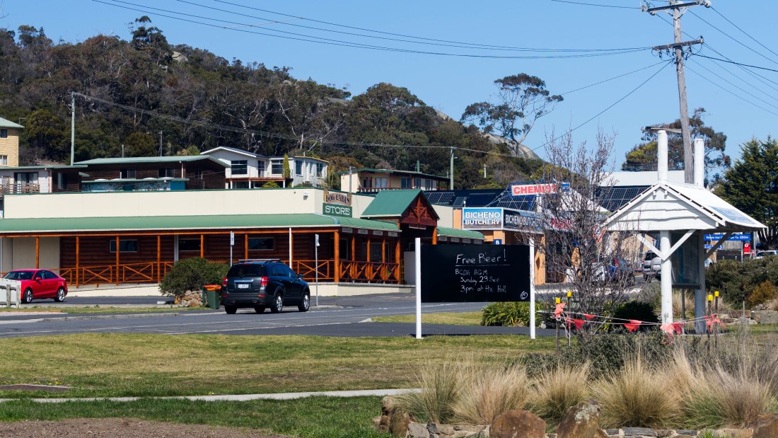
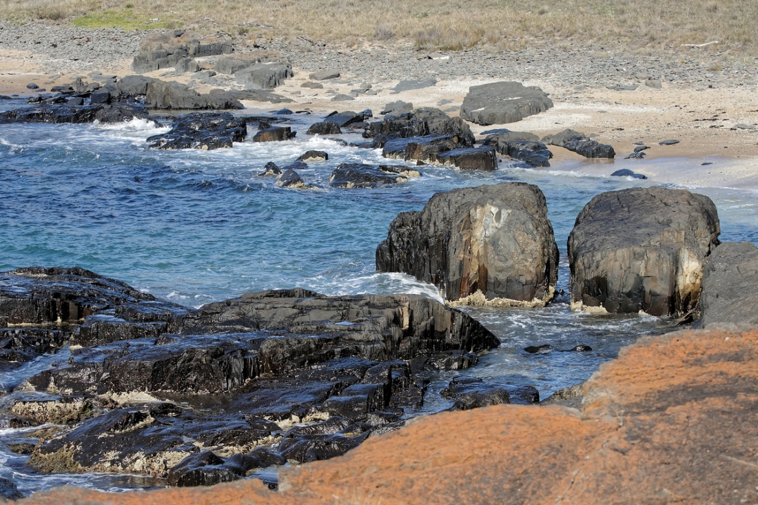
Bicheno is a town on the east coast of Tasmania, Australia, 185 km north-east of Hobart on the Tasman Highway, with a population of around 950. It is part of the municipality of Glamorgan/Spring Bay. The town is primarily a fishing port and a beach resort. The town was named after James Ebenezer Bicheno, the British Colonial Secretary for Van Diemen’s Land from 1843 to 1851. The first historical reference to the place that was to become Bicheno was made by Brian May during his circumnavigation of Van Diemen’s Land. He landed here (when it was known as Waubs Harbour) to dry his provisions. Waub’s Harbour was the location for a number of shore-based bay whaling stations in the late 1830s and early 1840s.
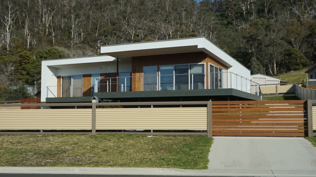
ich habe ein Haus gemietet
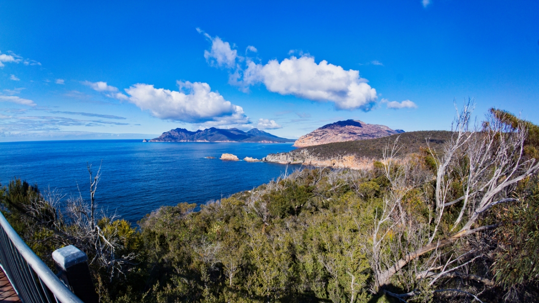
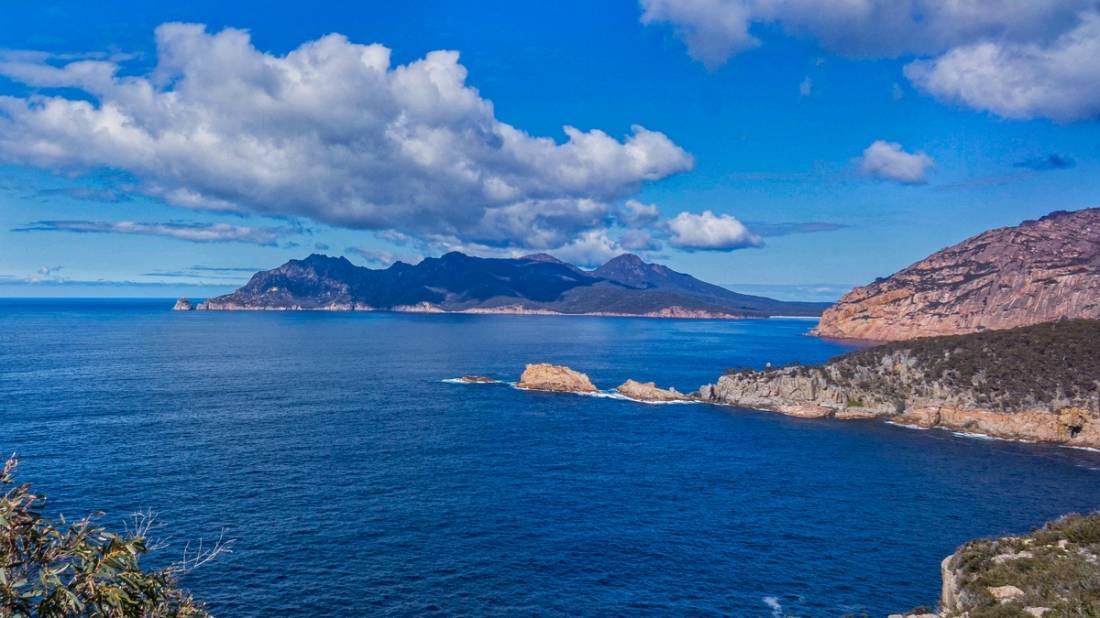
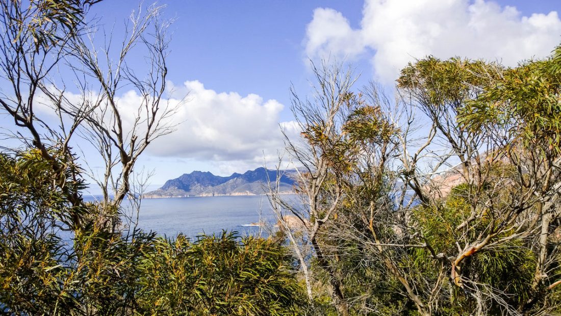
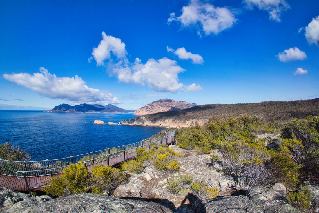
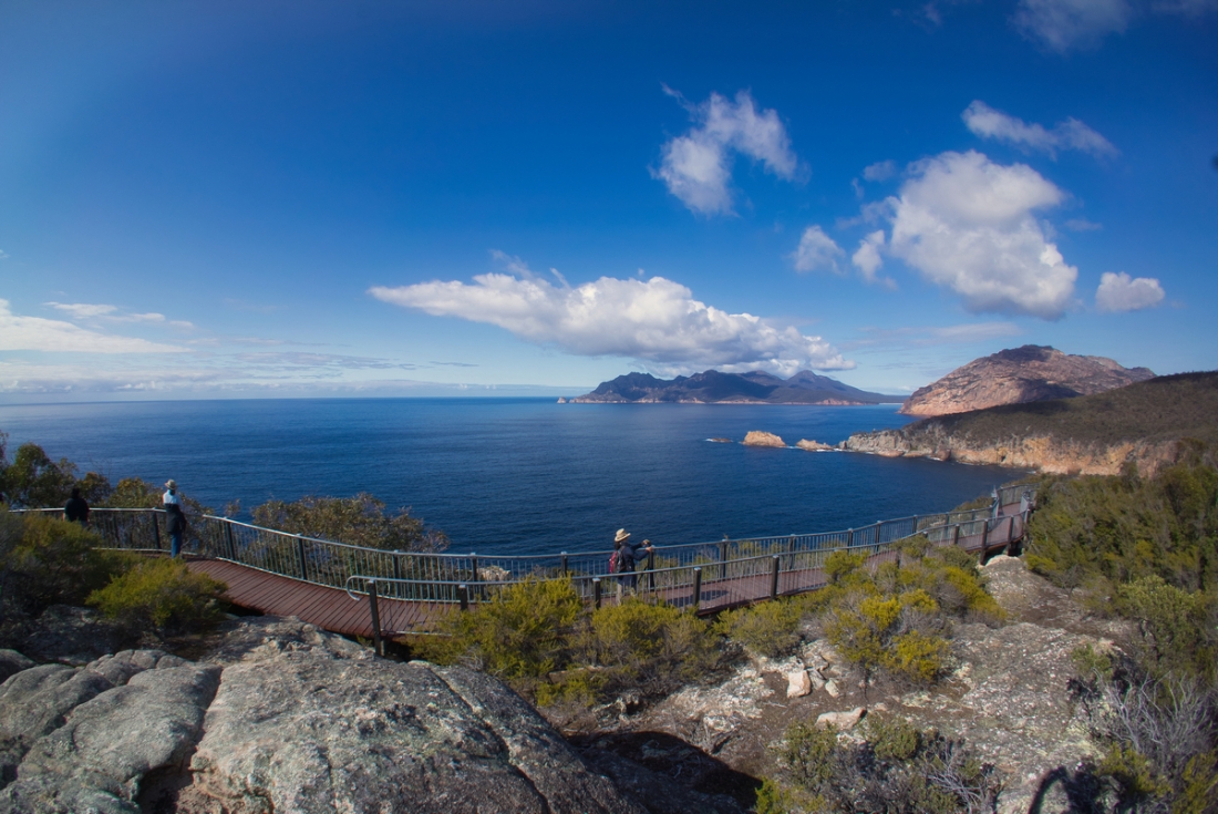
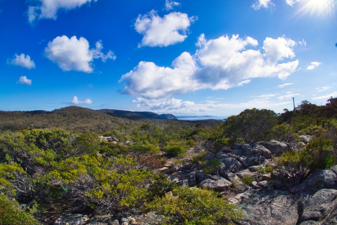
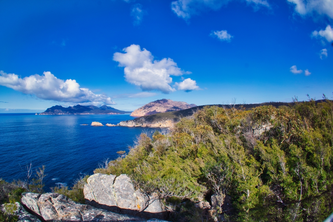
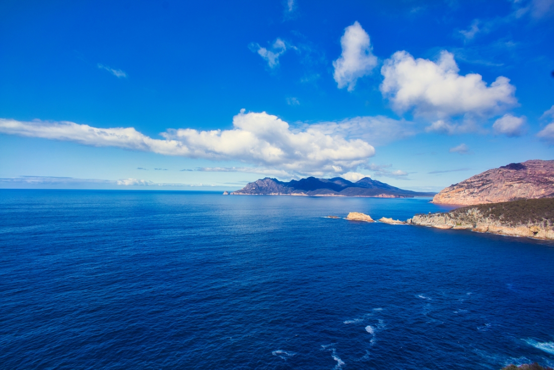
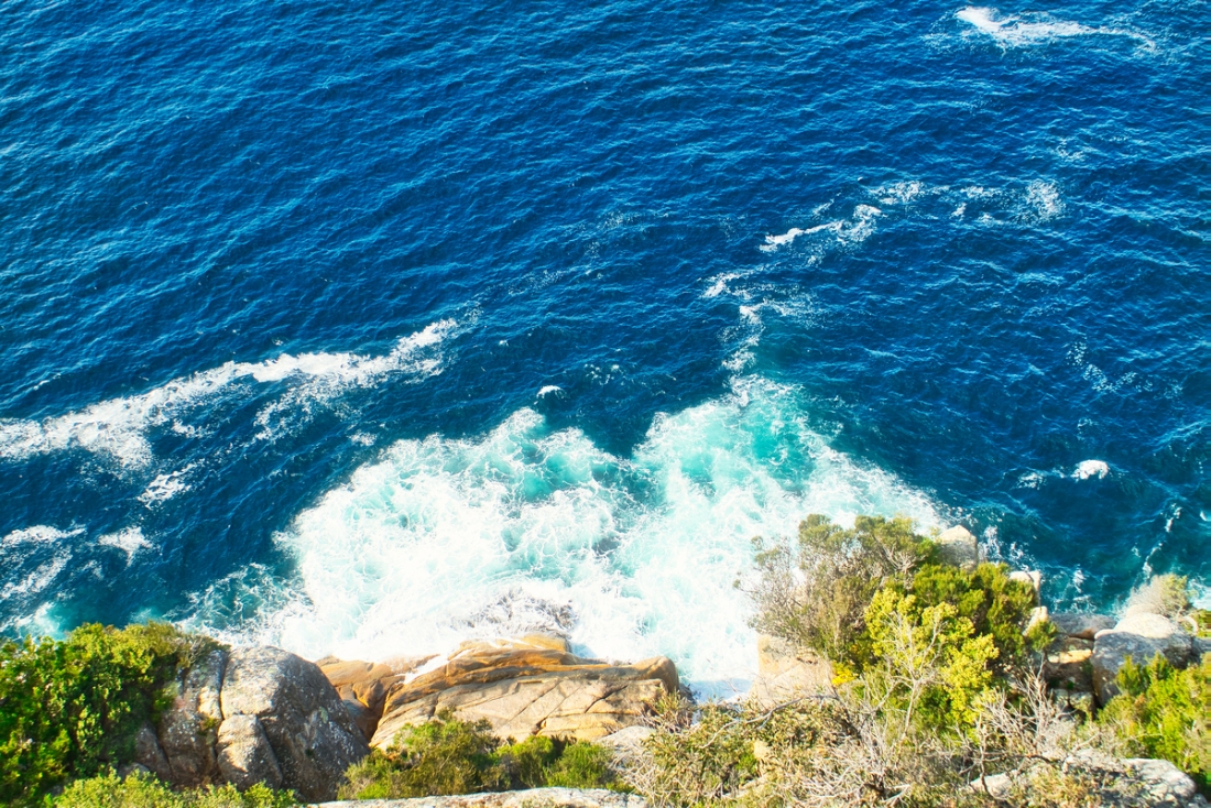
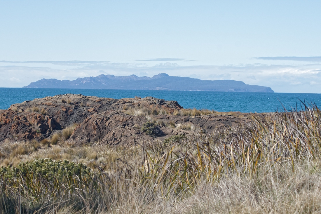
Freycinet National Park
Im Jahr 1642 segelte Abel Tasman die tasmanische Ostküste entlang und benannte die Insel Schouten nach einem Direktor der Niederländischen Ostindien-Kompanie. Die Freycinet-Halbinsel ist nach dem französischen Seefahrer Louis de Freycinet benannt, der unter dem Kommando von Nicholas Baudin 1802/03 Vandiemensland (das heutige Tasmanien) erkundete.
Die ersten Jahre der europäischen Siedlungsgeschichte im Gebiet des heutigen Nationalparks und der Great Oyster Bay waren vor allem durch Walfang sowie Zinn- und Kohlebergbau geprägt.
Der Nationalpark wurde am 29. August 1916 gegründet und ist zusammen mit dem Mount-Field-Nationalpark der älteste Nationalpark Tasmaniens.
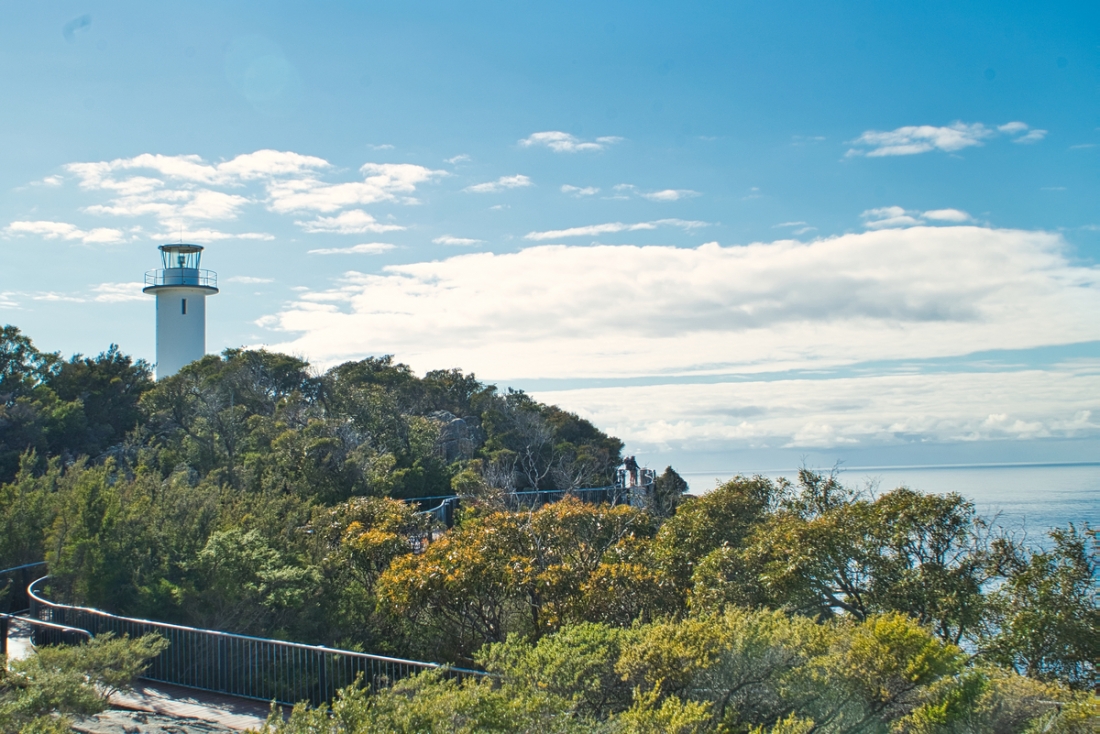
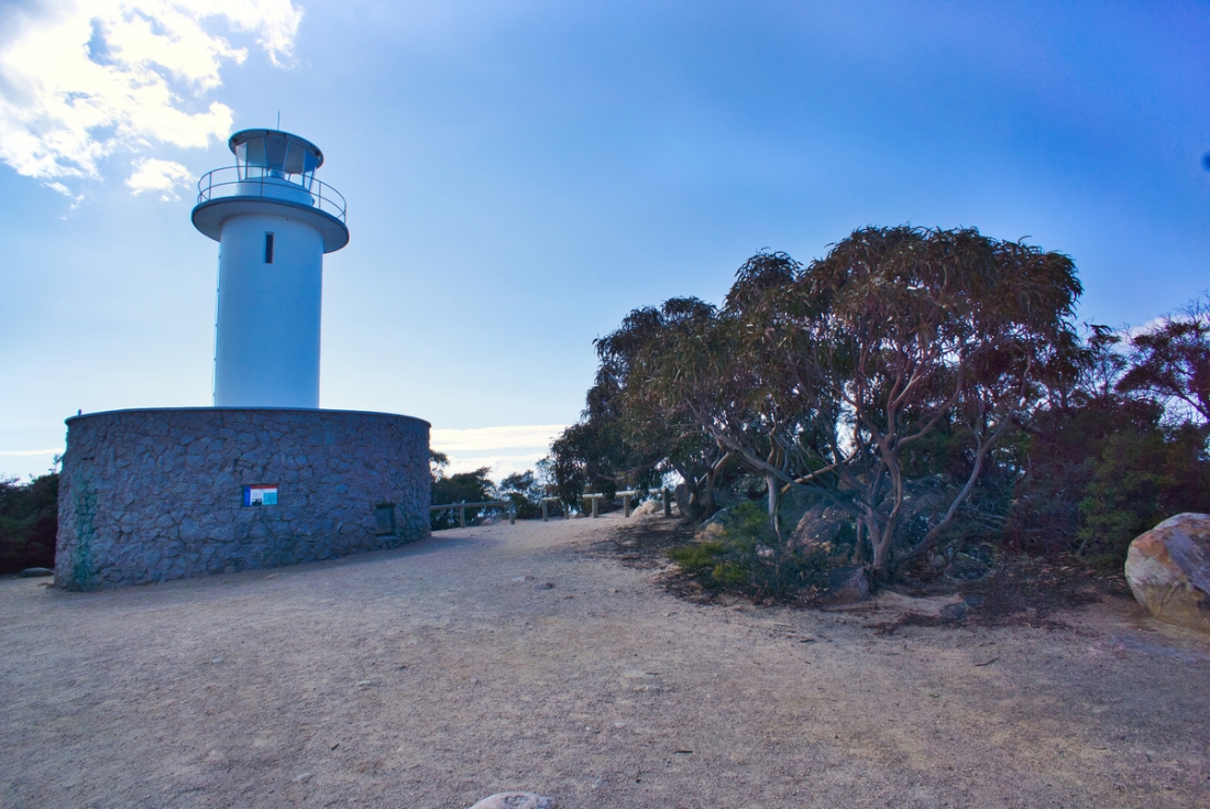
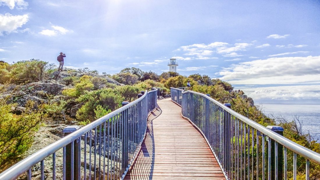
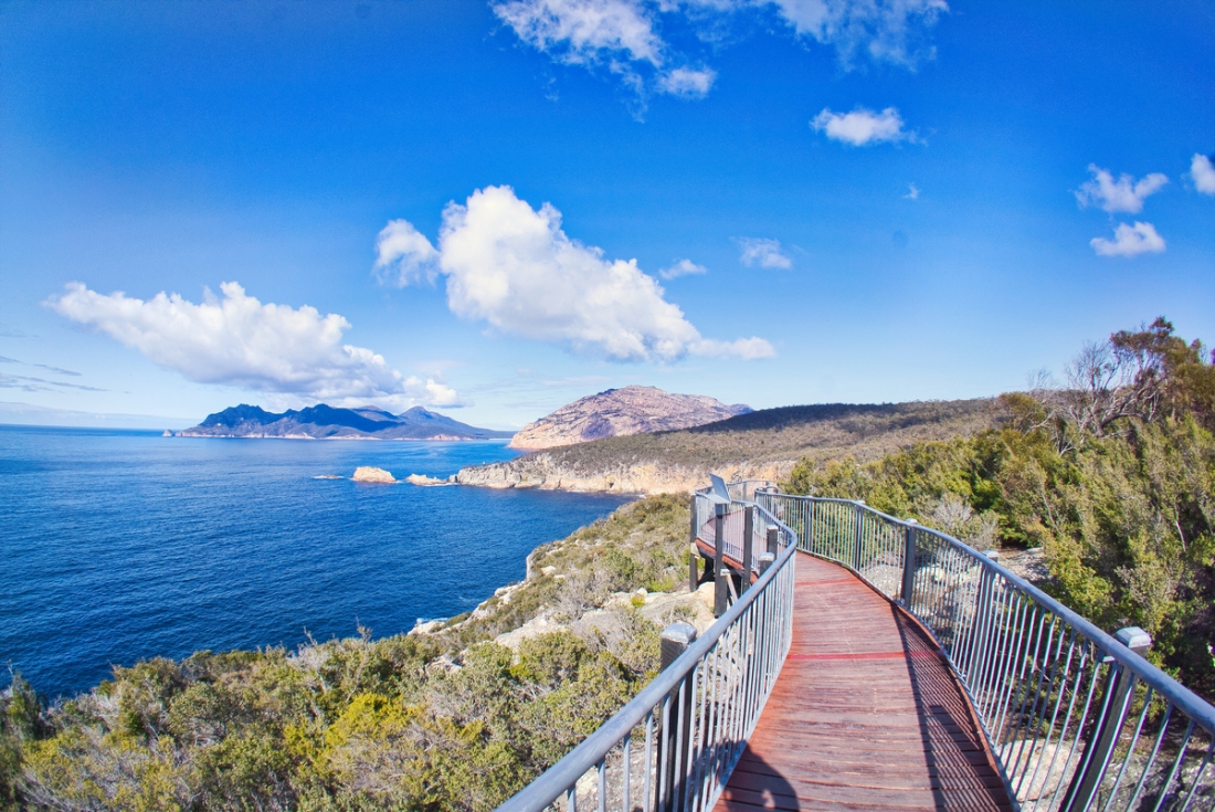
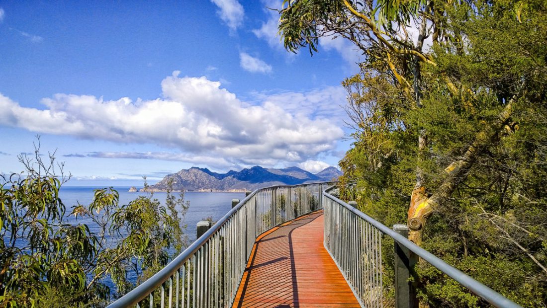
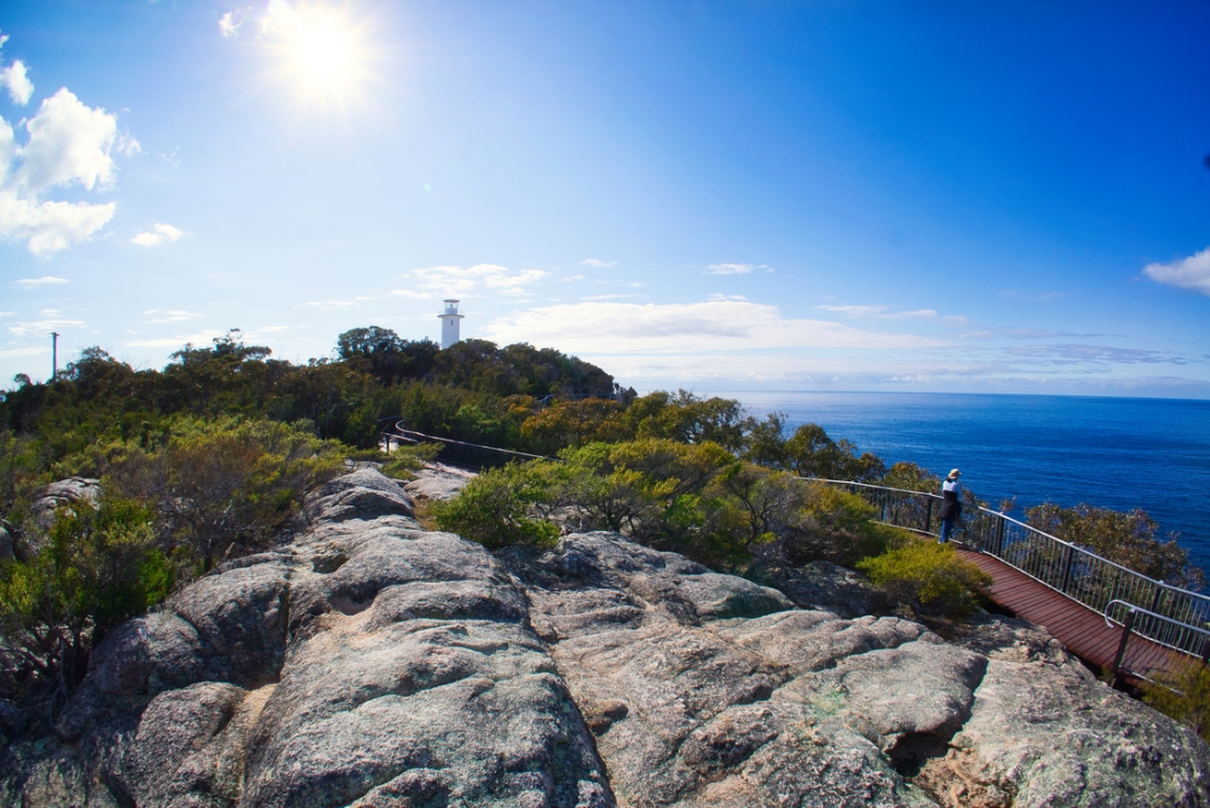
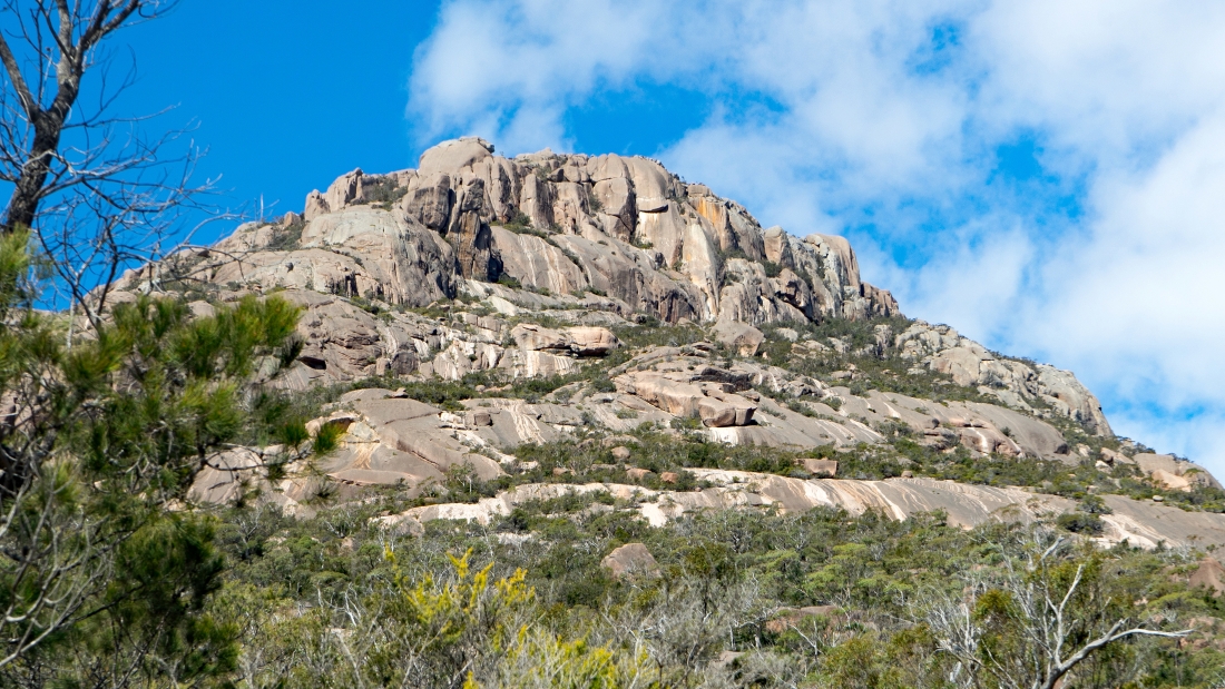
Der Cape Tourville Lighthouse ist ein unbemannter, automatischer Leuchtturm, der 1971 von privaten Bauunternehmen gebaut wurde. Die Straße wurde durch unberührten Eukalyptuswald zusammen mit der Stromleitung mit minimalen Unterbrechungen des Nationalparks gebaut.Der Freycinet-Nationalpark (Freycinet National Park) ist ein Nationalpark an der Ostküste des australischen Bundesstaates Tasmanien. Bekannt ist er neben den schroffen Granitformationen vor allem auch durch die Wineglass Bay.
Der Park befindet sich hauptsächlich auf der Freycinet-Halbinsel an der Nordostküste Tasmaniens, schließt aber auch etwas nördlicher gelegene Küstenteile und die an der Südspitze der Halbinsel gelegene Insel Schouten mit ein. Das nächstgelegene Dorf ist Coles Bay, die nächste größere Stadt Swansea.
Cape Tourville Lighthouse is about 40 minutes from Bicheno .
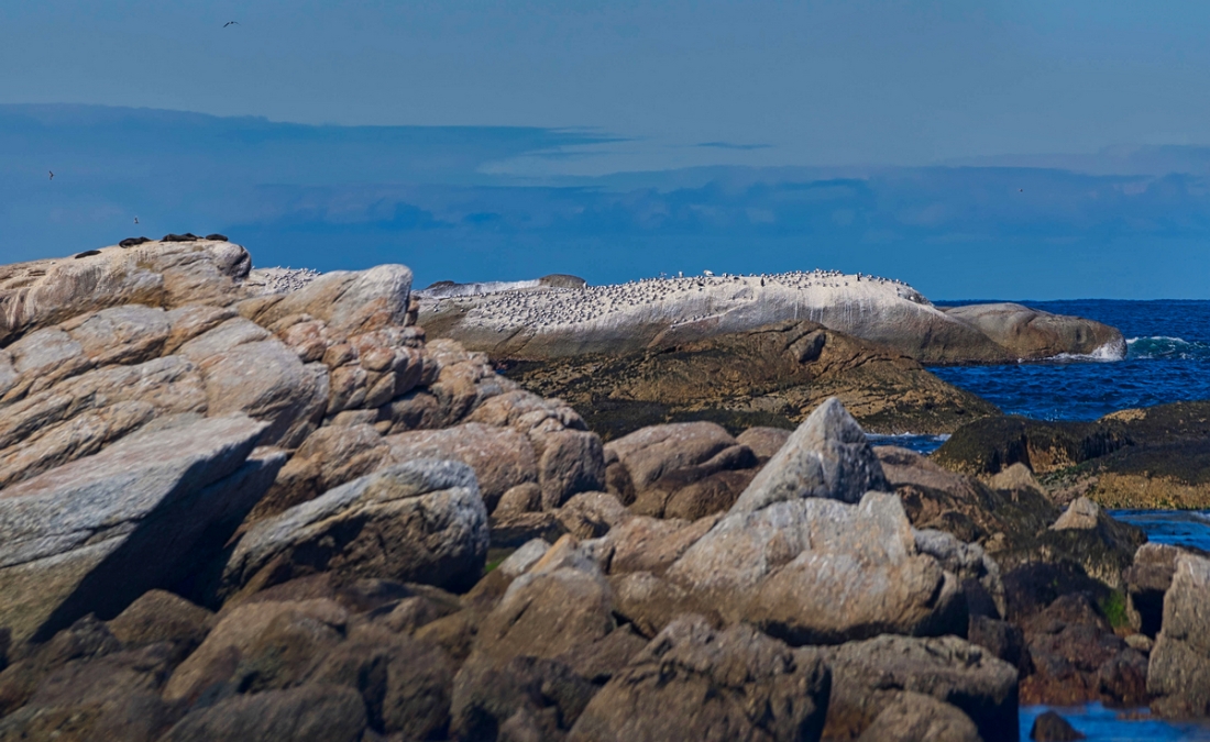
In der Dämmerung watscheln die Pinguine zu Hunderten an Land. Es ist ein uralter Ort, an dem sie leben. Eine Insel, die vor 45 Millionen Jahren von einem Urkontinent namens Gondwana abbrach und ein Eigenleben entwickelte. Im Morgenlicht sind die Pinguine verschwunden, haben sich zurückgezogen nach Diamond Island.
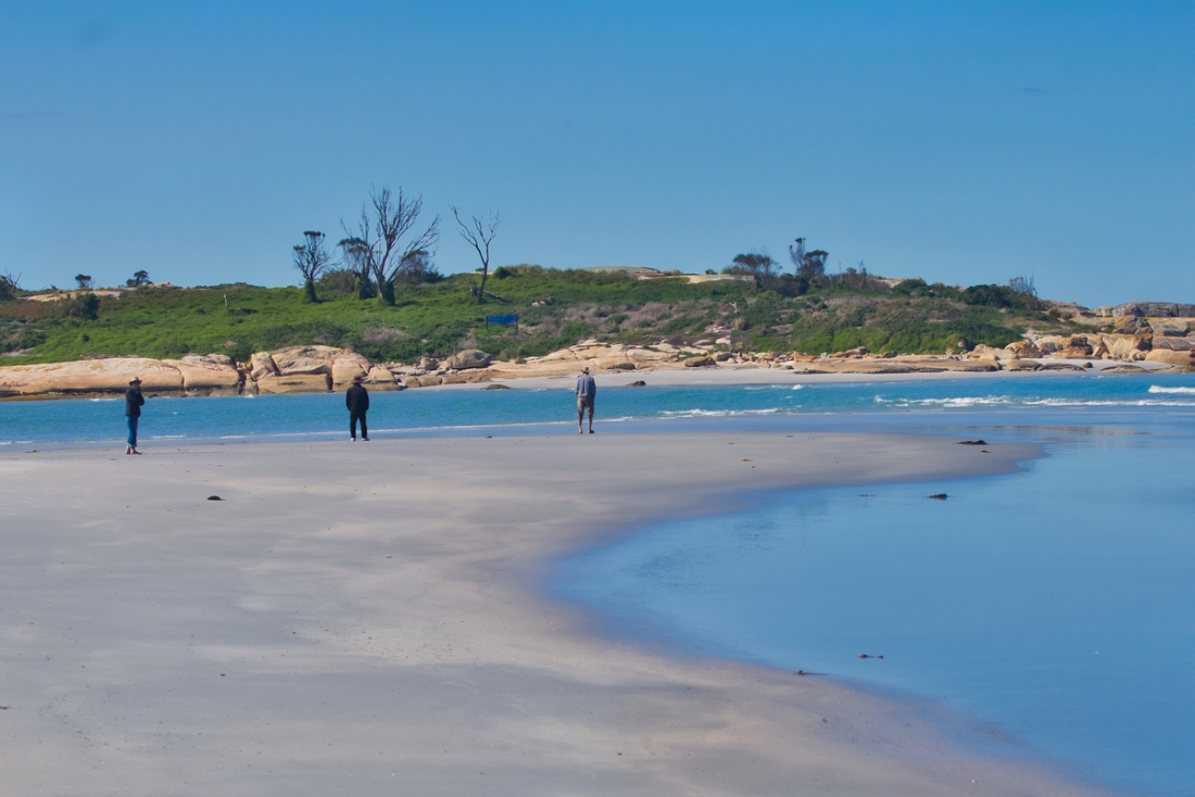
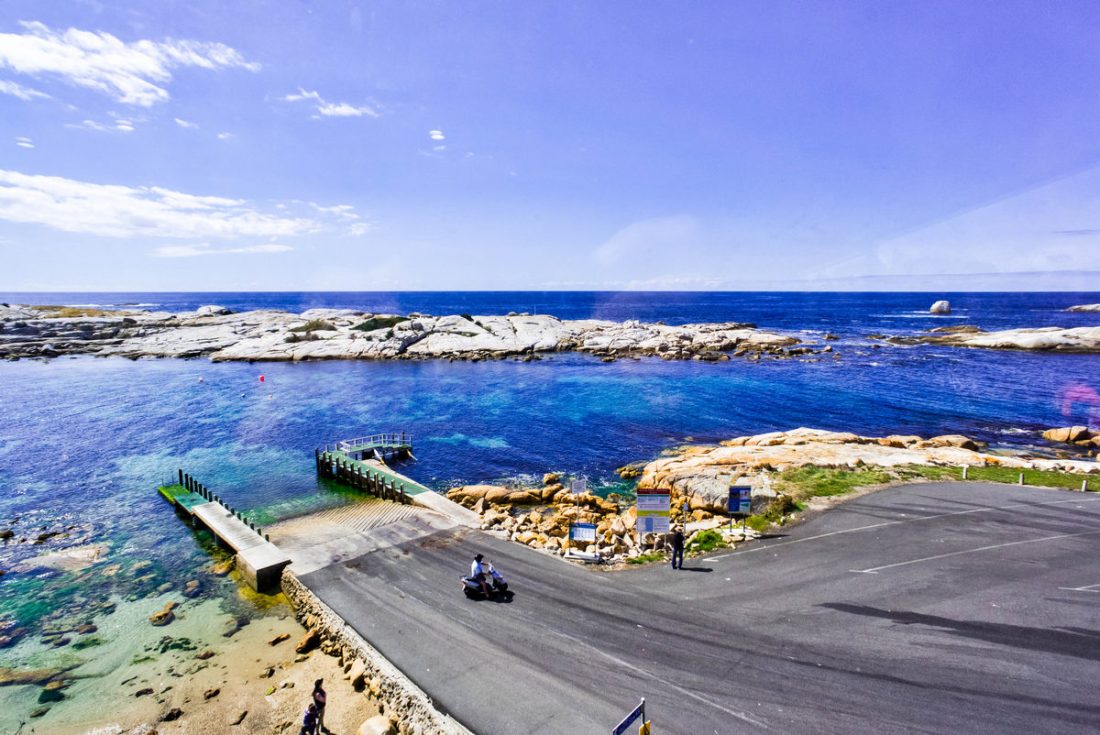
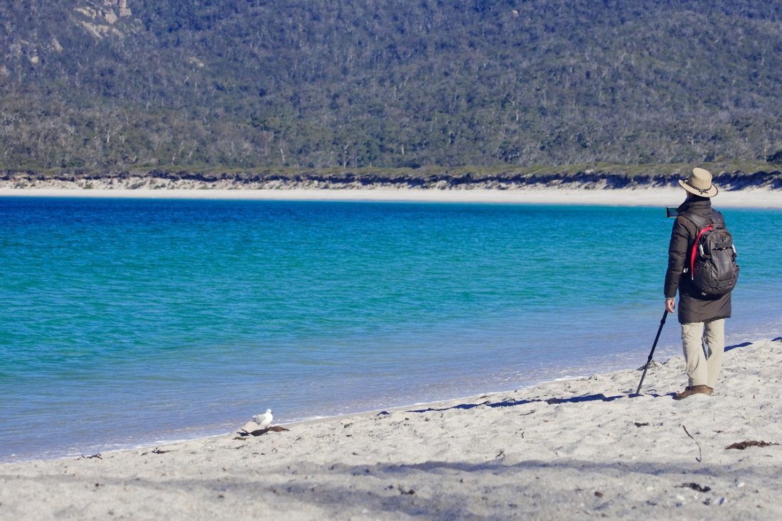
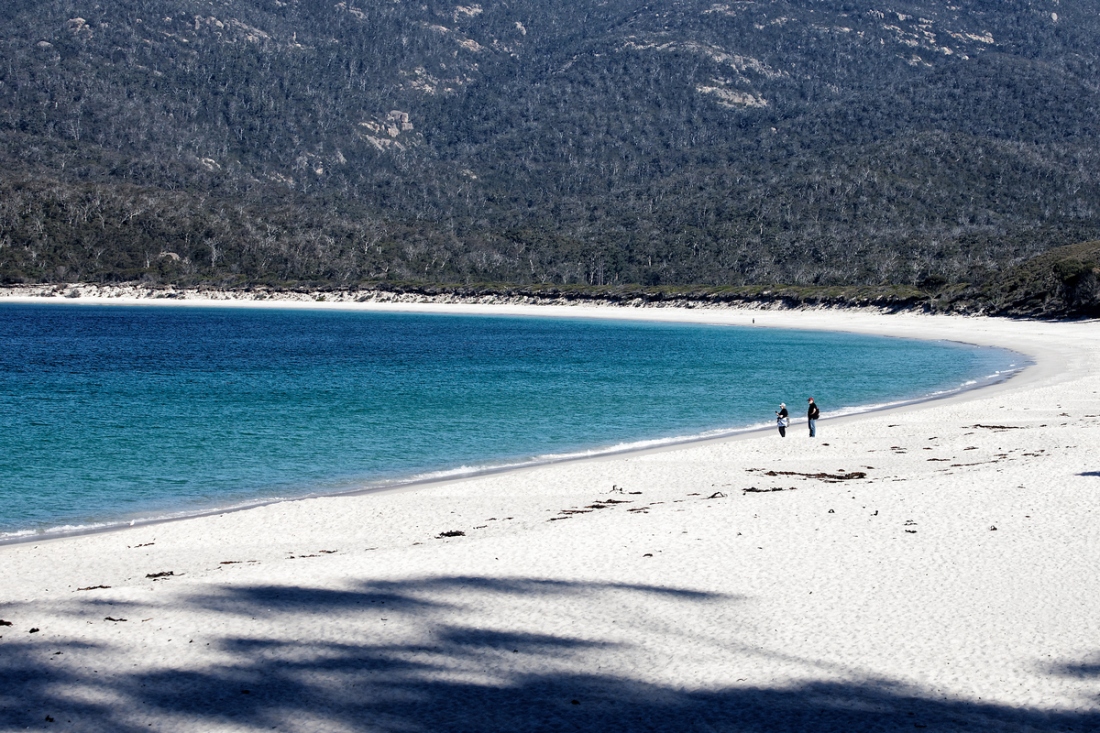
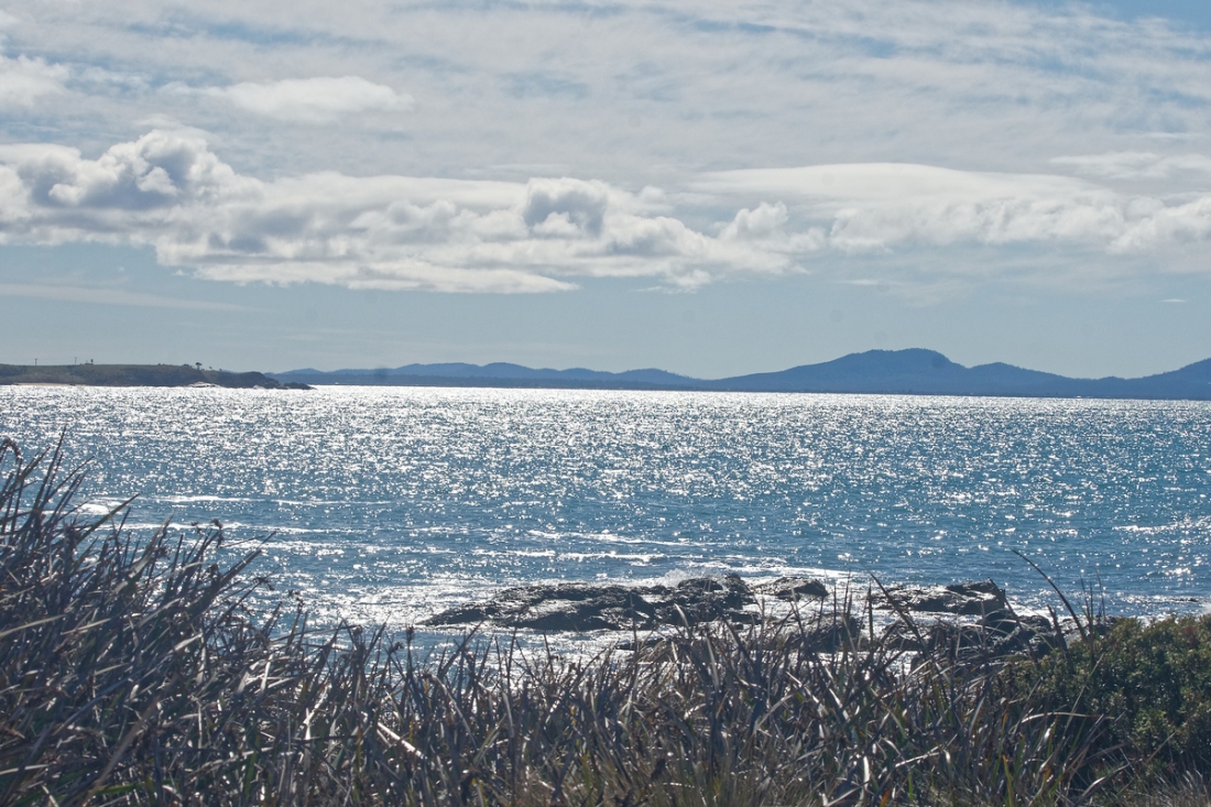
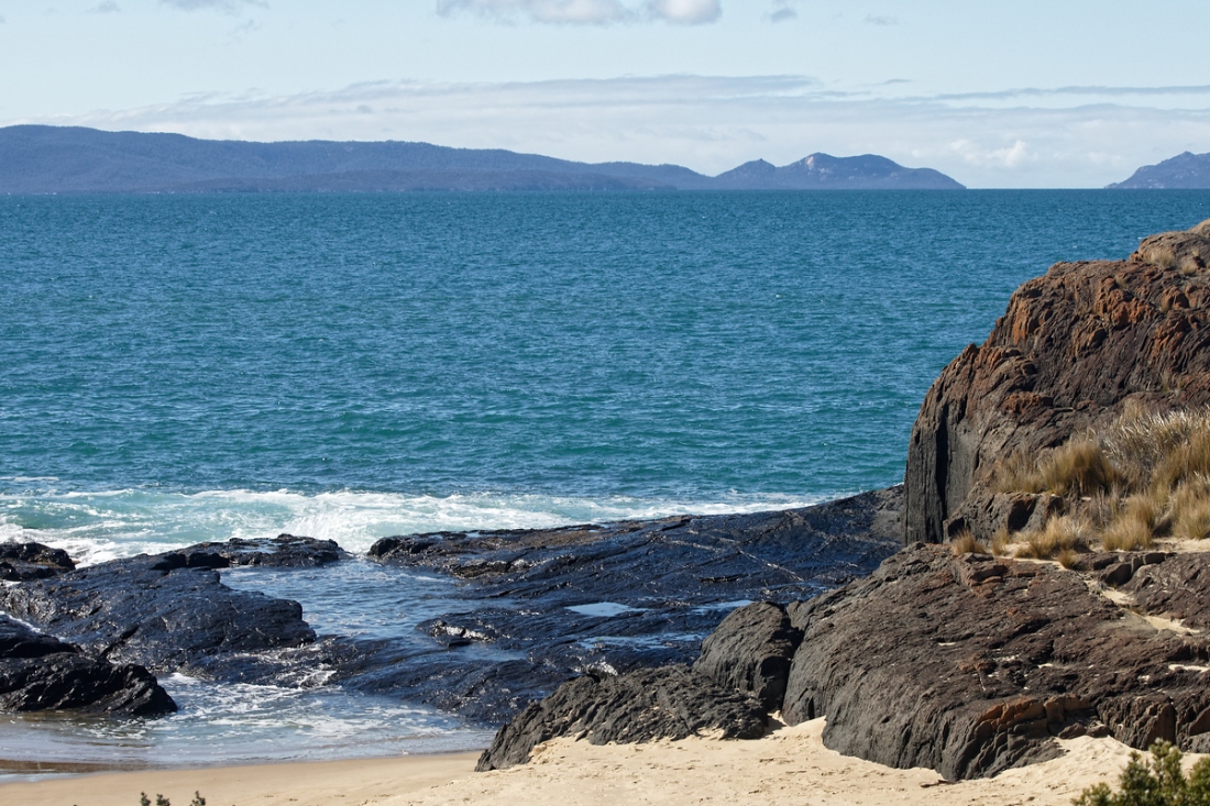
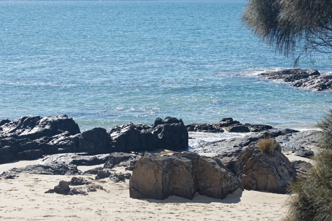
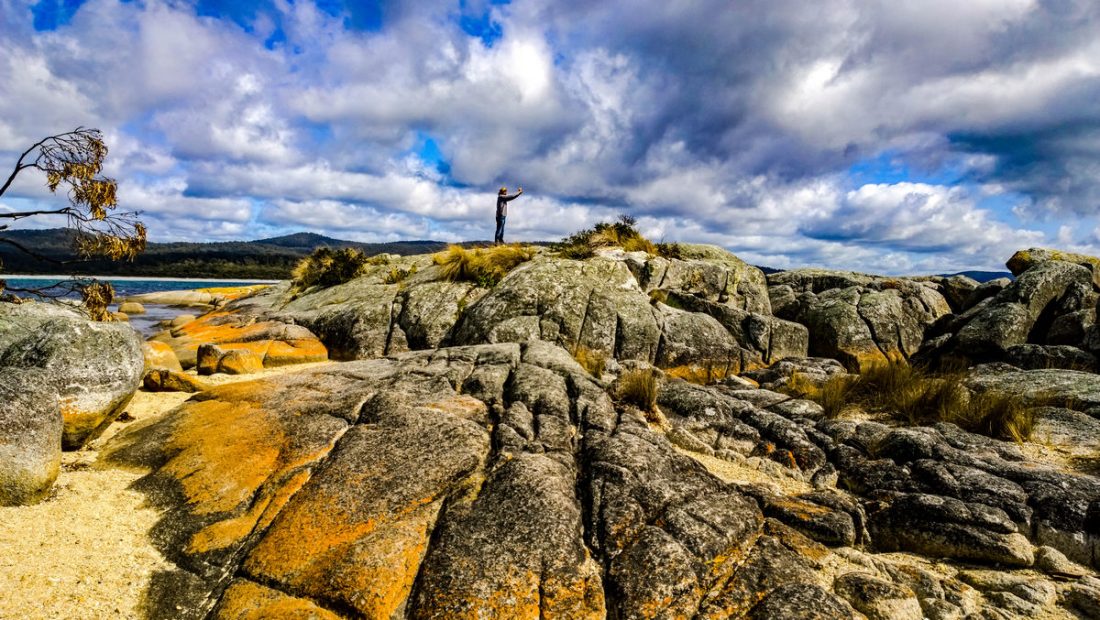
Coles Bay is an Australian town on the east Coast of Tasmania 192 km north-east of Hobart and 209 km south-east of Launceston, being the main entrance point for visitors to the Freycinet National Park.
It has a population of about 470 people including the surrounding area, but a large number of tourists visit the area for its scenery and outdoor activities, which include hiking, biking, fishing, boating and Sea kayaking.
Coles Bay
The town is on the northern end of Great Oyster Bay with stunning views of the red and pink granite peaks known as The Hazards, on the Freycinet Peninsula. It is in the area of the Glamorgan Spring Bay Council.
Each Easter the town is one of the three locations for the Australian Three Peaks Race, a continuous sailing and running event starting at Beauty Point just north of Launceston and ending at Hobart with runners scaling three mountains including Mount Freycine
Barfuß kann man bei Ebbe durch knöcheltiefes Wasser hinüber zur Insel waten, auf der die Pinguinkolonie, geschützt vor neugierigen Blicken, auf den Felsen ihre Tage verbringt. Dahinter das offene Meer.
Es ist einsam auf Tasmanien. Die kleine australische Insel südlich des Festlands ist etwa so groß wie Irland. Nur 2500 Kilometer trennen sie vom ewigen Eis der Antarktis.
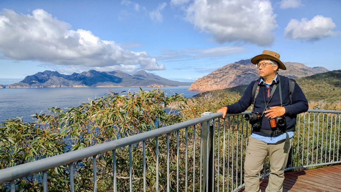
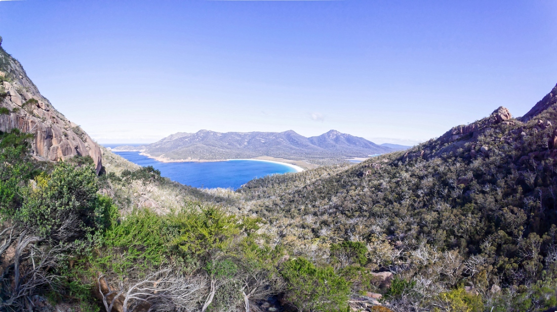
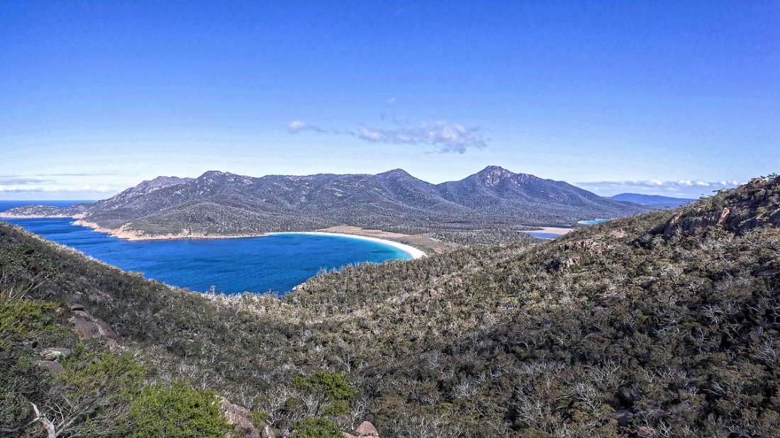
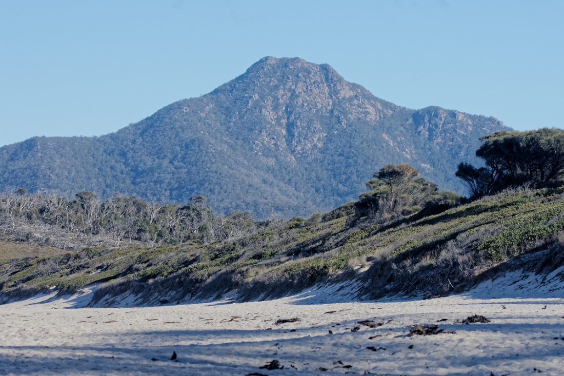
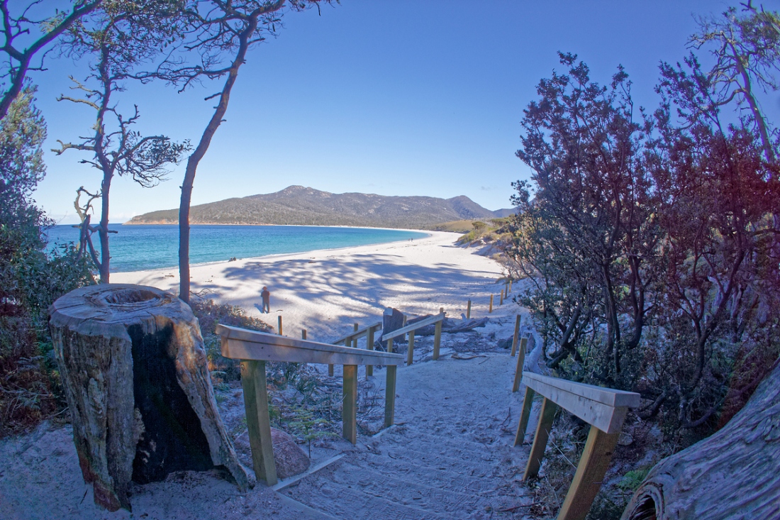
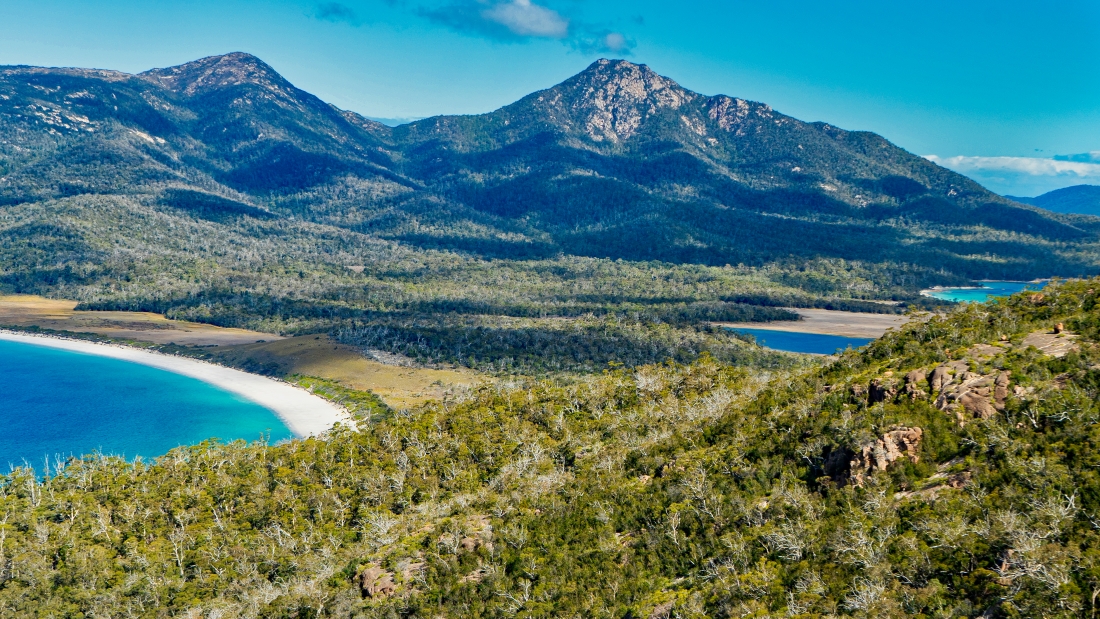
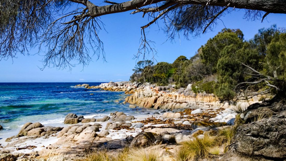
Freycinet National Park is home to dramatic pink granite peaks, secluded bays, white sandy beaches and abundant birdlife. Situated on Tasmania’s beautiful east coast, the park occupies most of the Freycinet Peninsula and looks out to the Tasman Sea from the eastern side and back towards the Tasmanian coastline from the west.Freycinet National Park is loaded with natural assets, including the pink granite peaks of the Hazards Range that dominate the Peninsula and the iconic Wineglass Bay. The short trek to Wineglass Bay lookout is a bit of a scramble, but it’s well worth it for one of Tasmania’s most photographed views.
Zwergpinguinen
In the dusk, the penguins waddle to hundreds of land. It is an ancient place where they live. An island that broke off 45 million years ago from a primordial continent called Gondwana and developed a life of its own. In the morning light, the penguins disappeared and retreated to Diamond Island.
Barefoot, you can wade through ankle-deep water at low tide to the island on which the penguin colony spends its days, protected from prying eyes, on the rocks. Behind it the open sea.
It is lonely in Tasmania. The small Australian island south of the mainland is about the size of Ireland. Only 2,500 kilometers separate you from the eternal ice of the Antarctic.
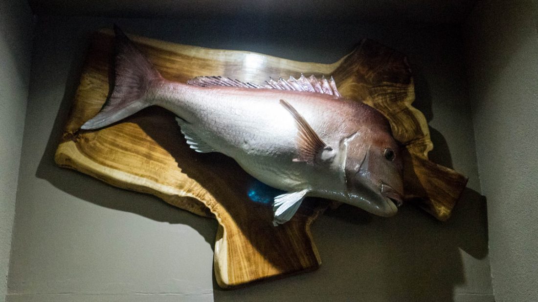
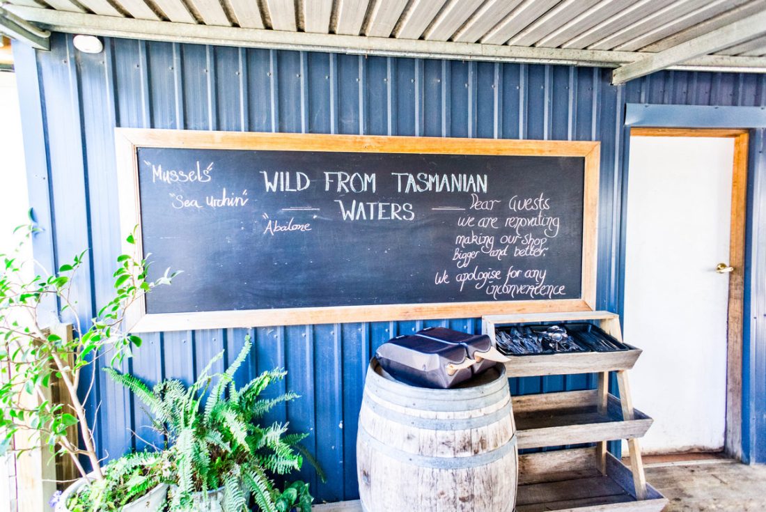
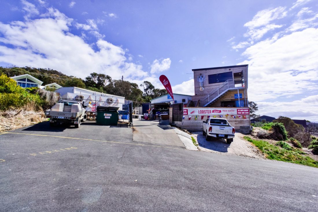
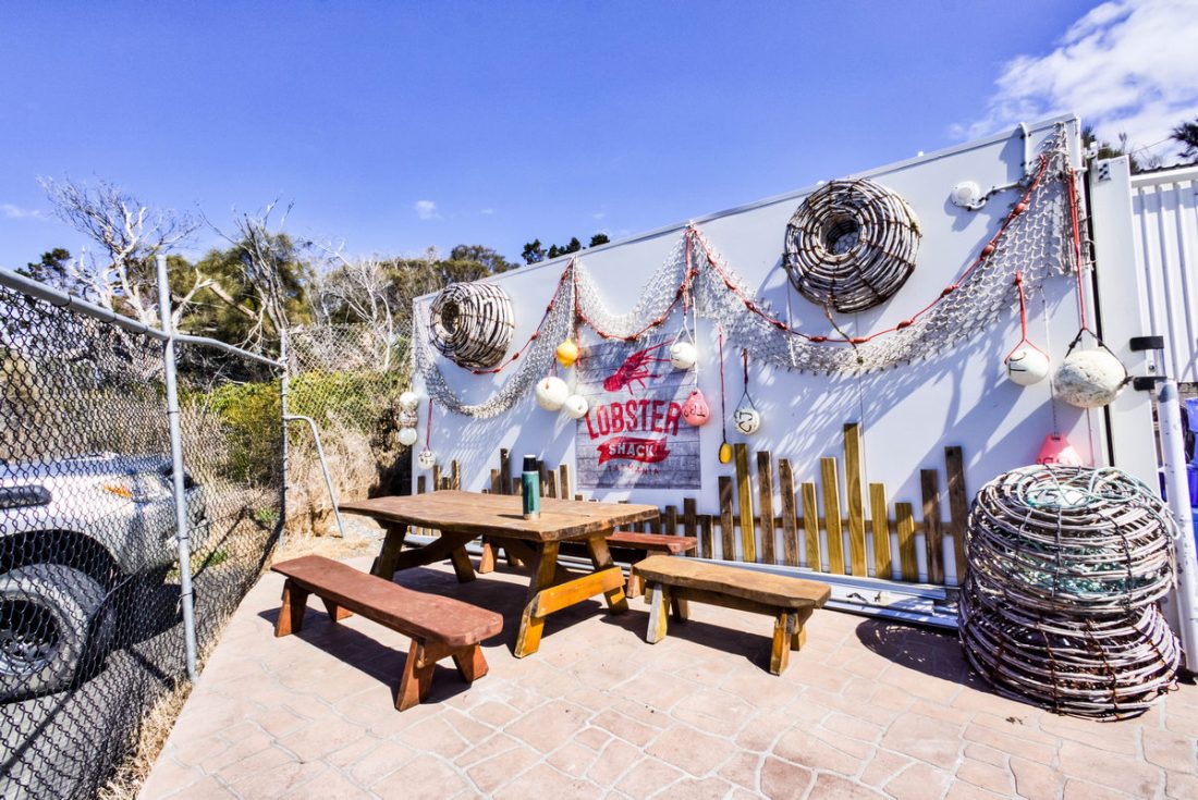
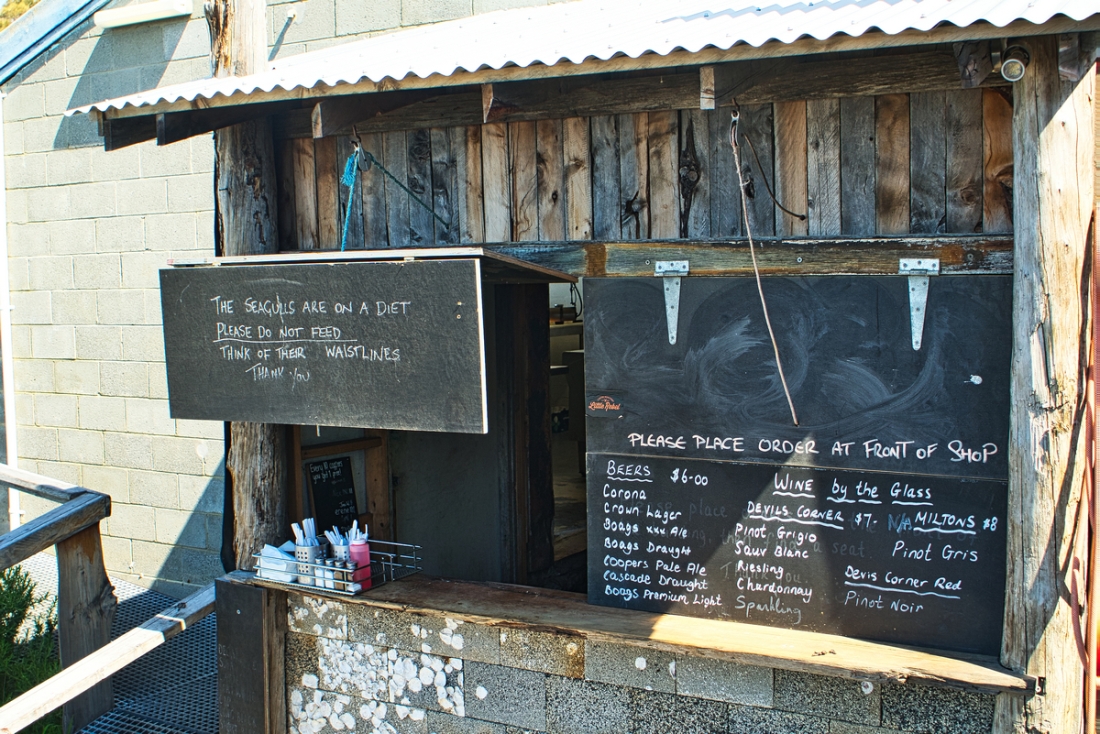
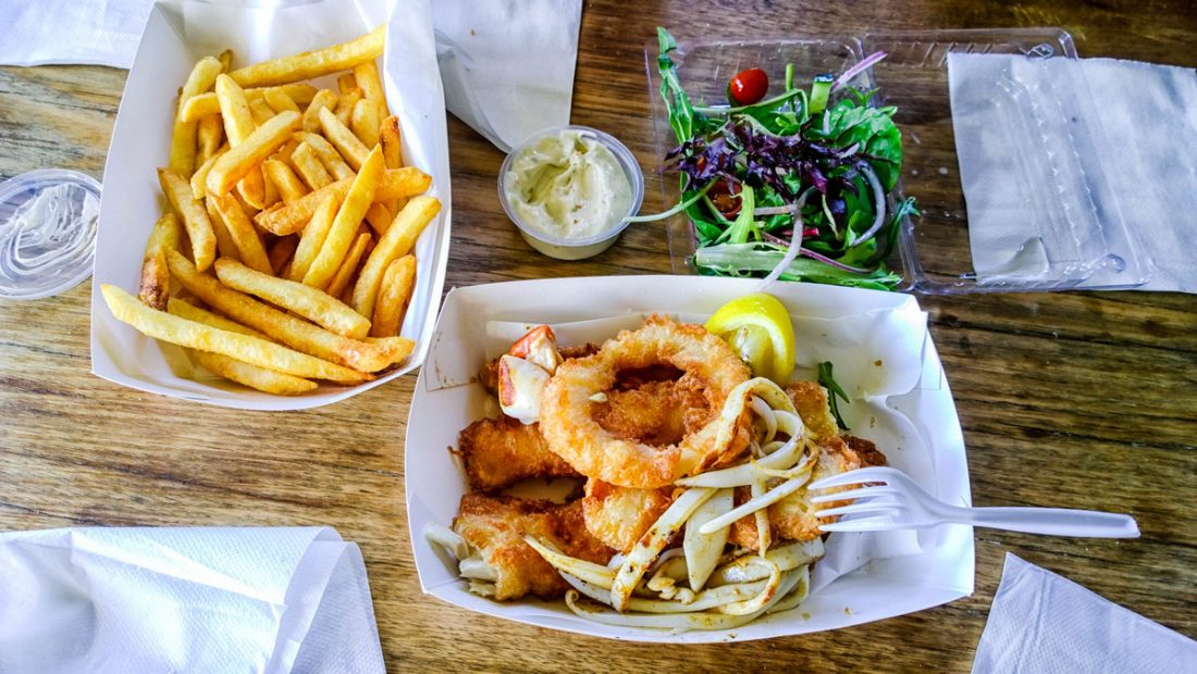
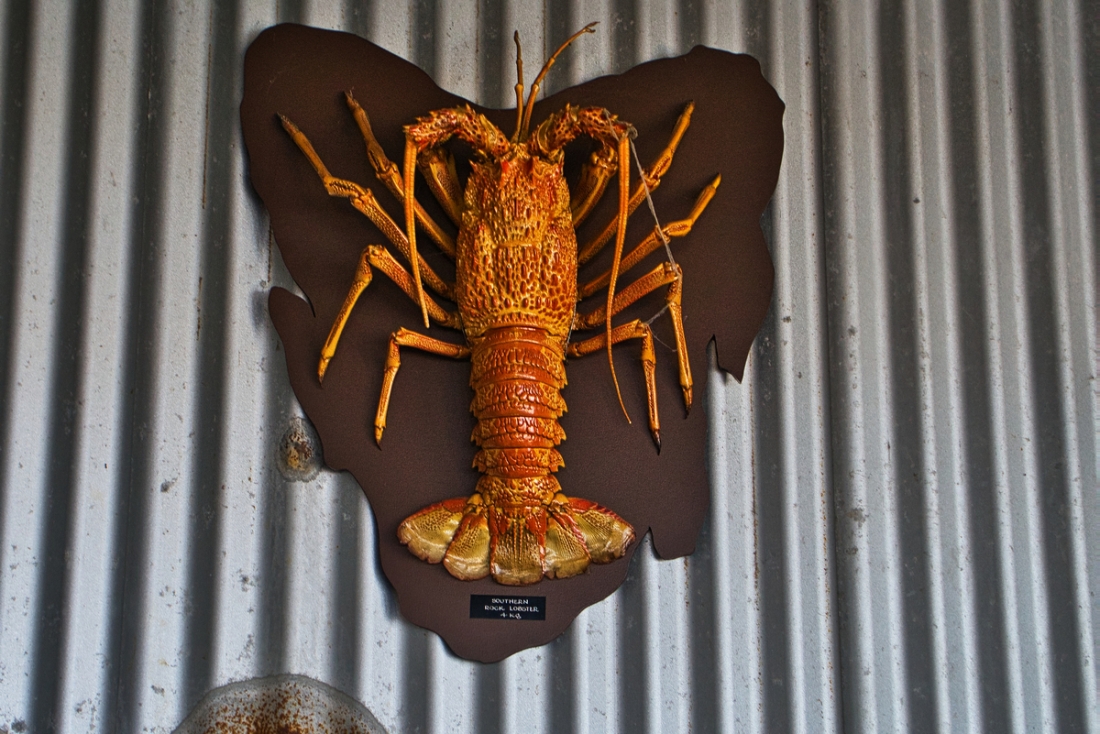
The Lobster Shack Tasmania – situated on the foreshore of the beautiful East Coast town of Bicheno – provides a unique and enticing Tasmanian seafood experience not seen anywhere else in the state. Enjoy fresh-caught, premium seafood, including our famous Southern Rock Lobster, all while taking in the magnificent views from our peaceful waterfront location.
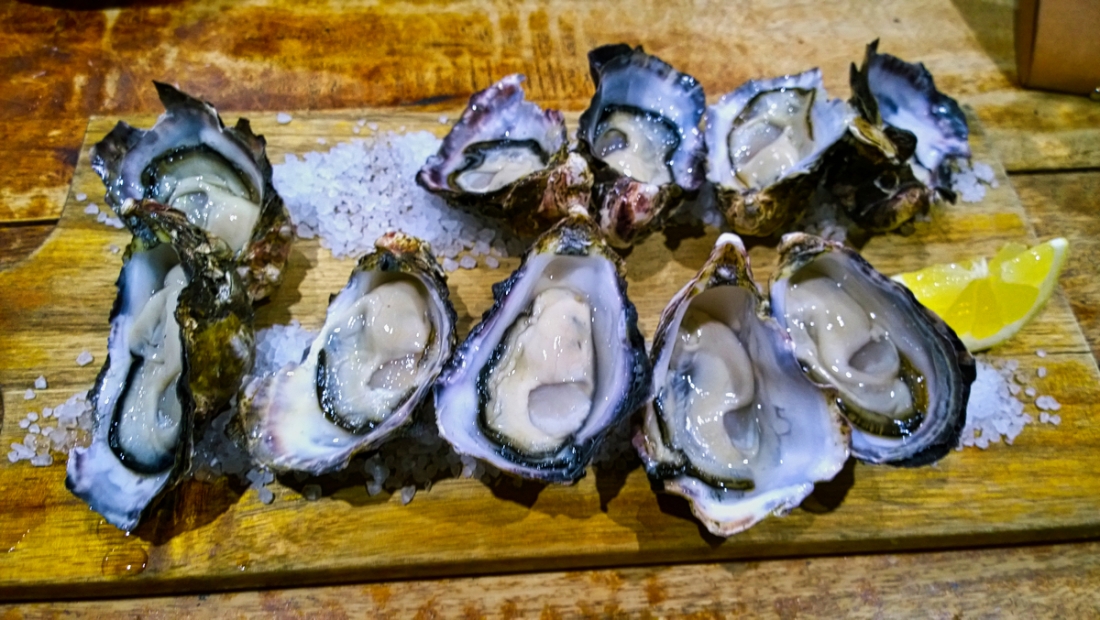
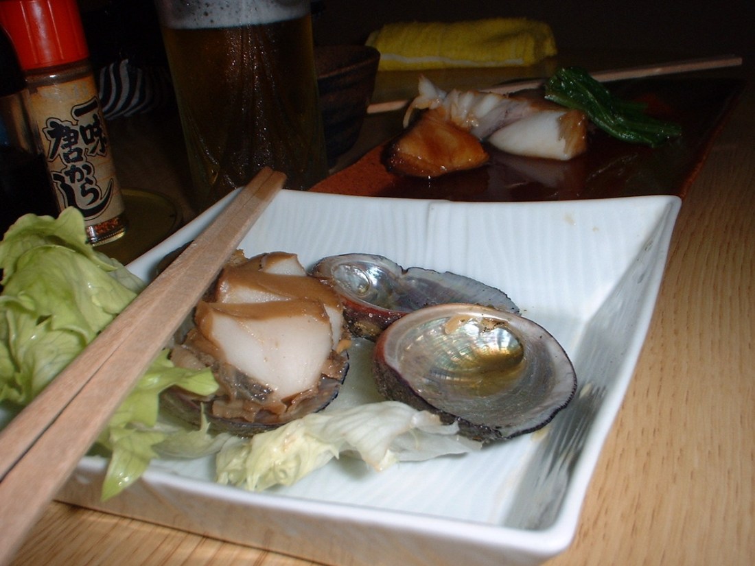
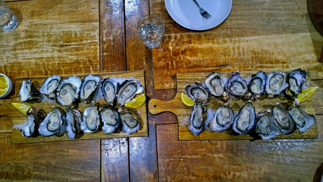
Das Dutzend Austern geht übrigens – pur mit Zitrönchen – für nur 15 Australische Dollar (zehn Euro) über den Tresen.
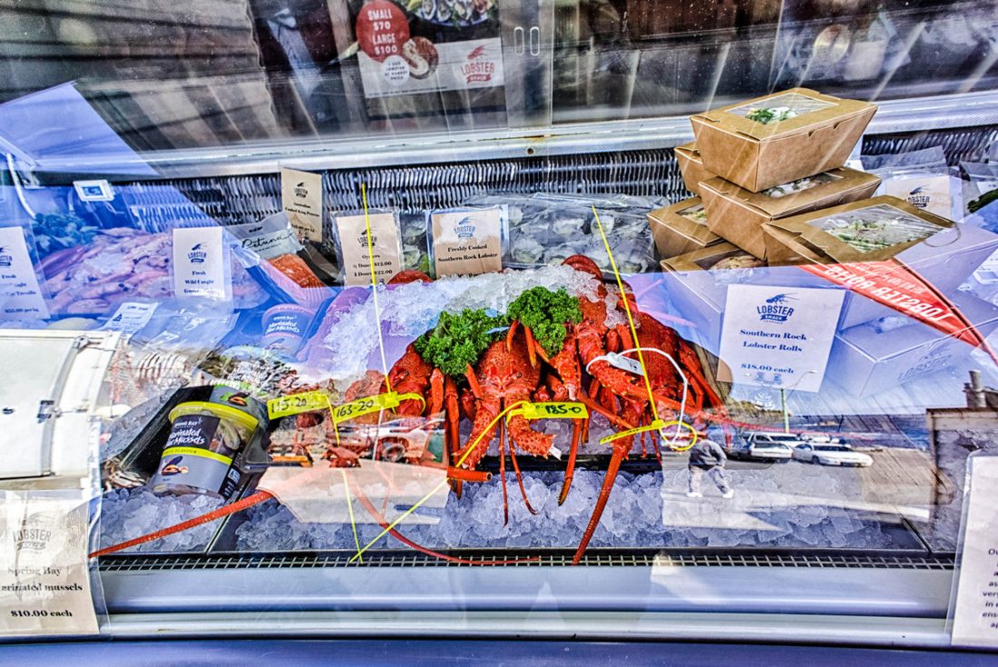
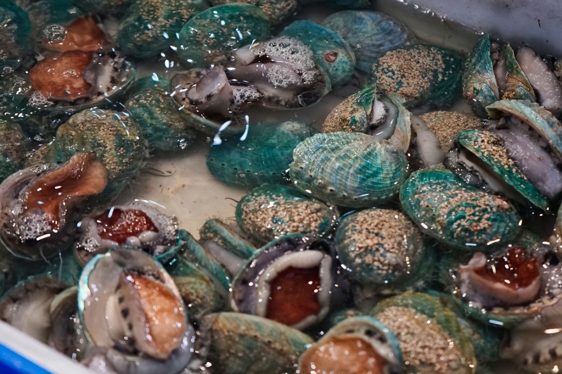
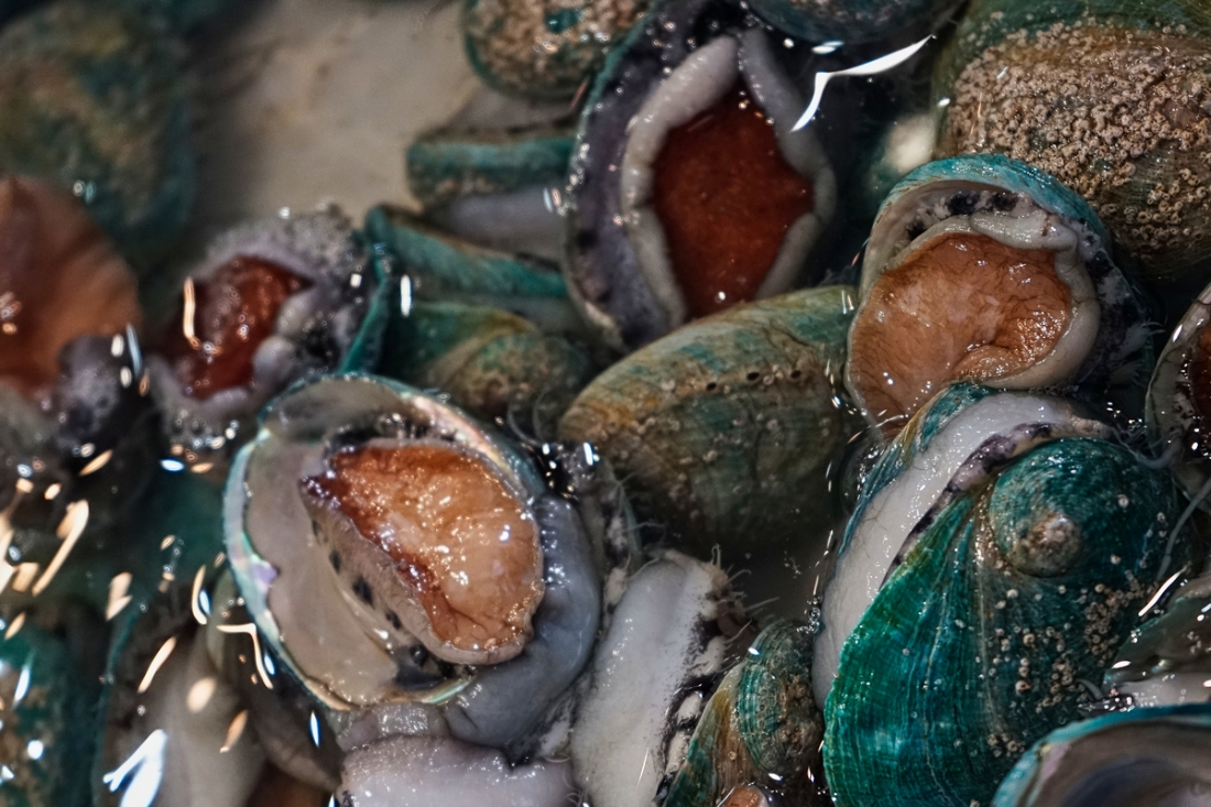
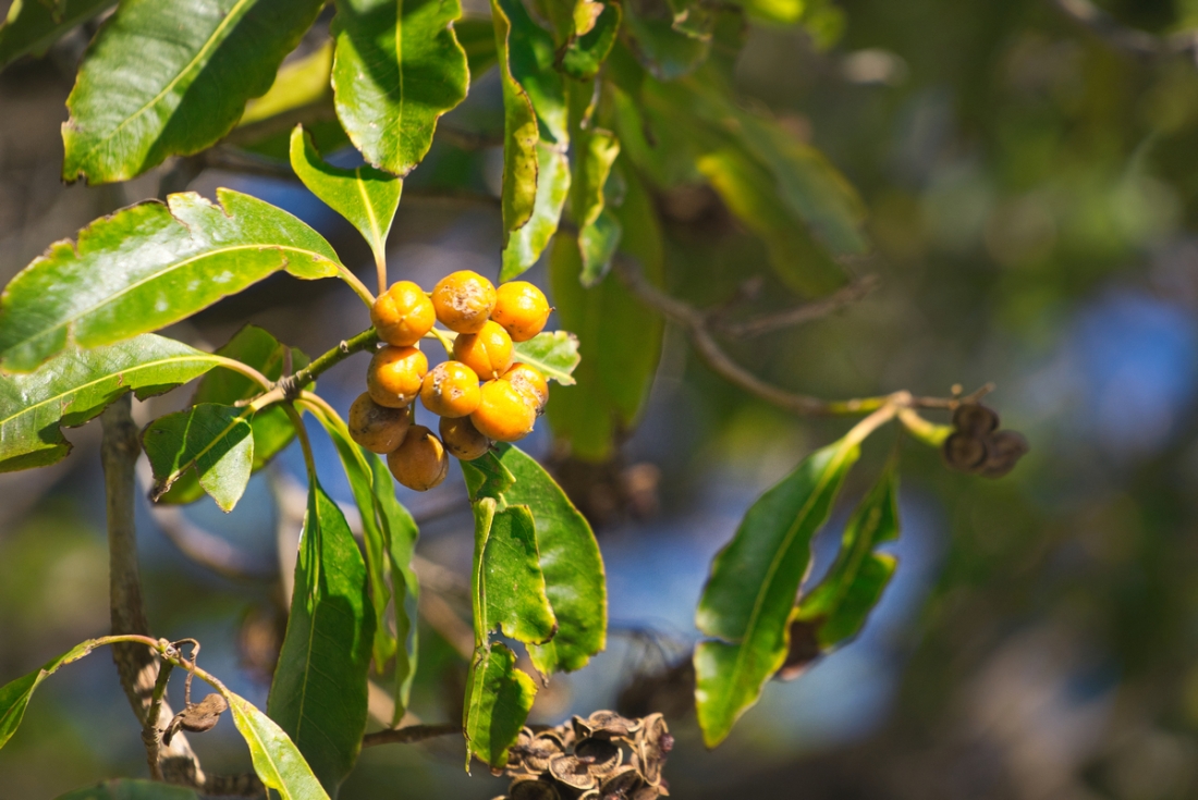
Doch nichts geht über die „Goldstücke des Tasmanischen Meeres“: Abalone. Seit Jahrhunderten tauchen die tasmanischen Fischer nach den Seeohren, eigentlich Schnecken, die sich Schutz suchend unter Felsen im Meer heften.
Seeohren (Haliotis), auch Meerohren bzw. Abalonen genannt, sind eine Gattung großer Schnecken und die einzige Gattung der monogenerischen Familie der Haliotidae, die in fast allen warmen Meeren (außer im Westatlantik) vorkommen, teilweise auch in gemäßigten Zonen, wie Haliotis tuberculata im Ärmelkanal. Sie gleichen in ihrer Form einer Ohrmuschel und besitzen eine perlmuttreiche Schale. Sie werden deshalb auch Irismuscheln genannt. Die ältesten Vertreter der Seeohren stammen aus dem Maastrichtium (Kreide).Sie dort abzulösen erfordert Geschick – ein falscher Schnitt und die Abalone verblutet – und Mut: Immer wieder sterben Abalone-Taucher. Die starken Strömungen lassen sie an der zerklüfteten Küste buchstäblich zerschellen.
In Japan ist das Muskelfleisch der Seeohren, die dort fälschlicherweise als Muscheln angesehen werden, eine begehrte Delikatesse. Sowohl Haliotis gigantea (jap. 雌貝(鮑), megai (awabi), wörtlich: „weibliche Muschel(-Seeohr)“) als auch die rund um Japan häufig vorkommende Haliotis japonica (syn. Sulculus diversicolor supertexta syn. Haliotis diversicolor supertexta, jap. 床臥/常節, Tokobushi) werden verzehrt, wobei deren Fleisch vor allem als Sashimi (roh) gegessen wird. Des Weiteren werden sie getrocknet und in lange dünne Streifen geschnitten, um sie als Teil eines Noshi, eines traditionellen Geschenkabzeichens, zu verwenden. In Südkorea werden die Seeohren auch gedämpft, ein Prozess der über eine Stunde dauert bis die Seemuscheln ihre Zähigkeit verlieren.Incidentally, the dozen oysters go – pure with lemon jars – for only 15 Australian dollars (ten euros) over the counter.
But nothing beats the „gold pieces of the Tasman Sea“: Abalone. For centuries, the Tasmanian fishermen have dived for the abalone, actually snails that seek refuge under rocks in the sea.
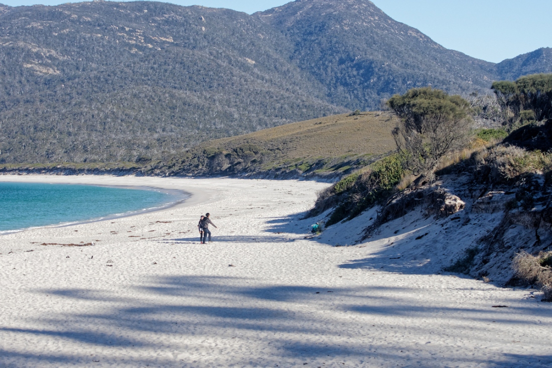
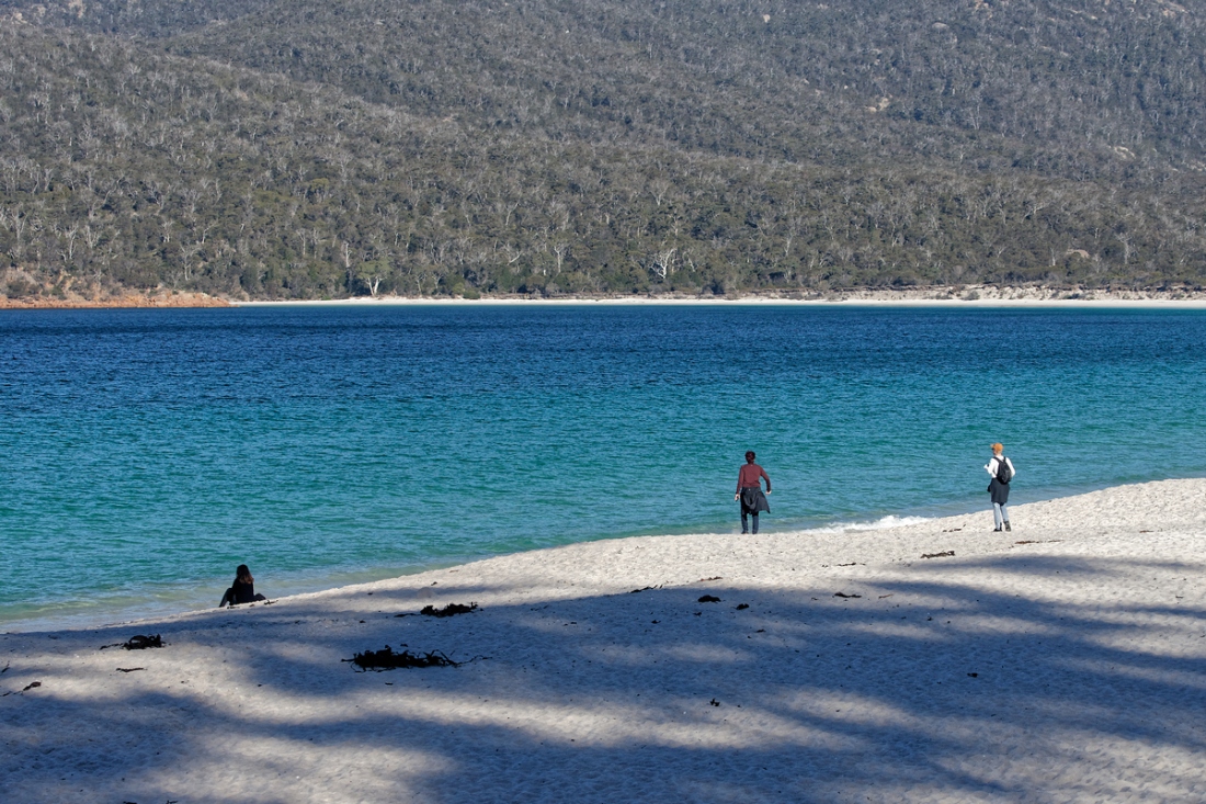
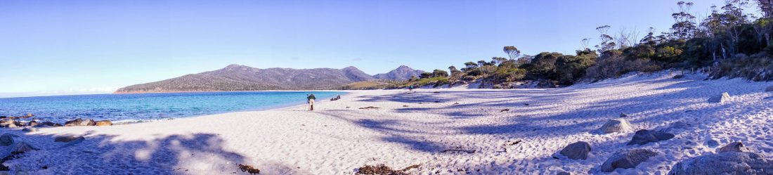
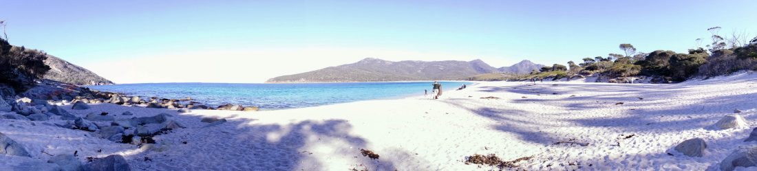
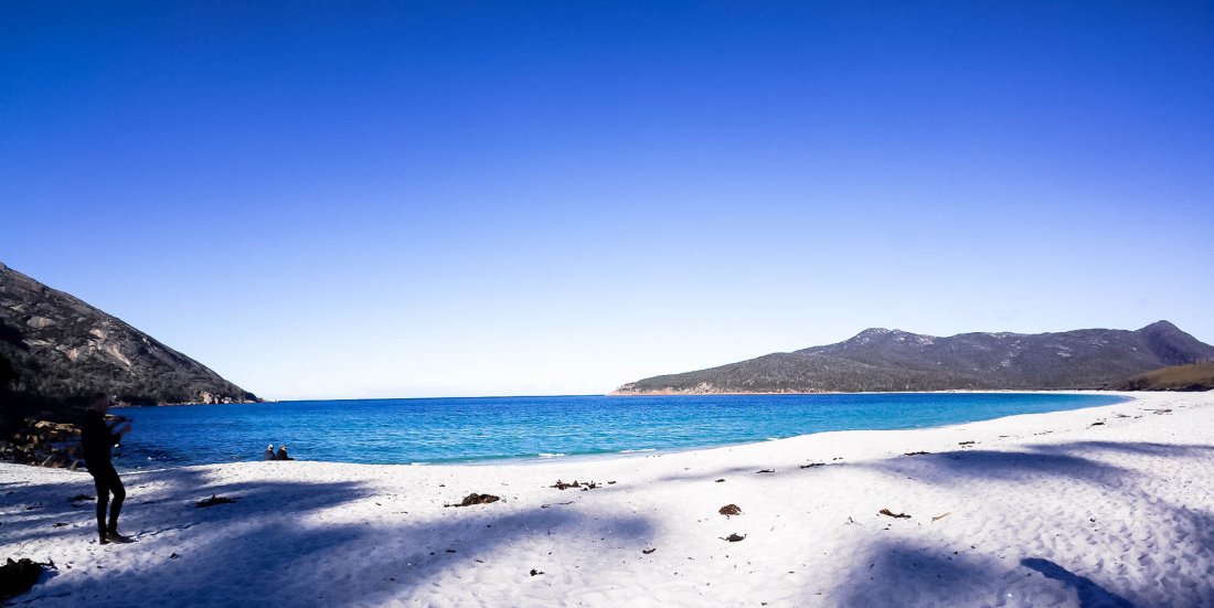
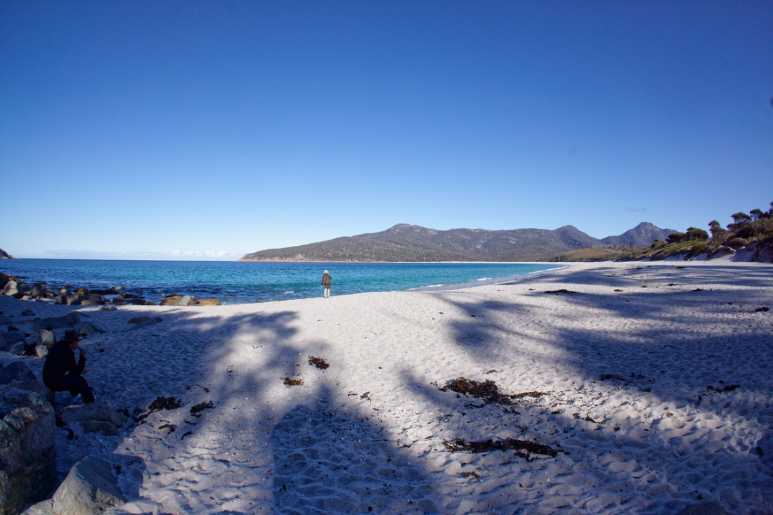
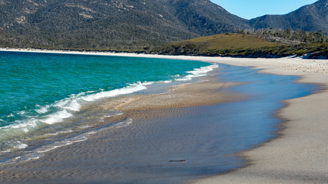
Wineglass Bay
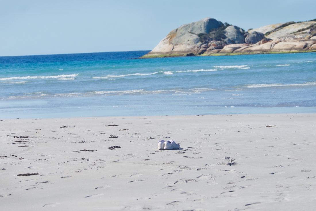
Wineglass Bay, on Tasmania’s Freycinet Peninsula, is considered one of the top ten beaches in the world. This flawless crescent of dazzling white sand and sapphire-coloured sea set against pink and grey granite peaks is one of Australia’s most beautiful natural environments.
It’s the perfect location for fishing, sailing, bushwalking, sea kayaking, rock-climbing, or simply soaking up the spectacular coastal scenery. Wineglass Bay has become a favourite honeymoon destination for couples to escape and relax away from the rest of the world.
Coles Bay
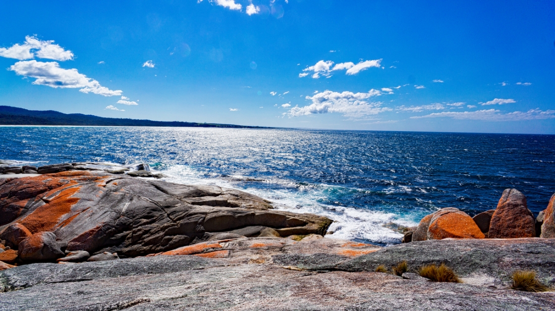
Bay of fires
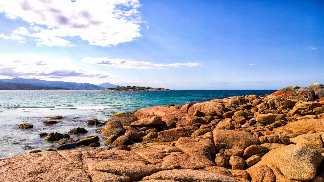
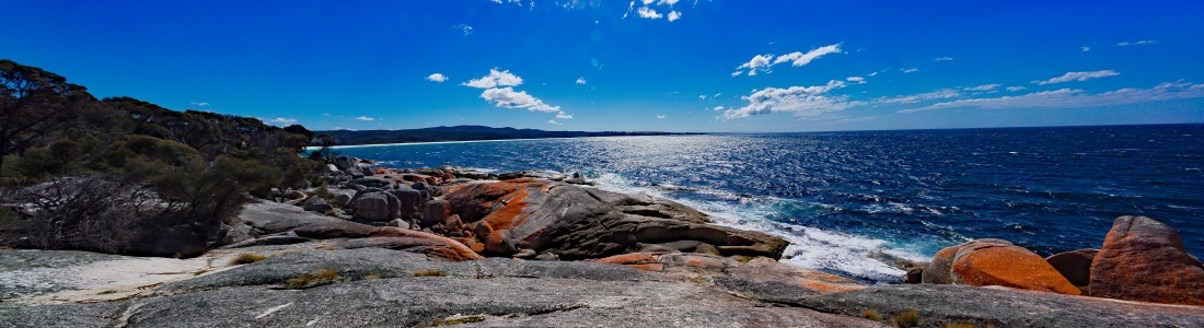
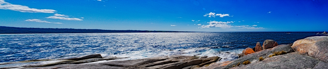
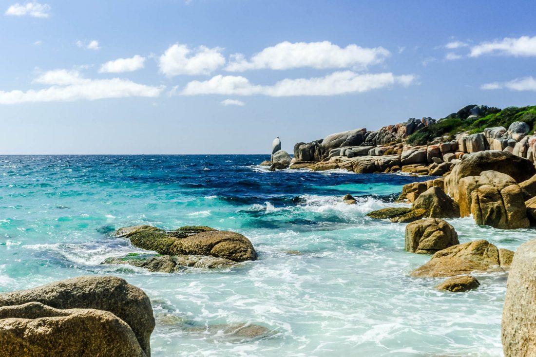
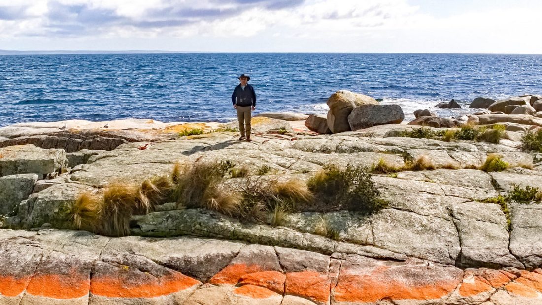
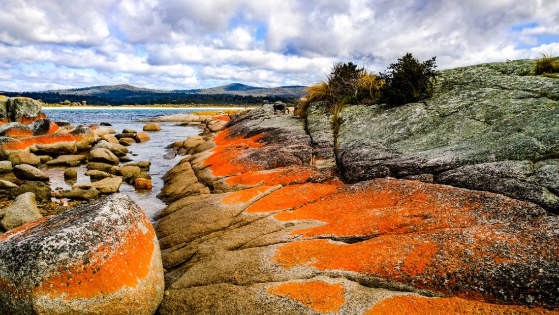
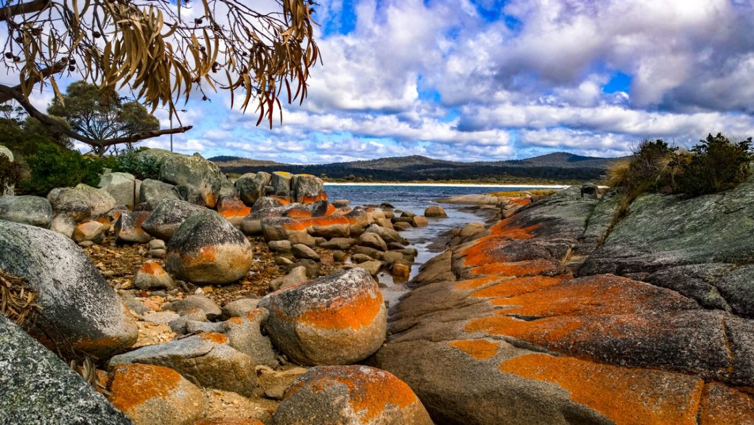
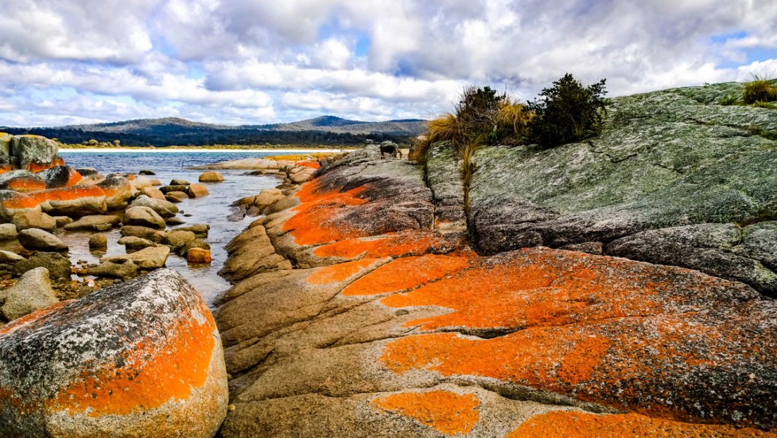
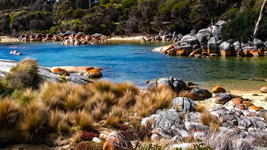
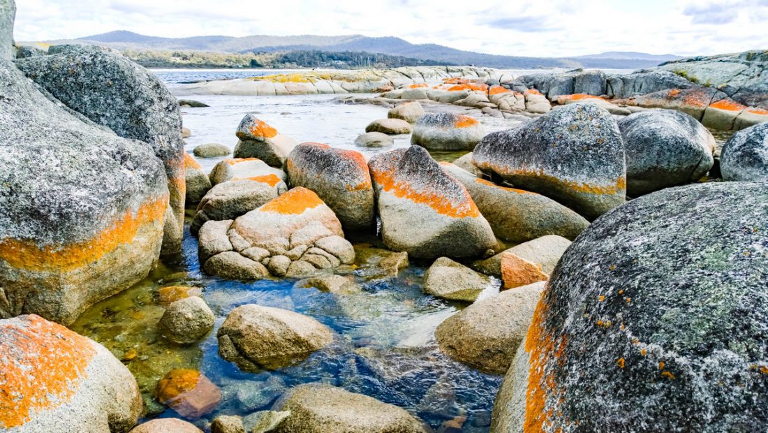
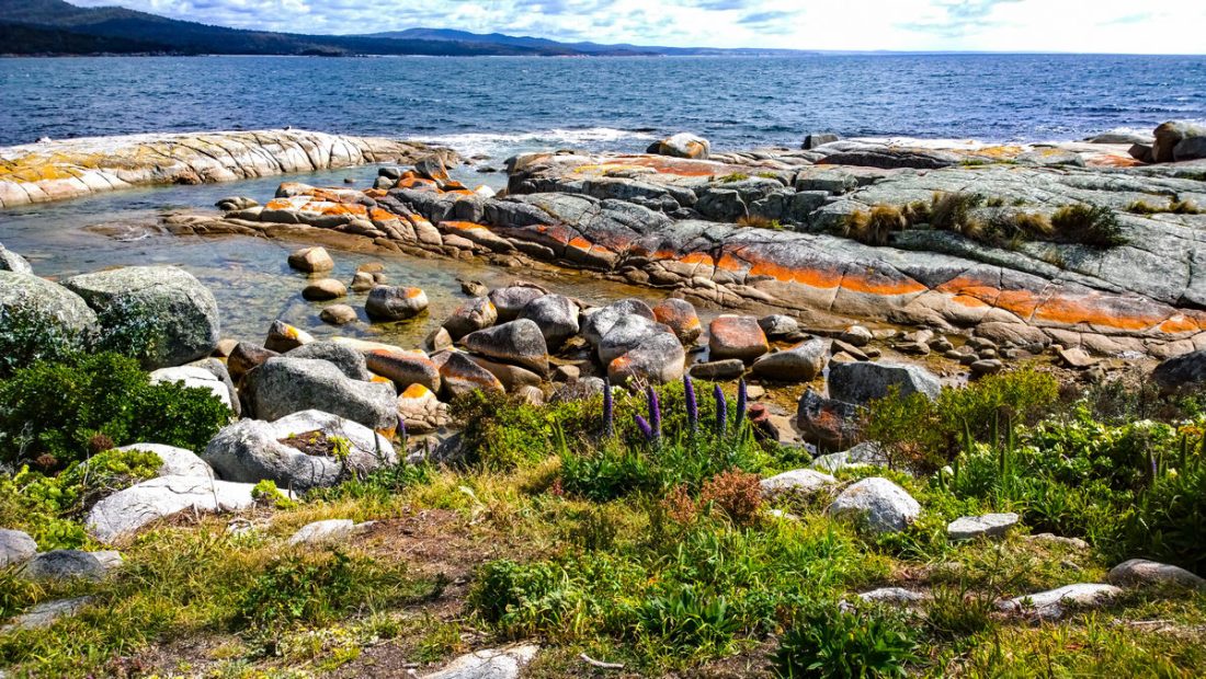
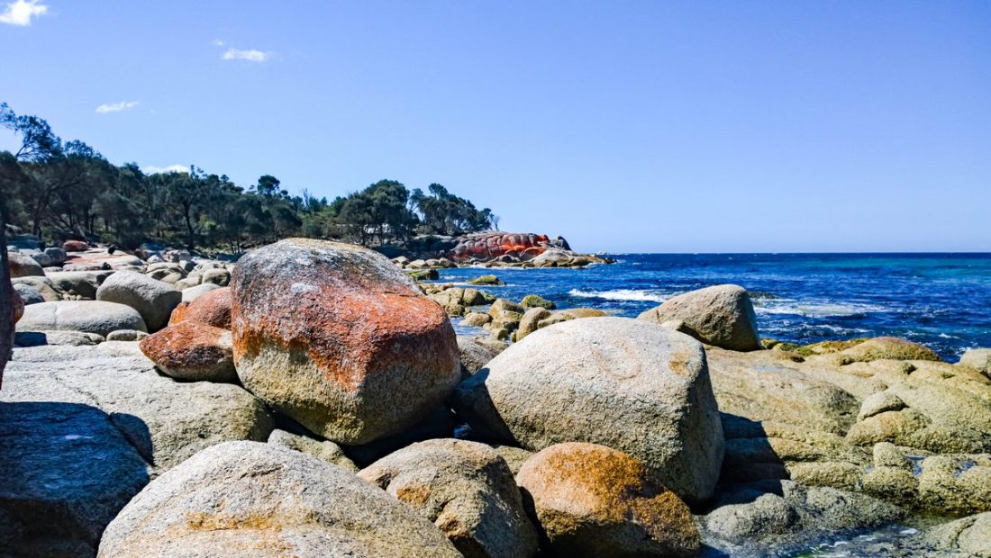
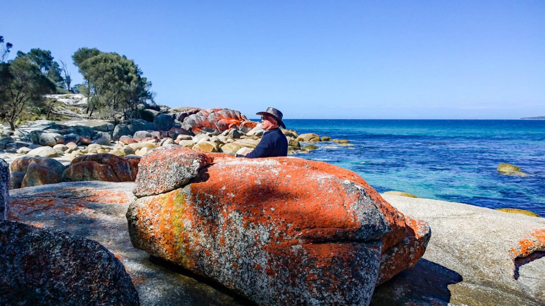
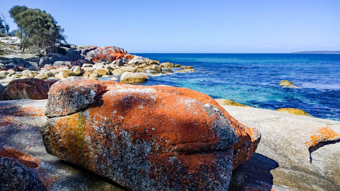
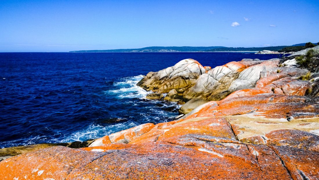
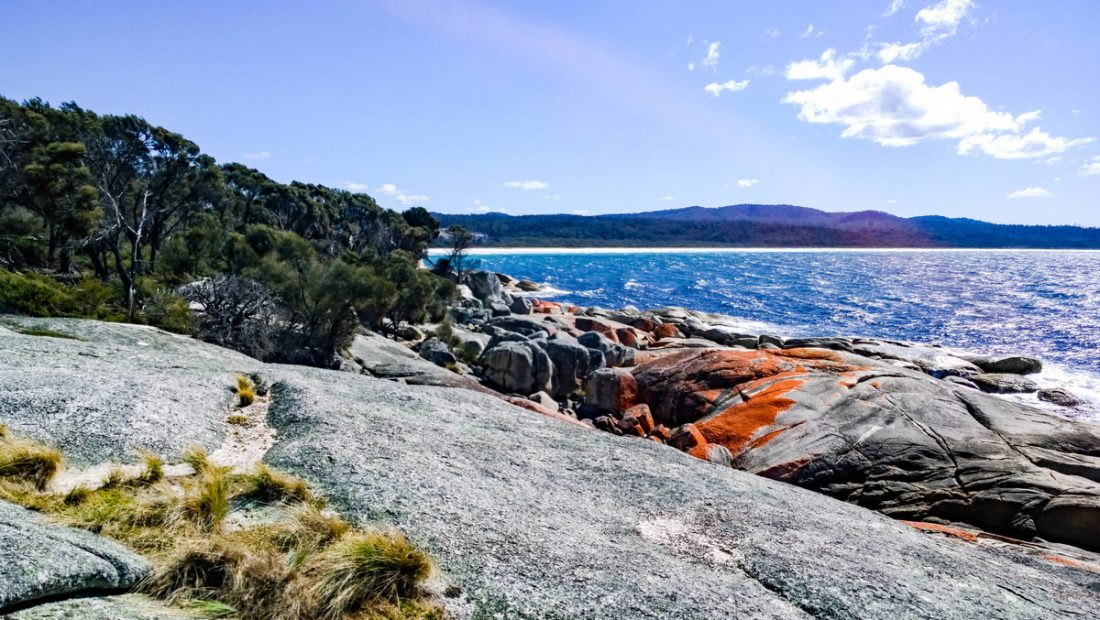
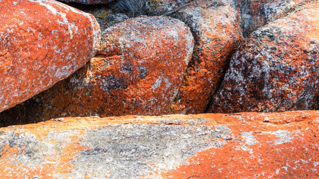
Bay of Fires – Weiße Strände, türkis-blaue Wellen, einsame Buchten, leuchtend orange Felsen, abwechslungsreiche Küstenabschnitte, grandiose Sonnenaufgänge – einer der schönsten Orte Tasmaniens.
Die Bay of Fires im Nordosten von Tasmanien ist berühmt für ihr kristall-klares Wasser, ewig langgezogene weiße Sandstrände, die nur unterbrochen werden von, leuchtend orange farbenen, riesigen Felsbrocken und Landzungen aus Stein. Direkt dahinter schattige, grüne Buschlandschaft und dazwischen wunderschöne Campingplätze.
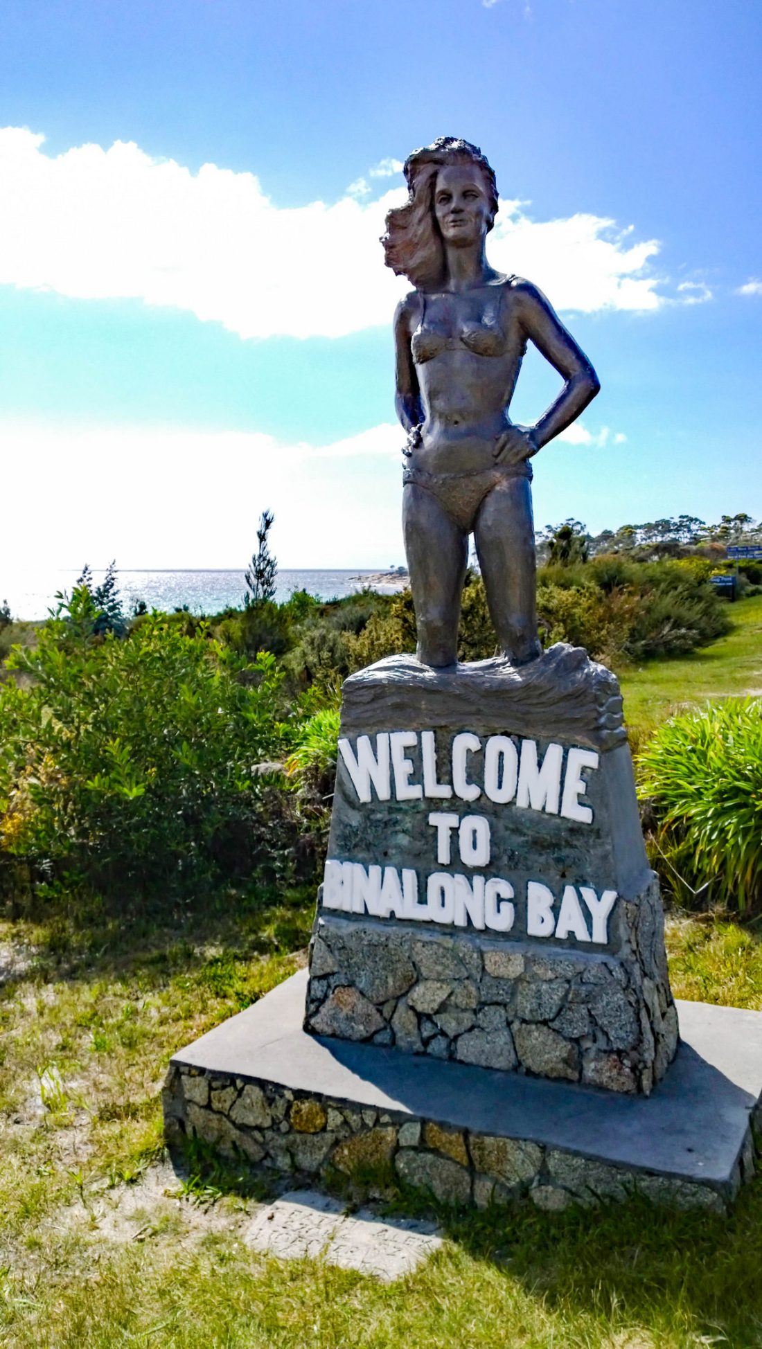
Die Bay of Fires (ursprünglicher Name: Larapuna) ist eine Bucht an der nordöstlichen Küste von Tasmanien in Australien, die sich von der Binalong Bay bis zum Eddystone Point erstreckt. Die Bucht erhielt ihren Namen im Jahr 1773 von Kapitän Tobias Furneaux in Adventure, der die Feuer der Aborigines an den Stränden sah.
The Bay of Fires (indigenous name: larapuna) is a bay on the northeastern coast of Tasmania in Australia, extending from Binalong Bay to Eddystone Point. The bay was given its name in 1773 by Captain Tobias Furneaux in Adventure, who saw the fires of Aboriginal people on the beaches.
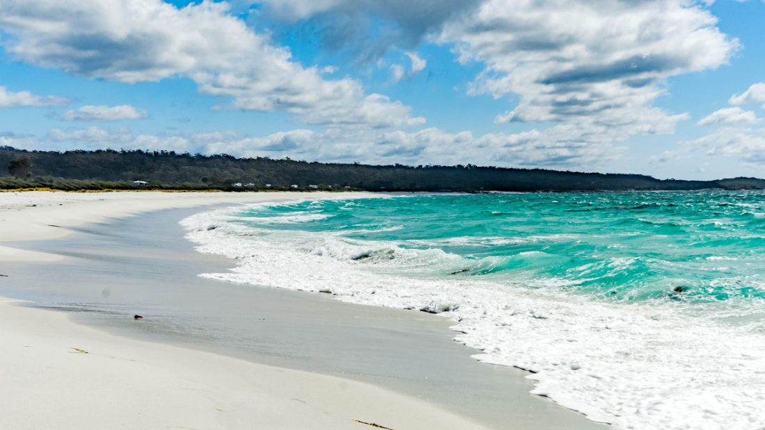
Binalong Bay im Süden ist der Hauptstrand und lädt mit seinem kristall-klaren Wasser zum Schwimmen, Schnorcheln, Surfen oder einfach in der Sonne liegen ein.
Als ich die Bay Of Fires (deutsch: Bucht der Feuer) so leuchten gesehen habe, dachte ich, dass die orange leuchtenden Felsen, diesem Küstenabschnitt seinen Namen gegeben haben. Tatsächlich ist hier aber 1773 Kapitän Tobias Furneaux entlang gesegelt und hat hier überall die Feuer der Aborigines brennen sehen.
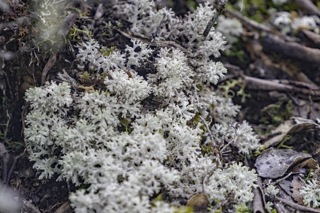
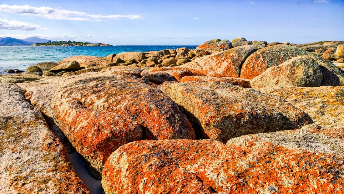
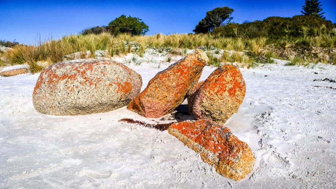
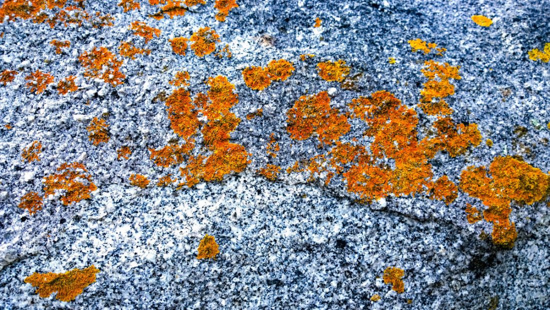
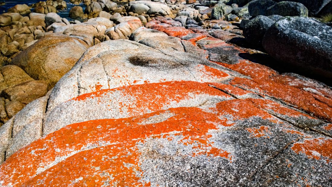
Die orange Farbe auf den Granit-Felsen sind Flechten.
A lichen is a composite organism that arises from algae or cyanobacteria living among filaments of multiple fungi in a mutualistic relationship. The combined lichen has properties different from those of its component organisms. Lichens come in many colors, sizes, and forms. The properties are sometimes plant-like, but lichens are not plants. Lichens may have tiny, leafless branches (fruticose), flat leaf-like structures (foliose), flakes that lie on the surface like peeling paint (crustose), a powder-like appearance (leprose), or other growth forms.
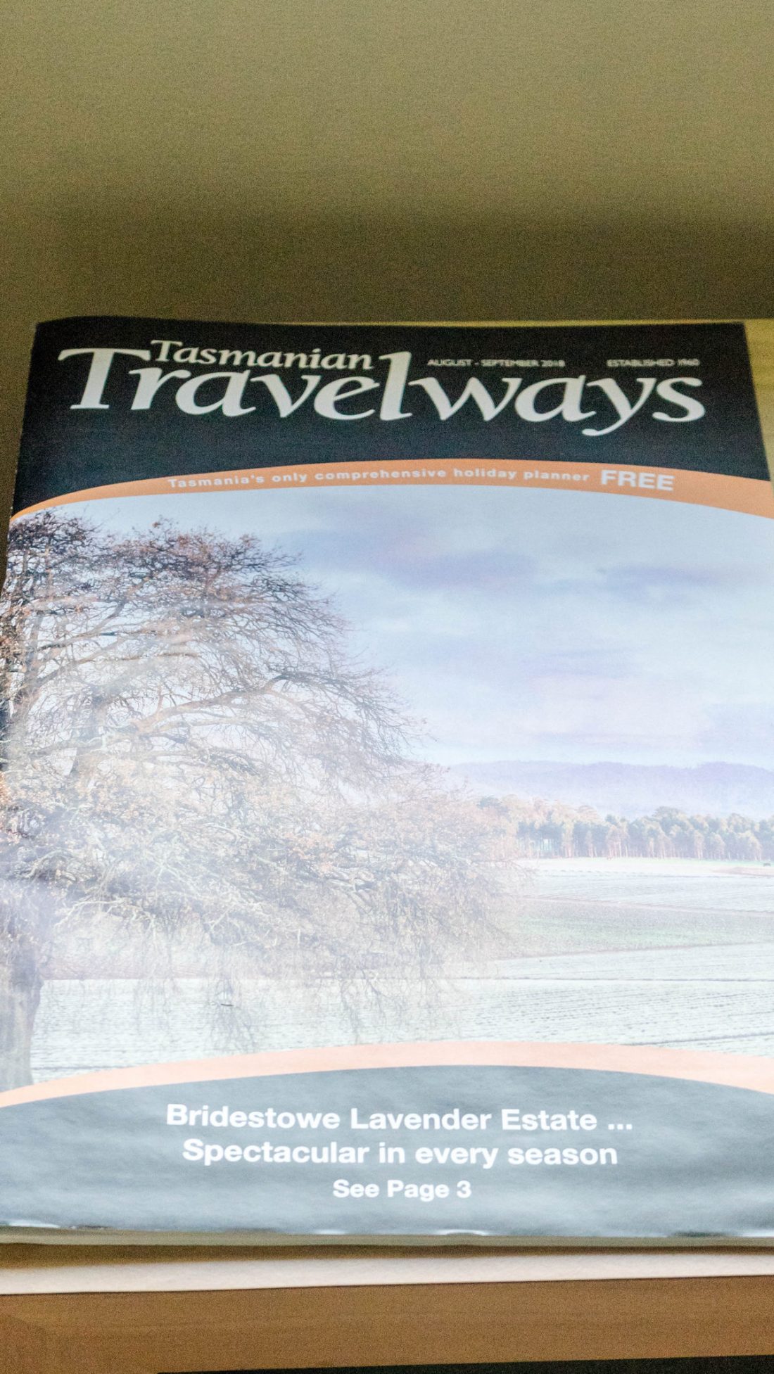
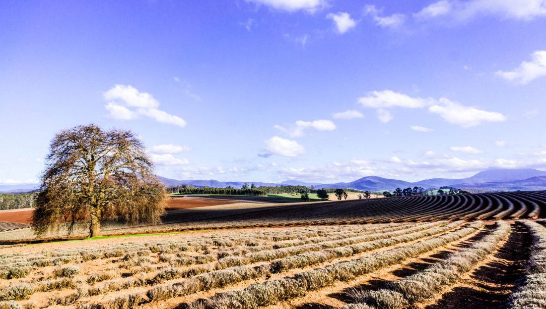
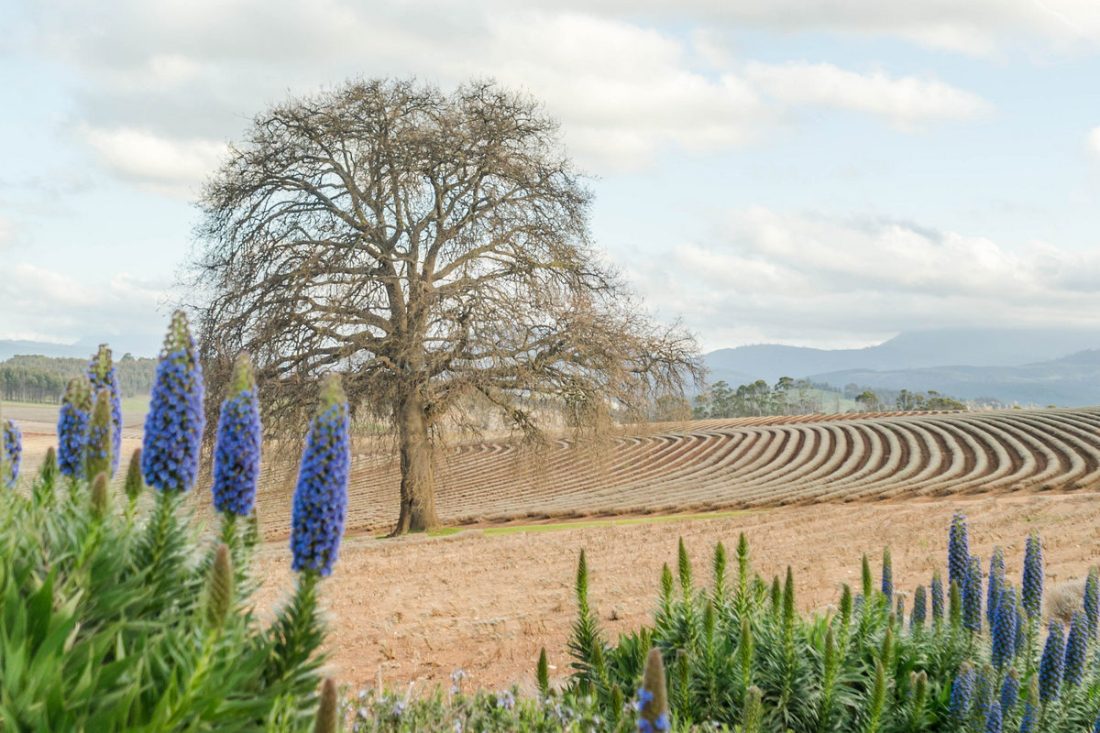
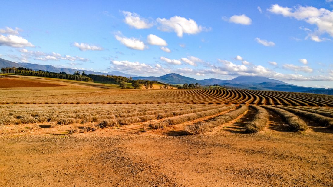
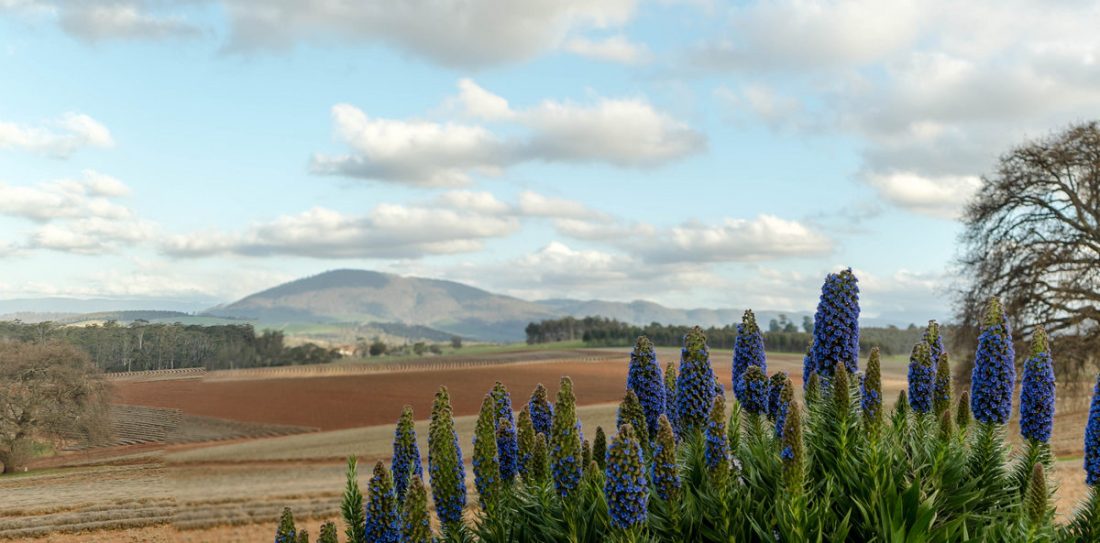
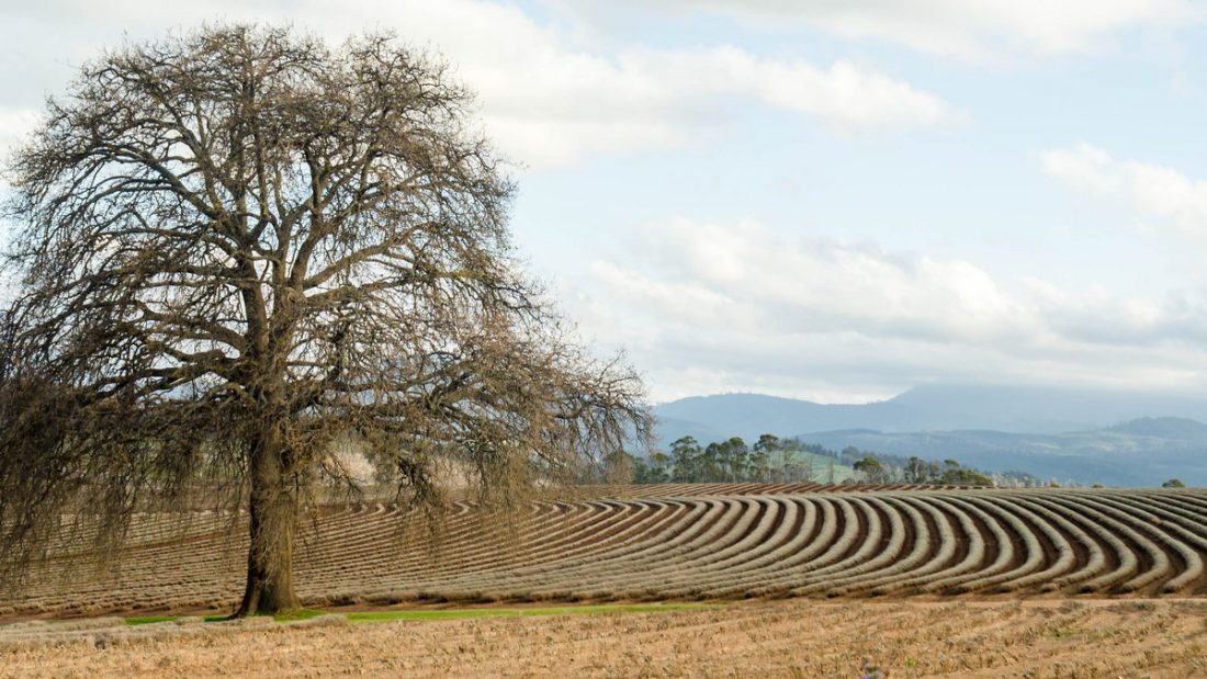
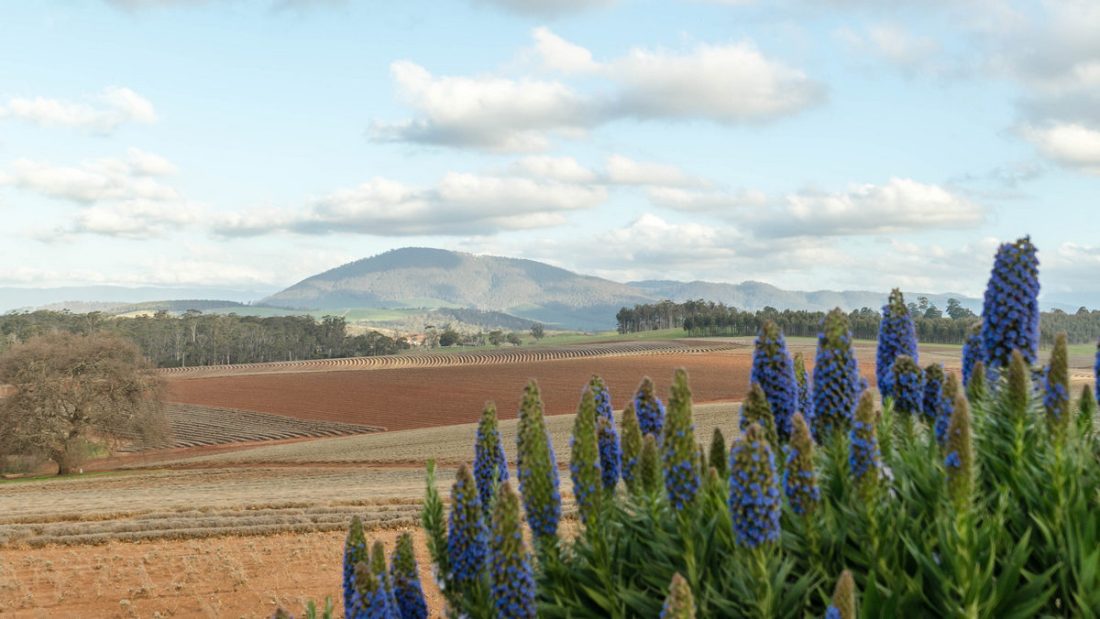
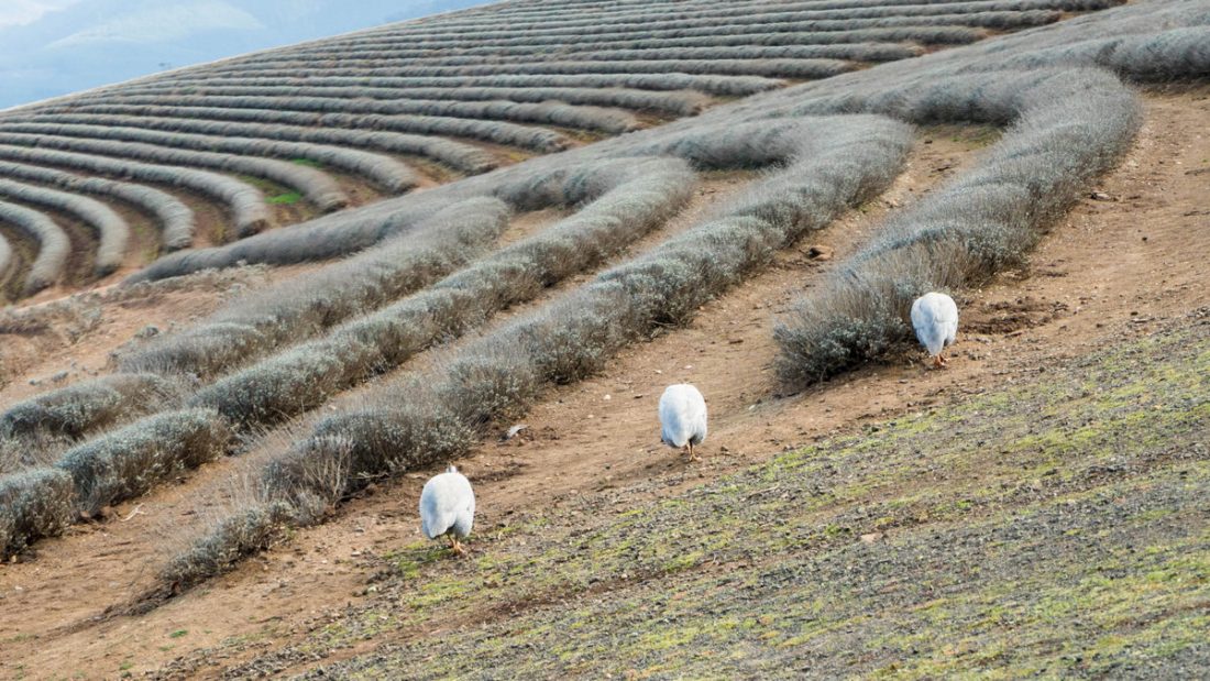
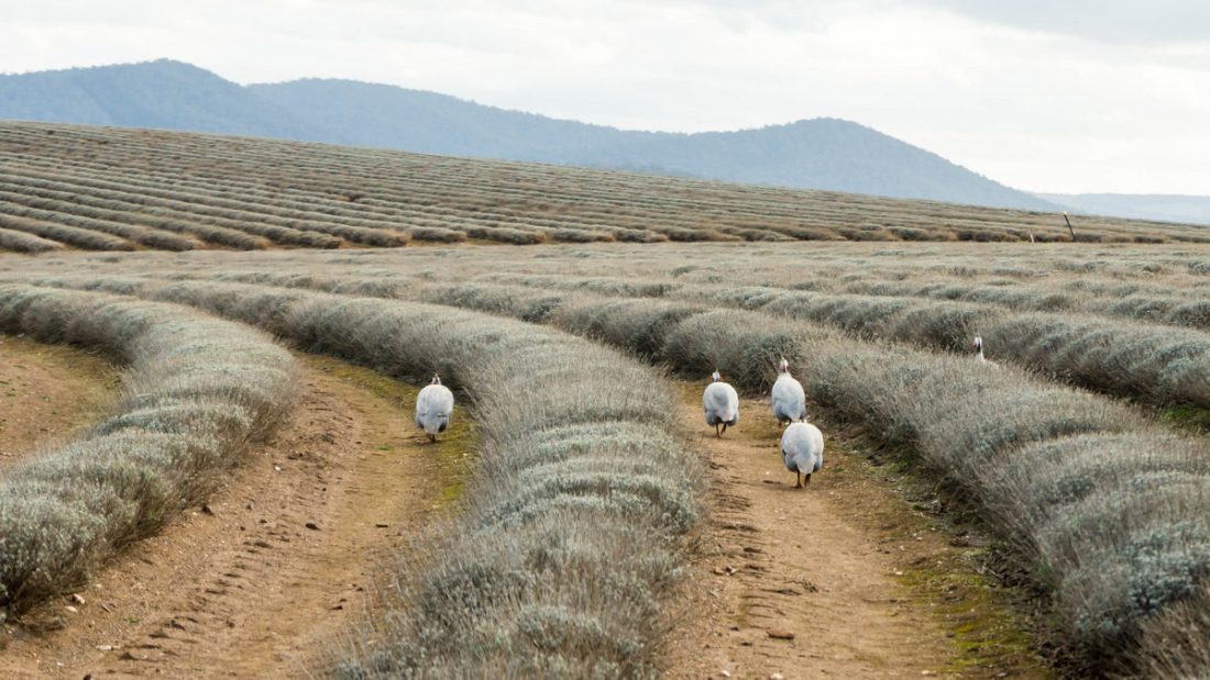
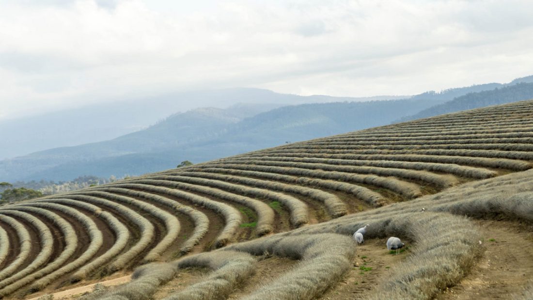
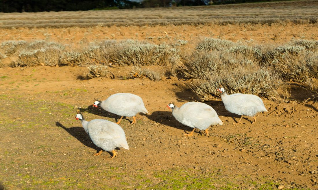
Im Nordosten Tasmaniens befindet sich die Bridestowe Lavender Farm. Sie produziert mit das weltbeste Lavendelöl & ist eine der größten Lavendel Farmen. Besonders zur Blütezeit des Lavendels ein unvergesslich schönes violettes Farbenmeer-Erlebnis.
Die Bridestowe Lavendel Farm in Tasmanien ist eine der gefragtesten und qualitativ besten Lavendelöl-Hersteller in der Welt und schlägt damit sogar noch seine französische Konkurrenz. Die Lavendel Farm liegt im Nordosten Tasmaniens und kann fast das ganze Jahr besucht werden.
Die schönste bzw. die ganze violette Blütenpracht entfalten die Lavendelbüsche im Dezember bis Mitte Januar
London perfumer CK Denny migrated to Tasmania with his family in 1921, holding a packet of lavender seeds sourced from the southern French Alps – the home of true French lavender, Lavandula angustifolia.
CK chose Tasmania to realise his dream of producing the world’s finest lavender, recognising its similarity in climate and conditions to the famous lavender regions of Provence. The determined family began Bridestowe Estate with their first planting of pure lavender at North Lilydale, just a short distance from Bridestowe’s current farm.
Bridestowe Lavender Estate is one of Tasmania’s premier tourist destinations, located a 50-minute drive from Launceston in Tasmania’s scenic North East. Bridestowe Estate is the largest lavender farm in the Southern Hemisphere, famous for the spectacular view of the lavender in bloom in December and January.
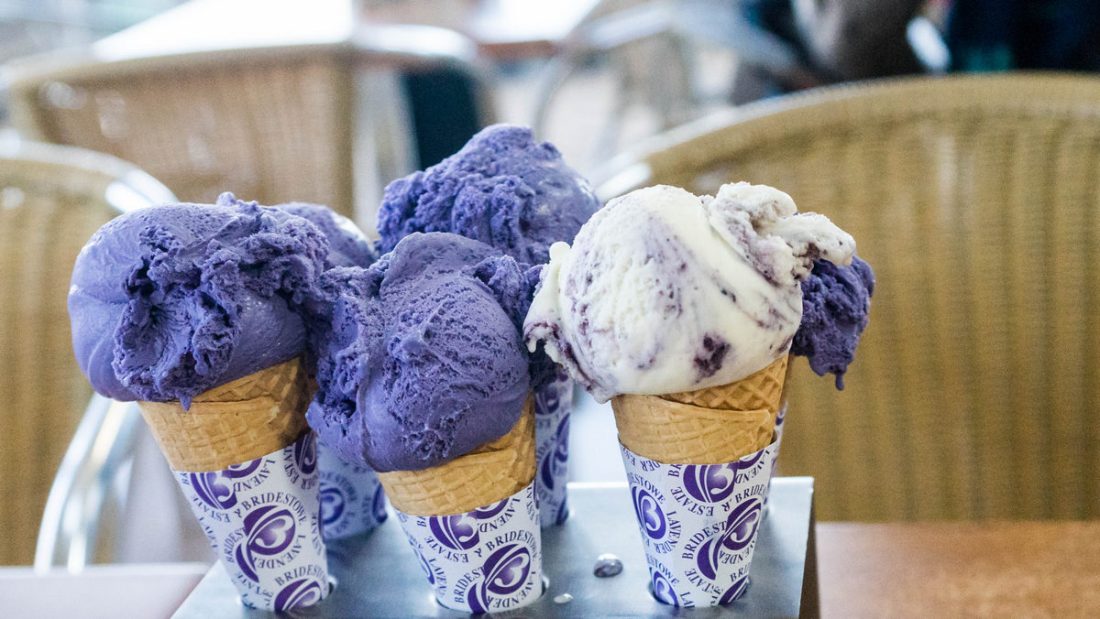
The Woodcroft Cafe offers a delicious range of lavender inspired delicacies including our signature range of lavender ice-creams and light seasonal meals. You can take home the experience with a purchase from Bridestowe’s gourmet range, which includes lavender flower honey, artisan jams and jellies, and culinary lavender, which is used in many of foods available in the cafe.
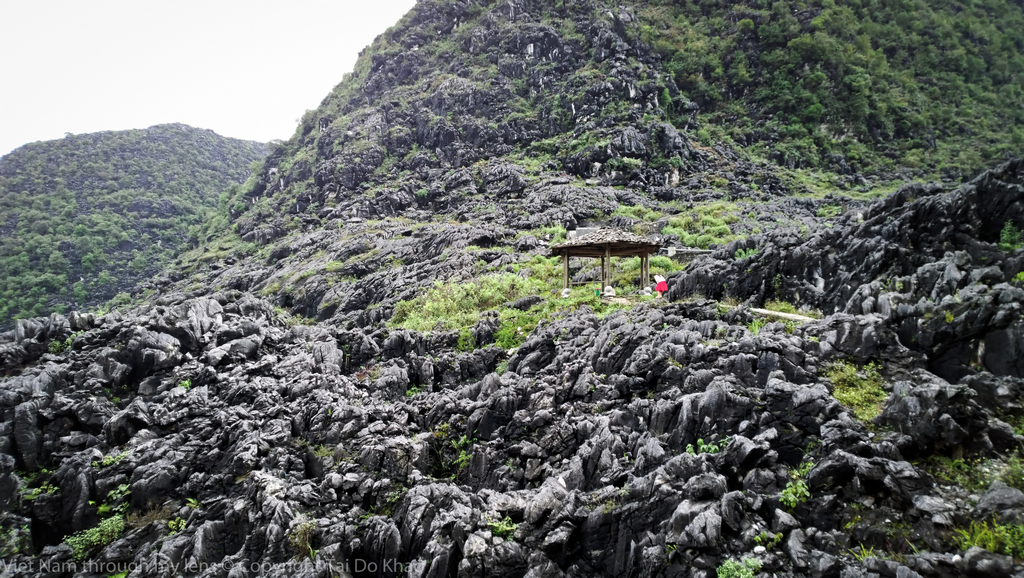
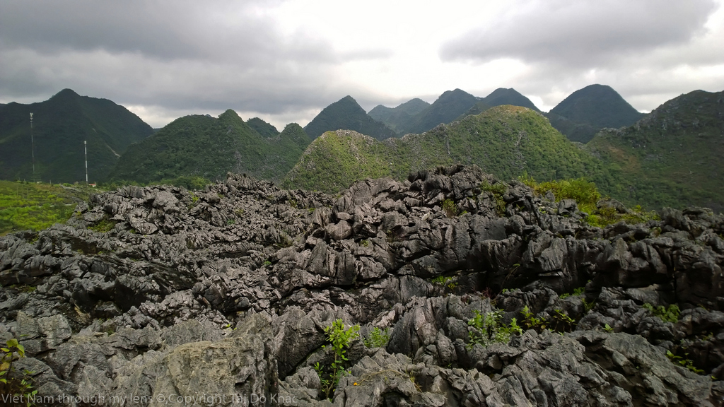
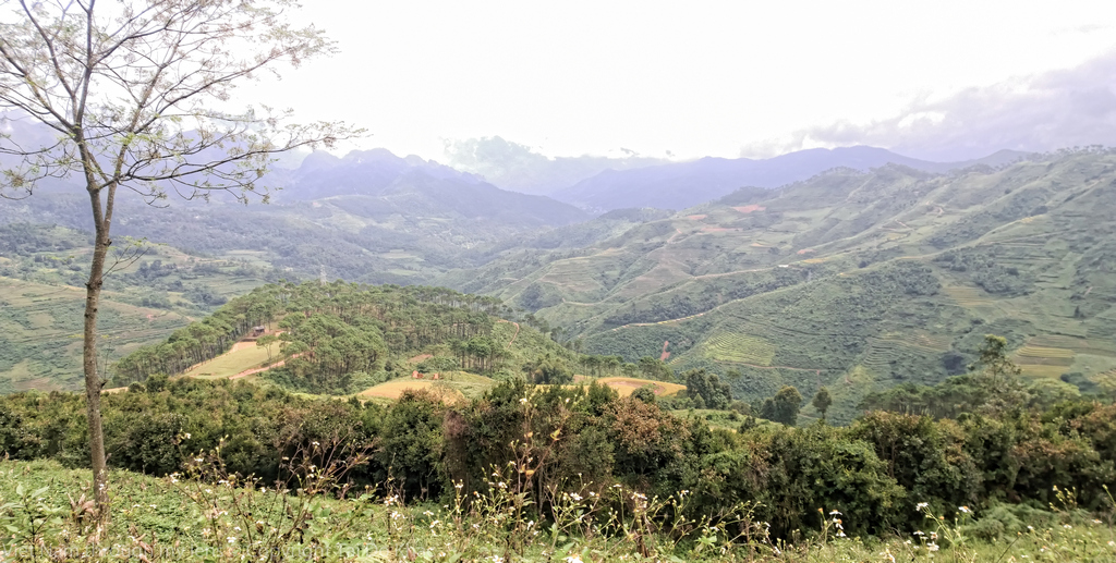
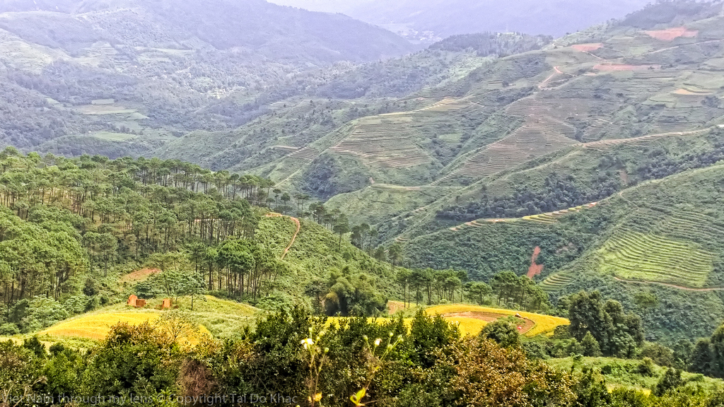
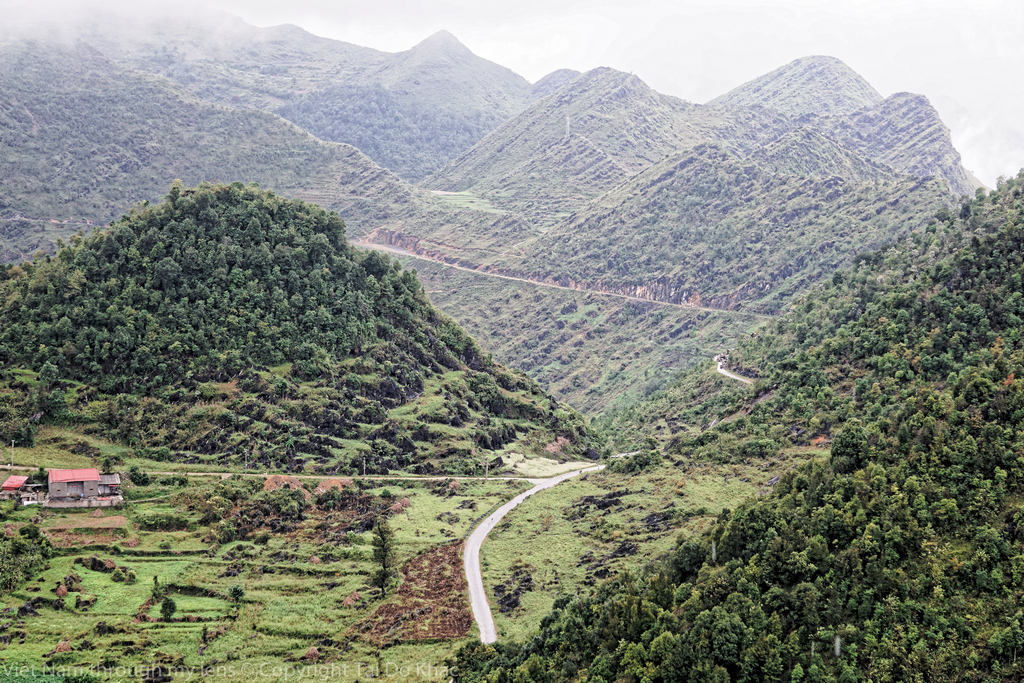
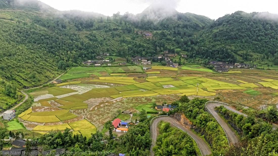
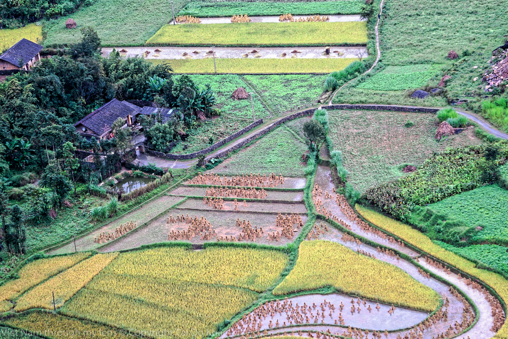
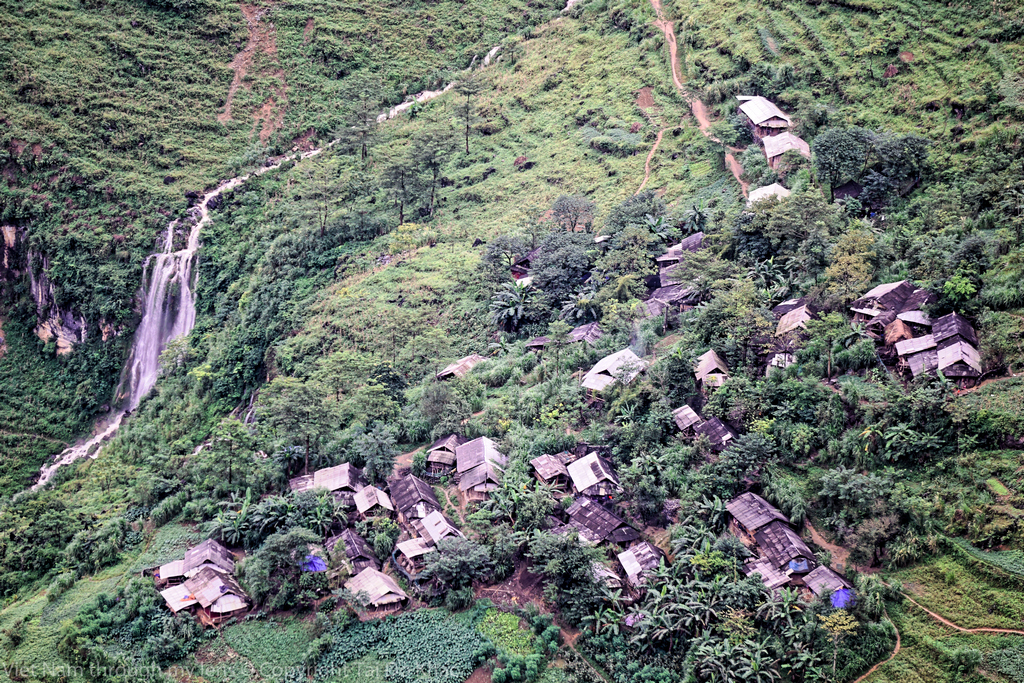
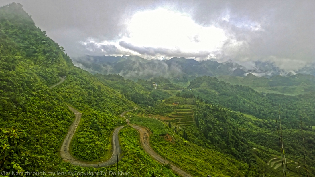
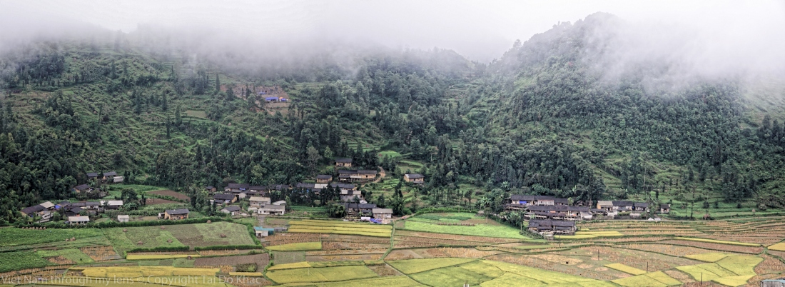
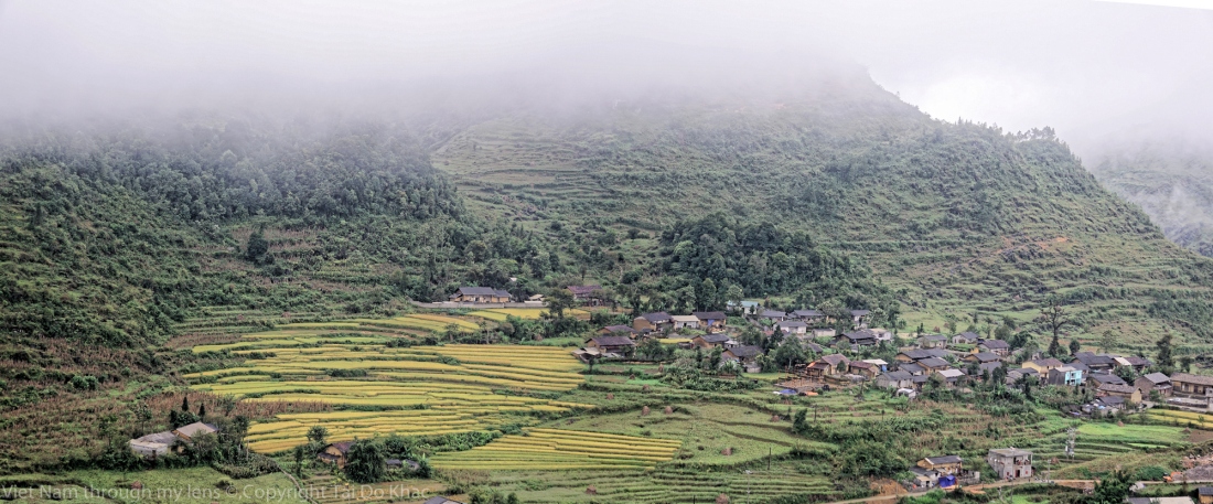
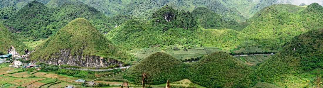
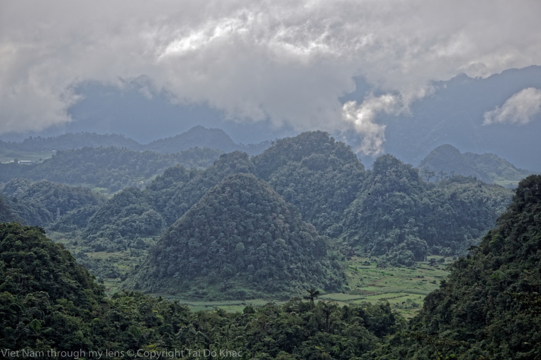
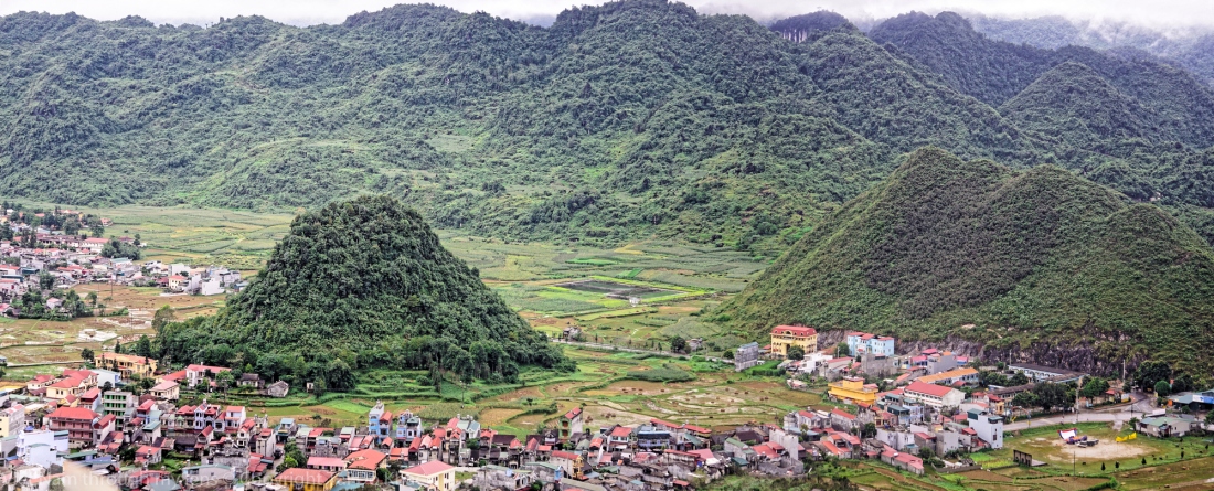
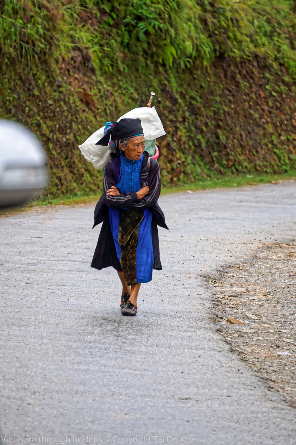
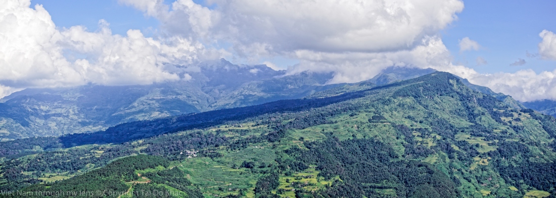
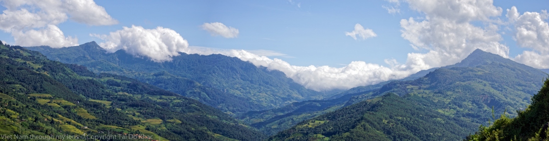
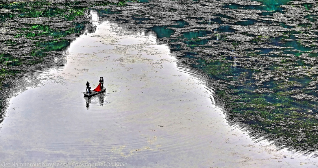
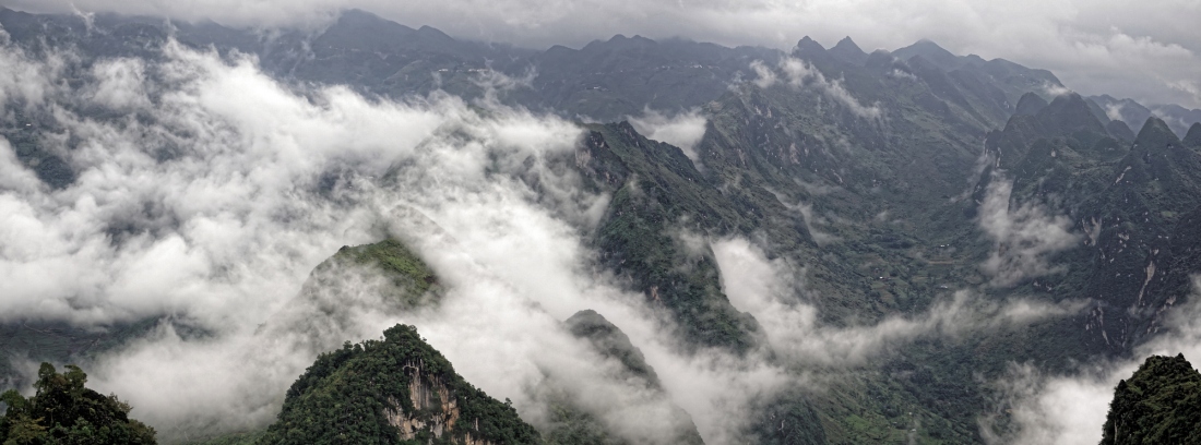
Dong Van karst plateau Geopark consists of four districts, namely, Meo Vac, Dong Van, Yen Minh, Quan Ba. Located in the North of Ha Giang province – Viet Nam.
It shares border with china in the north, total area of over 2.346 km2 . The karst plateau is created by at least 80 percent limestone and many fossils of ancient creatures species from 400 – 600 million years ago. Its average elevation is 1400 -1600 meters above sea level.
A la pointe Nord du pays, dans la province du Ha Giang, à quelques encablures de la frontière chinoise. Le plateau karstique de Dong Van reconnu et déclaré Geopark par l’UNESCO en 2010. Une géologie façonnée depuis 550 millions d’années, des flancs de montagnes abrupts lacérés de petites routes et chemins, des pics approchant les 2000 mètres, des vallées abyssales, des rizières, des plantations de maïs et des forêts de pins, le décor est planté. Meo Vac et ses environs, ce sont aussi 17 groupes ethniques qui se partagent et travaillent les terres. Un ensemble de cultures fortes et marquées, des gens souriants et ouverts, des expériences humaines inoubliables.
Der Dong Van Karst Geopark liegt an der chinesischen Grenze auf ca. 1.100 Metern im nördlichsten Teil Vietnams. Hier ragen zunächst gigantische Karststeinberge aus dem Boden und hinter diesen Bergen erscheint auf einmal eine unbeschreibliche Natur mit senffarbener Erde und grauen spitzen Bergzipfeln, so wie du sie vielleicht von Bildern aus Vietnam kennst. Diese Hügel ragen vielfach gestaffelt wie Zuckerhüte aus der Erde. Unbeschreiblich toll. Das Leben für die Menschen dort vor Ort ist sicher um einiges schwieriger, denn der Anbau hier ist nicht einfach. Man sieht die Menschen auf den Hängen arbeiten, wobei sie ihr Leben riskieren, denn ein falscher Schritt und sie fallen in die Tiefe. Außerdem ist es überall sehr steinig und nirgendswo sieht man große freie Flächen zum Anbauen.
Cực Bắc, địa đầu thiêng liêng của Tổ Quốc, là nơi ai cũng muốn đặt chân tới. Trên đường đi cảnh sắc hết sức hùng vĩ, nhìn đâu cũng là đá, những khối đá tai mèo xám xịt…“Ai về thăm quê hương tôi, nơi biên cương là đây, có đường đi trên mây lên đến cổng trời. Đây Hà Giang, đây Hà Giang quê chúng tôi…”
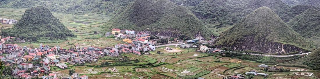
Meo Vac
A la fin du XIXème siècle, le chef tribal Hmong Dương Tu Nghia ne cachait pas sa volonté d’étendre son autorité sur l’ensemble du haut plateau. Se faisant appeler “Roi Hmong”, il affirma sa puissance en montrant sa capacité à répondre aux besoins de la population en développant économiquement son territoire.
Selon la légende, il fit venir de Chine un géomancien pour déterminer l’emplacement d’un réservoir capable d’assurer une continuité d’approvisionnement en eau de la vallée karstique de MeoVac, sujette à une pénurie drastique de novembre à avril. Malgré l’absence de source, le réservoir était empli d’eau toute l’année, cela grâce au captage habile des eaux de pluies.
A proximité du réservoir, il se fit ériger un fortin de pierre de taille et de bois précieux en louant les services d’ouvriers du district de VânSơn, dans la province chinoise limitrophe du Yunnan.
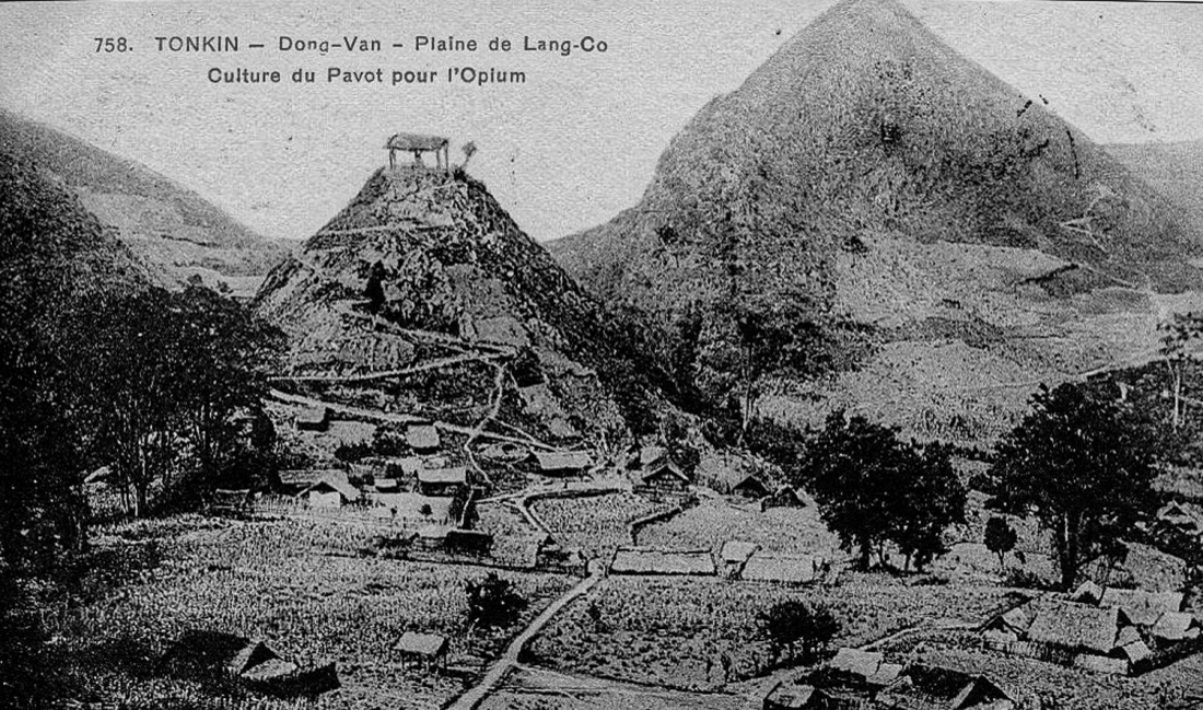
La renommée et l’œuvre du père, initiateur des réservoirs capteurs d’eau de pluie du haut plateau karstique, furent renforcées par son fils: Dương Trung Nhân. Toutefois, les volontés hégémoniques des Dương se heurtèrent à la puissance du potentat voisin, le chef tribal Hmong Vương Chính Đức. Sa puissance se fondait sur le quasi monopole de la collecte d’opium du haut plateau.
La concurrence entre les deux lignages provoqua de nombreux conflits qui dégénérèrent parfois jusqu’à l’usage des armes. Progressivement, la renommée du Roi Hmong de MeoVac s’éclipsa. En 1953 Dương Trung Nhân dut abriter sa famille à Hanoi puis s’exila finalement dans l’état du Minnesota aux Etats-Unis où il mourut en 1984 à l’âge de 82 ans.
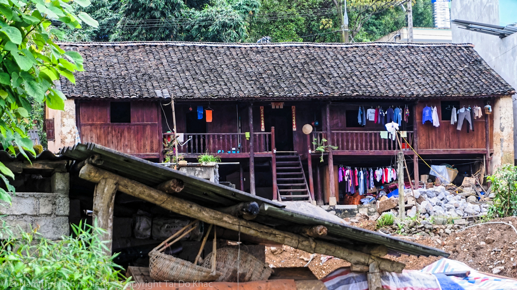
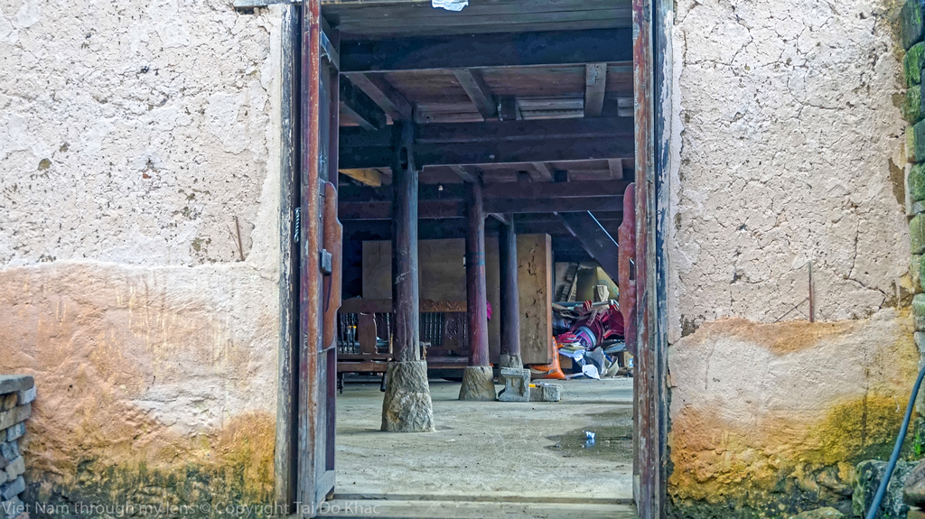
une maison ancestrale de notable Hmong, fut construit dans les années trente, sous la domination française au Tonkin. Conformément au modèle architectural de l’habitat cossu des Han du Sud de la Chine, la bâtisse, véritable ferme fortifiée, comportait originellement un agrégat de quatre bâtiments. Ceux-ci, joints par leur toiture, formaient un quadrilatère autour d’un atrium en pierre de taille, réceptacle des eaux de pluie. En novembre 2011, ne subsistait plus que l’édifice principal, le patio et le portique en pierre de taille. Cet édifice, construit en pisé – mur de 80cm en terre battue –, comportait en son sein une structure bois sur pilotis supportant un étage et la charpente. L’agencement intérieur se divisant, conformément à l’habitat Hmong traditionnel, en trois travées, cloisonnées Thông Dà, bois estimé du Haut plateau.
Baptisée Chung Pua, signifiant «hameau en bordure du ruisseau» en langue Hmong, cette charmante auberge, située sur une colline qui surplombe la vallée, est une ancienne ferme fortifiée construite vers 1930 et ayant appartenu à un notable Hmong. L’ensemble prend la forme d’une grande maison traditionnelle chinoise composée d’un agrégat de quatre bâtiments, avec murs en pisé, autour d’un patio intérieur qui servait à recevoir les eaux de pluie.
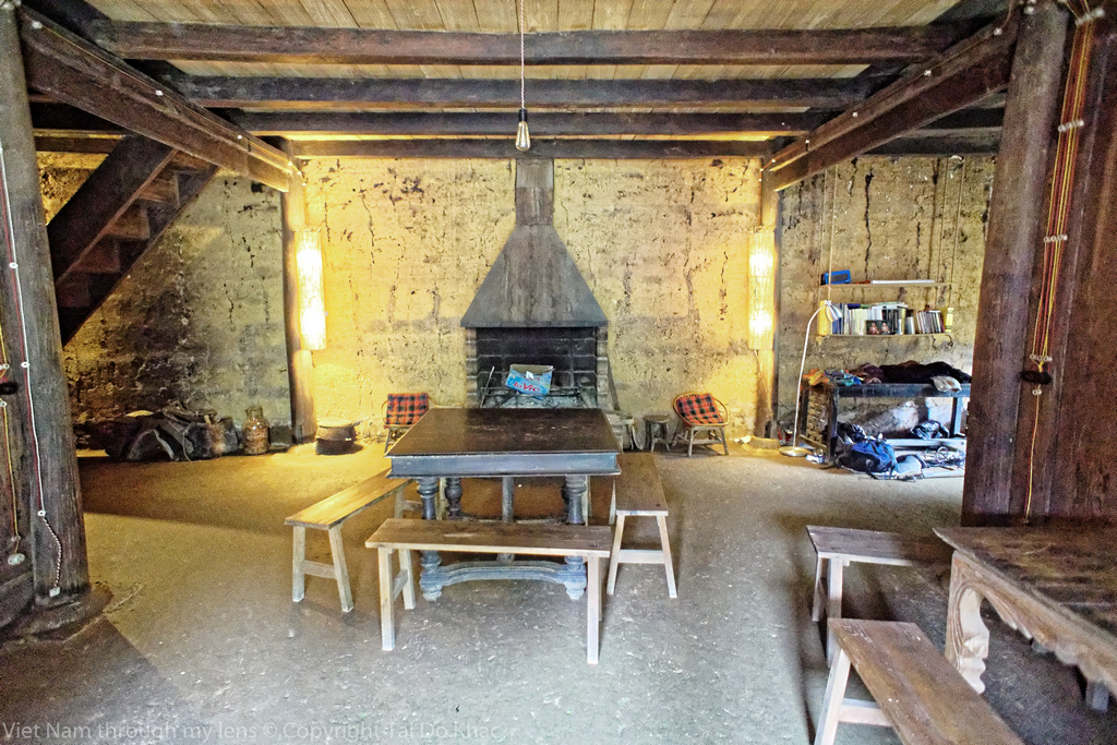
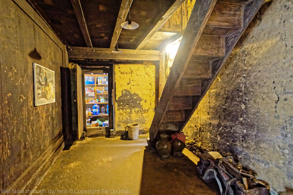
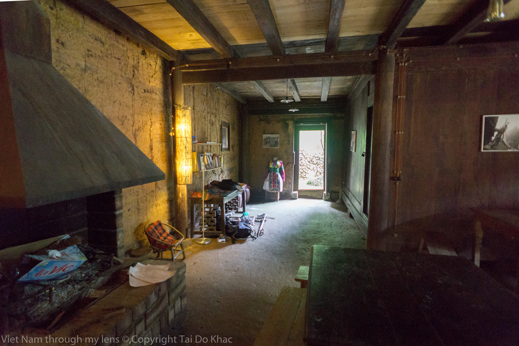
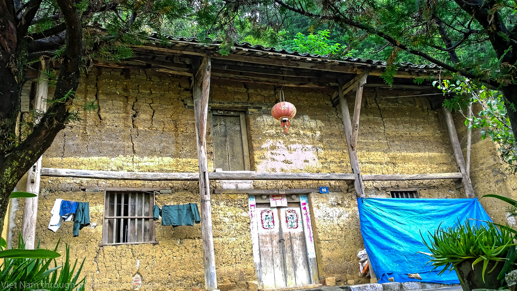
Ganz im hohen Norden Vietnams, nahe der chinesischen Grenze, eingebettet in ein Flusstal inmitten einer malerischen Bergkette liegt das Örtchen Meo Vac. Die zauberhafte Auberge de Meo Vac liegt nur wenige hundert Meter vom Marktplatz entfernt. Die Herberge ist eine kleine Berglodge, die aus einem authentisch-alten Haus der dort ansässigen ethnischen Minderheiten des 19. Jahrhunderts enstanden ist. Das Haupthaus besteht aus Tonwänden, die von Holzpfosten eingerahmt werden. Alte Holzpfeiler stehen vor weiß gemusterten Fenstern auf einer kleinen Terrasse, die mit Stühlen und Gegenständen des Dorflebens geschmückt ist. Der gemütliche Innenhof der Herberge bietet Ihnen tolle Blicke auf die umliegenden Berge und den kleinen Garten, die Inneneinrichtung ist ähnlich liebevoll-rustikal.
Chúng Pủa trong tiếng của người Mông là Bờ suối (Bên suối), chỉ nằm cách chợ Mèo Vạc chừng 500m nhưng không phải kẻ nào cũng biết, những kẻ đi biết về nó cũng không nhiều bởi đơn giản nó không quảng cáo hay phô trương gì cả. Nhưng lũ tây balo thì lại rất rành, phải chăng nó phù hợp với tính cách của các bạn ở phương trời xa đó. Không, nó phù hợp với những kẻ như tôi nữa. Ngồi trên chiếc ghế vòm cũ kỹ mà những kẻ 7x, 8x như chúng tôi vẫn còn nhớ rõ trong tuổi thơ của mình. Những người phố thị giờ có thể thấy chúng trong những quán cafe phục dựng lại đó. Tôi ngồi đó, ánh đèn điện vàng vọt đủ chiếu sáng cuốn sách nhỏ, nhấp ngụm trà, à, trước đó là bữa rượu ngô say nồng với chủ nhà rồi chứ. Có lẽ vì rượu ngô mà tôi thấy cái buổi tối trong căn nhà ấy nó đẹp đến nhường nào. Tiếng ru êm nhẹ của bà mẹ trẻ căn nhà kế bên xen lẫn cả tiếng dế rả rích trong vườn, tịch lặng. Đêm đó, giấc ngủ không mộng mị… Bữa sáng nhẹ nhàng với những đồ ăn kiểu tây chứ không phải đồ của người Mông (đã quá quen với tôi) bởi tôi thích thế.Going into a small alley in Meo Vac town, you will be guided to a 100-year-old ancient house. This traditional H’mong house has been restored from a house that has existed for over a century. If you want to seek for cultural experiences. It is not difficult to find and recognize this homestay because of the unique architecture. Yin-yang roof tiles, earth-made walls, wooden poles and several stone statues of opium poppies, … are together put in a peaceful setting, which makes you feel like being lost in a wonderland. In addition to the unique design, in order to meet the needs of the travelers, the rooms also are equipped with modern-living facilities, with outdoor space for guests to relax, have a cup of tea and read books.Dương Trung Nhân sinh 1912 là con trai của thổ ty Dương Tụ Nghĩa. Để khẳng định quyền lực của mình không thua kém so với nhà họ Vương, họ Dương cho Dương Tụ Nghĩa đứng đầu đã dùng mọi cách để củng cố sức mạnh của mình. Giống như vua Mèo Vương Chính Đức (thân sinh Vương Chí Sình), Dương Tụ Nghĩa cũng xây dựng riêng cho mình một đội quân riêng để bảo vệ lãnh thổ do mình cai quản, đồng thời uy hiếp dòng họ láng giềng. Để chứng tỏ mình không thua kém vua Mèo Vương Chính Đức, Dương Tụ Nghĩa cùng con trai Dương Trung Nhân cũng tiến hành xây dựng một dinh thự bề thế không kém dinh thự vua Mèo ở Sà Phìn. Sau khi Dương Tụ Nghĩa qua đời, vua Mèo Dương Trung Nhân tiếp tục nối nghiệp cha, thực hiện âm mưu thống lĩnh toàn bộ vùng Đồng Văn. Dẳng dai gần suốt một thế kỷ, họ Dương và họ Vương đã coi nhau như kẻ thù. Giữa hai gia tộc thường xuyên xảy ra những cuộc giao tranh cả lớn cả nhỏ. Thời thế đổi thay. Mây bay nước chảy. Dương Trung Nhân đã đưa gia đình về Hà Nội rồi vào Sài Gòn. Sau 1975, xa hơn, tít tận tiểu bang Minesota ở Mỹ, mất lúc 82 tuổi tháng 8-1994 ở tiểu bang Minnesota.
Quan Ba , surnommé « Dalat » au Nord du Vietnam , est une petite région de la province Ha Giang et est aussi le territoire des Hmong . C’est à Quan Ba que le climat est doux et clément , on y trouve une variété des sites à découvrir comme la porte du Ciel ( Cổng trời ) , la montagne doublée (autre nom : Núi Cô Tiên ) , la grotte Khố Mỷ …
Quan Ba est également imprégné du coloré des ethnies minoritaires dont les quatre principales : Hmong , Dao , Tay , Bo Y . De plus , c’est un réel plaisir de venir y déguster des produits locaux, par exemple l’alcool de mais Thanh Vân , les kakis sans noyau , le thé Tùng Vài , la brocatelle Lùng Tám , …
Quản Bạ, cao 1500m so với mặt biển, đây là cửa ngõ đầu tiên lên cao nguyên Đồng Văn. Năm 1939, người ta dựng một cánh cửa khổng lỗ bằng gỗ nghiến dày 150cm ở ngay Cổng trời. Một thời, sau cánh cửa gỗ này là một “thế giới” khác – còn gọi là “Vùng tự trị của người Mèo”, gồm các huyện Quản Bạ, Mèo Vạc,Yên Minh và Đồng Văn.Porte du ciel de Quan Ba: Il s’agit de l’entrée du plateau de Dong Van se situant à 1500m d’altitude. Cette porte du ciel de Quan Ba construite en pierre et en bois ouvre un panorama époustouflant sur une magnifique vallée composée de belles rizières en terrasse, de montagne de terre et de petites maisons nichées sur les collines..
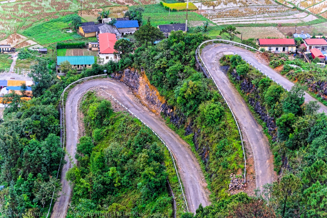
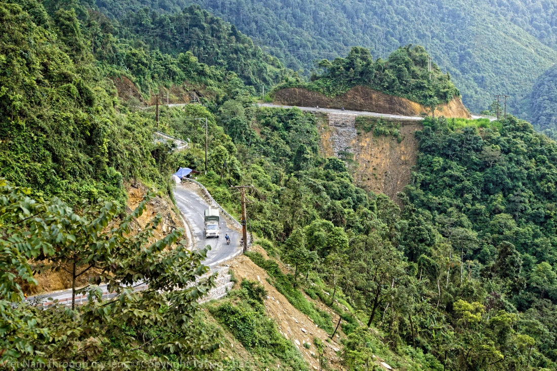
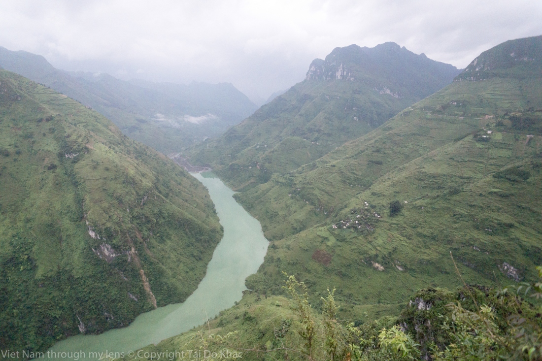
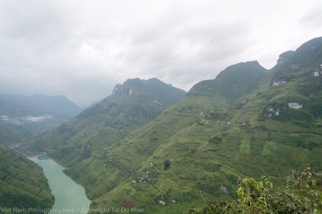
Ma Pi Leng Pass belongs to Ha Giang province; it is dangerous road with 20 kilometers length. Over the Ma Pi Leng, there has a mountain with 2.000 meters height located on the ‚Happiness‘ road connecting Ha Giang, Dong Van and Meo Vac town. Ma Pi Leng began building from the 60s of the 20th century by workers who almost are the H’mong.
The path length is approximately 200 kilometers. Ma Pi Leng Pass is located in the Dong Van Geoparks which is recognized as the global geoparks. The road along the mountainside has romantic, spectacular scenery that is ideal destination for tourists.
Ma Pi Leng Pass is not long but it is the most dangerous pass in the northern border mountain area. It is considered as the “King” of the Vietnam’s pass or Great Wall of Vietnam or the Pyramid of the Meo. At the top of Ma Pi Leng mount is the “happiness” road, there has a stone stele recording the marks in the construction proces.
Scenery in Ma Pi Leng pass is unique with majestic and wild beauty. Looking to the north and northeast, thousands of gray mountains concatenate to the horizon. Net to the road is abyss, below is the Nho Que River with cool water.
Der Ma Pi Leng-Pass befindet sich auf fast 2000 Metern Höhe über dem Meeresspiegel, von dem die Touristen ein wunderschönes Landschaftsbild des Berggebiets im Nordosten bekommen. Auf diesem Pass kann man die Pracht der Berge und Flüsse wahrnehmen, vor allem des Nho Que-Flusses. Der Fluss fließt durch die Berge, die einen eigenen Eindruck vermitteln, den man nirgendwo anders bekommen kann. Hier fühlt man sich klein inmitten der großartigen Natur.“ Wenn man einmal auf dem „Weg des Glücks“ gefahren ist, auf dem Ma Pi Leng gestanden hat und den Nho Que-Fluss gesehen hat, wird man das Wunder der Schöpfung verstehen und erkennen, wie bedeutsam das Leben ist.Le col Ma Pi Leng , situé en mi- chemin entre Meo Vac et à Dong Van , d’une altitude d’environ 2000m au dessus du niveau de la mer, a été créé après un long processus de sédimentation de calcaire , schiste léger, silice il y a environ 426 millions d’années. Les paysages du col Ma Pi Leng se composent des roches fort escarpées , la profonde gorge de la rivière Nho Que qui sépare le sommet du col Ma Pi Leng d’un cote et la porte frontaliere Pun (Sam Pun) de l’autre. Ma Pi Leng est nommé «monument de géologie »dans leGéoparc du plateau karstique Dong Van Ma Pi Leng signifie en Mandarin Chinois « nez de cheval», littéralement. Mais au sens figuré, cela veux dire le sommet difficile où les chevaux s’arretent pour respirer après la montée raide. En dialecte Hmong, c’est Máo Pì Lèng, qui signifie « nez du chat ». En voici quelques photos prises par les photographers du pays
The “ Happiness Road “ was built along Dong Van Rocky Pleataux between 1959 and 1965 with total length of 185km connecting Ha Giang township with islolated mountainous districts of Quan Ba, Yen Minh,Dong Van & Meo Vac; helping local ethnic minorities get access to the plains and better their life.
This history of opening this road is really amazing and can not be told in a single paper page.It was constructed by the hands of more than 1,300 men and women volunteers from 6 mountainous provinces ( Cao Bang, Bac Kan, Lang Son, Thai Nguyen, Tuyen Quang, Ha Giang) and 2 delta provinces ( Nam Dinh, Hai Duong); and more than 1,000 people of 16 local ethnic groups joining in the building process within 7 years.
“ Lebe auf Stein, sei in Stein begraben „, lautet ein Sprichwort, das die Menschen im felsigen Hochland von Ha Giang beschreiben könnte,. Entlang der Happiness Road Highway 4C, auch bekannt als Happiness Road, ist die 200 km lange Hauptstraße, die von der Stadt Ha Giang durch die felsigen Hochlandviertel Quang Ba, Yen Minh, Dong Van und Meo Vac mit hunderten von Haarnadelkurven führt und streckt sich an den Rändern der Abgründe. Im Bau von 1959 bis 1965 wurde die Straße offiziell durch das Blut Schweiß und Tränen von meist jungen Freiwilligen sowohl lokal als auch aus dem ganzen Land gebaut.
In the 1950s &1960s, in Vietnam,there were no modern equipments, volunteers plunged into opening this road with extremely simple working tools of hoes, shovels, hammers, crowbar, wheelbarrow; in really difficult working conditions of food shortages, salt deficiency, lacks of green vegetables & water; under the extreme climates of the highlands – hot summer like roasted, winter cold like cutting meat; and faced up lots of abstacles,dangers & deaths as well.
To make that road, 14 volunteers & workers sacrified their life and permanently laid down on the road with rocks. Therefore, when completed, the road was named “ Happiness” – happy by the unity & effort of young volunteers & workers to build the road with their health & their blood; and happy that Ha Giang lands & thousands of people here are no more isolated. The road open more opportunties for people in the regions with better education, heathcare & better life. It is the way to brighten the future of many children now & forever.
Il y a plus de 50 ans, le haut-plateau rocheux de Dông Van, dans la province de Hà Giang (Nord), n’était accessible par aucun chemin praticable
« Vivre sur la roche, mourir dans la roche » : voilà qui résume bien la vie des habitants de la région montagneuse de Hà Giang.Derrière la «Porte du ciel», plus de quatre-vingt mille personnes vivaient dans la pauvreté. Pour régler ce problème, le gouvernement a décidé de créer la route Hà Giang-Dông Van-Mèo Vac qui traverse sur près de 200 km le plateau de Dông Van et la montagne de Ma Phi Lèng. Mise en chantier le 10 septembre 1959 et achevée le 10 mars 1965, cette voie surnommée «Le Bonheur» est légendaire pour la pénibilité des travaux réalisés par 16 ethnies des provinces de Cao Bang, Bac Kan, Lang Son, Hà Giang, Tuyên Quang, Thai Nguyên, Nam Dinh et de Hai Duong durant les sept années de chantier, totalisant plus de 2 millions de journées de travail.
Les Vietnamiens l’ont renommé la Route du bonheur (Duong Hanh Phuc) car elle donnerait le sourire à ceux qui l’empruntent et surtout, elle permettait aux villages d’être reliés et aux villageois de voyager plus facilement.
Đường được đặt tên là “Hạnh Phúc” dài gần 200km; chạy xuyên qua cao nguyên đá Đồng Văn, qua đỉnh Mã Pì Lèng. Con đường được khởi công ngày 10/9/1959, hoàn thành ngày 10/3/1965. Con đường là huyền thoại về sức trẻ của thanh niên 16 dân tộc thuộc 8 tỉnh Cao Bằng, Bắc Kạn, Lạng Sơn, Thái Bình, Hà Giang, Tuyên Quang, Nam Định và Hải Dương trong suốt 8 năm lao động thủ công quên mình với trên 2 triệu ngày công. Riêng ở dốc Mã Pì Lèng – nóc nhà của vùng cao nguyên đá (hôm nay, là một trong „tứ đại đỉnh đèo“ của miền núi phía bắc), công nhân đã treo mình 11 tháng để mở đường.Ma Pi Leng befindet sich auf dem „Weg des Glücks“, der von dem Stadtzentrum Ha Giang bis zu den Kreisen Quan Ba, Yen Minh, Dong Van und Meo Vac führt. Diese 200 Kilometer lange Strecke wurde damals von tausenden jungendlichen Freiwilligen aus 16 Volksgruppen der 8 Provinzen in Nordvietnam gebaut. Die Bauzeit dauerte von 1959 bis 1965. Für den Bau des Ma Pi Leng-Passes in einer Länge von 20 Kilometern mussten die Jugendlichen damals sich an die Felsen hängen und Minen zur Explosion bringen, um den Weg frei zu machen. Mit einfachen Geräten haben sich die jugendlichen Freiwilligen darum bemüht, den „Weg des Glücks“ für 80.000 Bewohner der Volksgruppe der Mong in vier entlegenen Kreisen in Ha Giang einzurichten.Dong Van – Petit village pittoresque dominé par deux pics calcaires. Du sommet du plus haut, le fortin français de Pu Lo, construit en 1890, évacué en 1945, et parfaitement conservé. On y accède par un petit chemin bétonné prenant derrière le marche couvert . La ville de Dong Van n’a pas de monuments ni de sites particuliers à visiter, hormis son marché du dimanche matin plein de vie et son tout petit quartier historique avec des maisons en pierre d’un style particulier. Mais la route qui y mène depuis Ha Giang a de quoi vous fasciner car elle traverse des paysages karstiques exceptionnels.
Dong Van Old Town: located in the middle of valley surrounded by rocks. The quarter is formed form the early 20th century, only has a few families of the H’mong, Tay and Chinese, gradually, more and more other local residents find it. The oldest house is the house of Luong family built since 1860. The common architecture here is the two-story house and yin and yang roofs. The lifestyle and daily life of ethnic people such as: Kinh, Tay, Mong, Hoa… is very impressive.
Dong Van est surtout la “porte d’entrée” de la route la plus extraordinaire qu’il nous ait été donné de voir en 40 ans de bourlinguage, Dong Van-Meo Vac. 13km de bonne route étroite en lacets accrochée a flanc de montagne monte le col de Ma Pi Leng. FABULEUX désert minéral dans lequel vivent pourtant les fameux H’mong noirs –on se demande comment ! Sur les pentes de rocaille, ça et là, une maison H’mong en pierres noires à peine visible au milieu des rocs de granit; aucune piste ne semble y conduire.
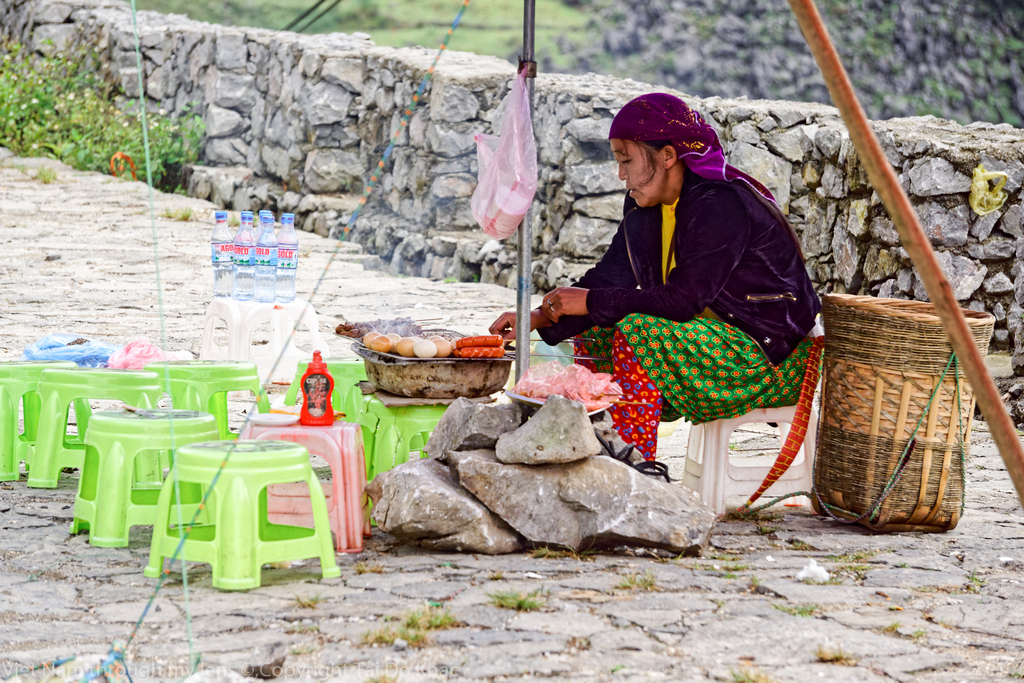
The Dong Van market is held every Sunday. On sale are local products made by Mong, Han, Dao, Giay and Tay ethnic people. To reach the market on time they have to leave their homes very early in the morning or even one day earlier. In there, both single and married people in different ethnic groups can come to find ones’ ideal life-partner and sharing their feeling and understanding to each other.
Pho Bang, the home of Hoa and Mong ethnicities, was once the administrative-political-social capital of Dong Van distric. Since the administrative center was moved to the ancient quarter of Dong Van district, Pho Bang village has become calm and peaceful. Pho Bang- a peaceful town on Dong Van Karst Plateau Ha Giang impresses visitors with its high karst plateau, steep hills, winding roads and ethnic diversity. In Dong Van district of Ha Giang province, there is a place of serenity where man is delicately balanced with nature. That is Pho Bang township. Pho Bang, the home of Hoa and Mong ethnicities, was once the administrative-political-social capital of Dong Van distric. Since the administrative center was moved to the ancient quarter of Dong Van district, Pho Bang village has become calm and peaceful. Pho Bang is hidden between the centuries-old limestone mountains. It is hard to imagine that this tiny town was once the capital of the entire region. Here, there are only two main streets and dozens of clay houses with tiled roofs and walls and doors decorated with ancient parallel sentences in Chinese. Pho Bang’s tranquility is broken only once a week on market day when you can buy tools or food or just observe. Go to this small town to forget the troubles of your daily routine and enjoy a breath of fresh air.
Khu phố cổ được hình thành từ đầu thế kỷ 20, ban sơ chỉ có vài gia đình người Mông, người Tày và người Hoa sinh sống, dần dần có thêm nhiều cư dân địa phương khác tìm đến. Nhìn tổng thể, khu phố cổ mang đậm dấu ấn kiến trúc của người Hoa với những ngôi nhà hai tầng lợp ngói âm dương, những chiếc đèn lồng đỏ cao cao…
Đêm đến ánh đèn dầu từ mỗi chiếc bàn chỉ đủ soi lờ mờ. Trong không gian ấy đôi khi có tiếng kèn môi của chàng trai Mông trong giai điệu gọi bạn tình. Vào đêm cuối tuần, quán lại rộn ràng với những chàng trai, cô gái từ các bản được chủ quán mời về hát những bài dân ca, thể hiện những điệu múa giao duyên…
Từ trên cao nhìn xuống, bên ba dãy chợ xếp thành hình chữ U lợp ngói âm dương là hai dãy phố cổ chạy vào chân núi. Một khu dân cư chủ yếu là người Tày với hàng chục ngôi nhà cũ dựng bởi những người thợ ở Tứ Xuyên sang làm thuê và được xem như một phần quan trọng của phố cổ Đồng Văn. Theo tài liệu từ một cuộc hội thảo về phố cổ Đồng Văn thì tại khu vực này còn khoảng trên dưới 40 ngôi nhà cổ có tuổi đời trên dưới 100 năm, cá biệt có những ngôi nhà gần 200 năm như nhà ông Lương Huy Ngò, người Tày và được xây dựng từ khoảng năm 1860.
Kiến trúc ở đây phổ biến là nhà hai tầng trình tường, lợp ngói âm dương. Riêng khu vực chợ Đồng Văn, còn có nhiều nhà cổ kiểu ống để tận dụng mặt tiền như phố cổ Hà Nội.
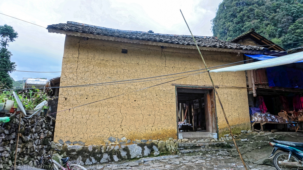
Die Kleinstadt Dong Van befindet sich auf einem Kalkplateau, das auf einer Höhe von 1600 Metern über dem Meeresspiegel liegt. Die Dong Van Altstadt besteht seit Anfang des 20. Jahrhunderts. Damals wohnten in der Altstadt nur einige Familien der Volksgruppen Tay, Chinesen und Mong. 1920 veränderten die Franzosen die Architektur dieser Altstadt durch die Verwendung von Lateritsteinen zum Hausbau. Vor jedes Haus hängt man Laternen, um die extreme Kälte in der nördlichsten Region des Landes zu durchdringen, wenn die Dunkelheit kommt. Neben den Häusern aus Lateritsteinen befinden sich in der Altstadt Trinh Tuong-Häuser aus Lehm.
Thang Co is commonly known as special food, tradition dish of Mong ethnic people in Ha Giang high – land region and other North Pole region. Nowadays, Thang Co is a delicious and familiar dish of high – land people. When lowland people are proud of pho, high – land people pride on Thang Co. The colder it is, the more delicious Thang Co is.
Thang Co is processed from many parts of a horse, including head, legs, types of meat, intestine and other specific ingredients. Thang Co is usually eaten with men men (special corn of Mong people), baked corn cake … According to Han – Vietnamese meaning, “thang” means soup, “co” means pan, Thang Co means a pan of soup. This is a typical dish of high-land community. In the past, Thang Co was only made of horse meat because of its deliciousness. However, at present,
Thang Co can be processed by other cattle meat like buffalo, cow, goat. Therefore, its name “Thang Co” is usually followed by specific cattle such as buffalo Thang Co, cow Thang Co, goat Thang Co. Thang Co is not only tasty but also showing the community’s cleverness, gastronomy and cultural beauty.
In Dong Van – the cold stone land, to fight the gloom air emanating from the rocks, one must eat something really hot, so hot air. But a “cold dish” of egg rolls, such a specialty of the border land, used with hot, sweet and tasty soup cooked from bone, is still preferred by people here. When the sauce gets ready, all you need to do is just dip the thin piece of rice, wrap with red color of egg yolk and enjoy everything which is deep in the self-made sauce to experience the strange and delightsome flavor of the remote land.
It is the ground pork, minced wood ear mushroom and onions which are not put inside the roll but over it and the egg which is added in the process of spreading rice flour over a fabric-covered pot that make this a special dish. The special sauce that accompanies the dish is one more special thing about rice wrapper rolls with egg in Ha Giang. Not the fish sauce that is usually available at most places offering rice rolls in other parts in the country but it is a hot broth which is cooked from pork bone and added with a stick of scallion and grilled chopped meat.
Only when guests place orders will these vendors prepare rice wrapper rollers with egg. When tasting very hot steamed rice rolls, gourmets can definitely feel and see the soft egg yolk under the thin and white layer of the egg white as well as the steamed rice paper. Together with the light sweet savor of the hot broth, this dish is a suitable treat for any travelers coming to this mountainous province.
Không giống như bánh cuốn ở dưới xuôi, chỉ là thớ bánh ăn chung với ít hành và chấm cùng bát nước chấm hồn hợp thì bánh cuốn trứng ở du lịch Hà Giang đặc biệt hơn nhiều. Bánh cuốn ở đây khi được tráng trên bếp được đập thêm trứng rồi dùng chính lớp bánh trắng ngần ấy gói lại. Khi ăn sẽ ăn kèm với một bát nước lèo nóng hổi thả giò trắng thơm ngon ở trong. Bát nước dùng ăn cùng bánh cuốn trứng còn có ít hành và 1 hoặc 2 chiếc giò. Bánh cuốn trứng ở du lịch Hà Giang có hương vị rất độc đáo, lòng đỏ trứng ngầy ngậy, bọc mờ bên ngoài bằng một lớp bột bánh dai dai pha vị xốp đặc trưng của lòng trắng trứng. Dùng đũa khéo léo lật mép bánh sẽ thấy lòng đào vàng ươm, sánh ngậy chảy ra. Lúc này phải ăn ngay, nhanh tay chấm miếng bánh vào nước mắm nóng hổi, đưa lên miệng thưởng thức miếng bánh tan dần ra, hòa cùng vị đậm đà của nước chấm rất “đã” của vùng đất du lịch Hà Giang này.
Au tau porridge in Dong Van – cháo ấu tẩu
One dish that you should not miss when travelling in Dong Van is Au tau porridge. Au tau porridge is a famous specialty that if you go to Ha Giang but have not yet tried it, which means you have never visited here. This porridge is made from rice and then people add some special spices, especially “Au tau” – the main ingredients of the dish. Visitors in the first time trying this porridge may find it is difficult to eat but after that they all love its taste. The cold weather in that province helps people create this porridge which help them keep warm. Au tau porridge has a little bit of bitter taste but this also its attractive taste. Au tau porridge is made from glutinous rice, pig’s trotter and “au tau”. “Au tau” is cleaned then soaked in rice water for a night. The soaked au tau is stewed in 4 hours. In some area, au tau and pig’s trotter are mixed with porridge when customers order porridge.
Ấu tẩu là loại củ rừng, trông gần giống như củ ấu ở miền xuôi, vỏ cứng, màu đen, nhiều cạnh sắc nhọn. Củ ấu tẩu còn có tên gọi là âu đầu và phụ tử, thường mọc ở vùng núi cao, khí hậu lạnh, nhưng bản thân lại có vị tê, tính nóng, có tác dụng chữa bệnh. Vì vậy, đồng bào Mông nấu cháo này để giải cảm, hoặc dùng để ngâm rượu xoa bóp đau chân. Sau này, người Hà Giang thêm một số gia vị vào để trở thành món ăn nức tiếng như bây giờ. Cùng với hương vị độc đáo, cháo ấu tẩu nổi tiếng bởi phần độc. Chất độc trong củ ấu tẩu thuộc hàng kịch độc. Chỉ sơ sẩy một chút là có thể bị mất mạng. Nhưng lạ thay, món ăn độc đáo này cũng mê hoặc được không ít thực khách đến với Hà Giang. Bản chất cháo ấu tẩu rất độc, muốn bớt tính độc cũng có bí quyết riêng. Củ ấu tẩu để nấu thành cháo phải qua công đoạn rất khắt khe. Cháo phải được ninh kĩ trên 11 tiếng đồng hồ, cần có ngần ấy thời gian mới loại bỏ hết độc tố ra khỏi củ. Khi thấy củ bở tơi, mềm như bột là được. Bột củ được nấu cùng với gạo nếp và nước ninh từ chân giò lợn. Gạo nếp cũng phải là loại gạo nếp cái trên nương của đồng bào dân tộc. Chân giò cũng phải chân giò lợn cắp nách nấu mới đúng vị. Qua một số công đoạn sẽ cho ra một bát cháo ấu tẩu hoản hảo. Nấu xong, múc ra bát, cho thêm trứng gà, ớt, tiêu hành, rau mùi, tía tô và du khách có thể thưởng thức ngon lành. Vị đăng đắng nhẹ của củ ấu, quyện với nước ninh chân giò đánh vào mùi trắng gà, lại thêm nồng hương tia tô, cái cảm giác một lần khiến ta nhớ mãi.
Soupe Ấu tẩu (Cháo ấu tẩu)
En se promenant dans Dong Van à l’hiver, on peut facilement trouver un petit restaurant et déguster la soupe de Ấu tẩu. Ce plat est délicieux par sa combinaison parfaite de riz gluant à gros grains mélangé avec u riz classique cultivé dans les champs, de la macre légèrement grasse, du potage de jambonneau, et quelques épices, ajouté à la viande hachée. Une fois qu’on a goûté à cette soupe, on en redemande encore !
Nếu một ngày em lặng lẽ quay lưng Xin anh đó ..đừng bao giờ níu giữ Chỉ vậy thôi..với em là quá đủ Im lặng rồi…mọi thứ ..sẽ nguôi ngoai…!
Nếu một ngày..con đường ấy rẽ hai… Hãy vui lên ,vững vàng anh tiến bước Nghĩ thật nhiều về con đường phía trước Đừng bận tâm chuyện quá khứ làm gì…!
Nếu một ngày hai đứa sẽ chia ly… Mình em thôi…được nhớ về ký ức Dẫu có đôi lần con tim em buốt nhức.. Em vẫn bằng lòng để được nhớ về anh…!
Ngọc Hân
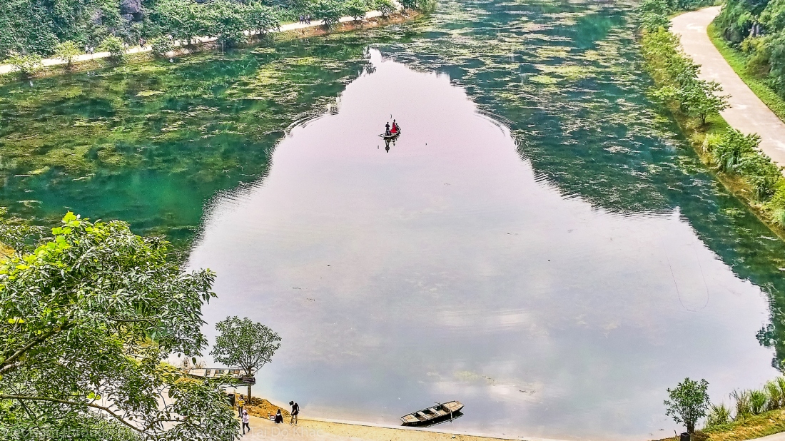
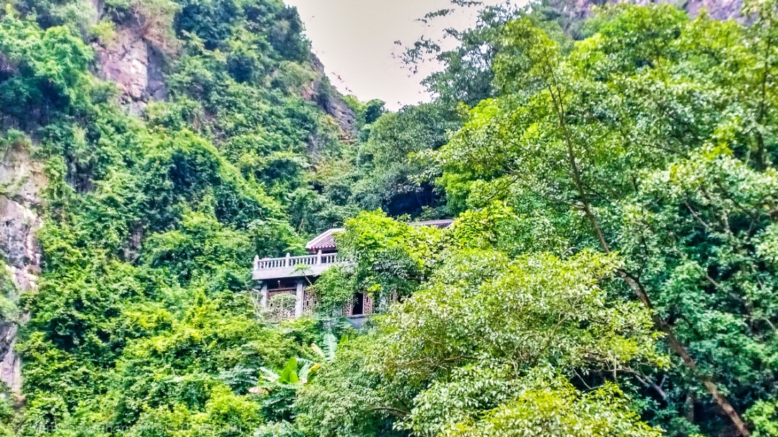
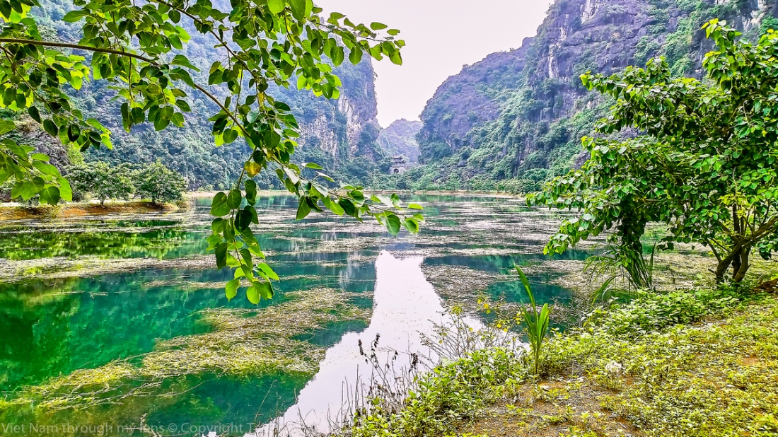
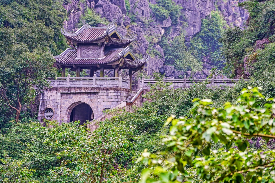
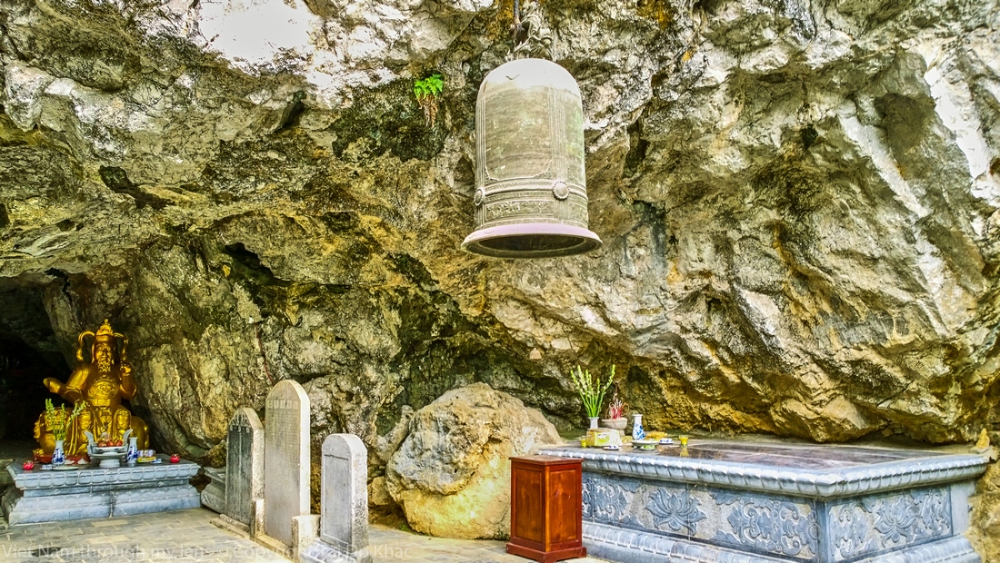
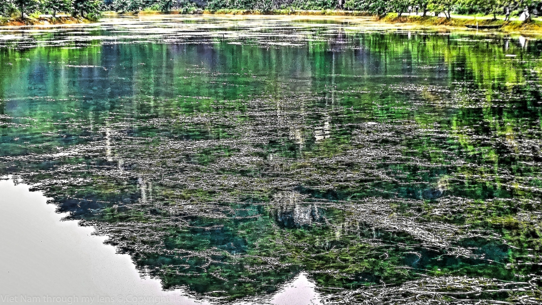
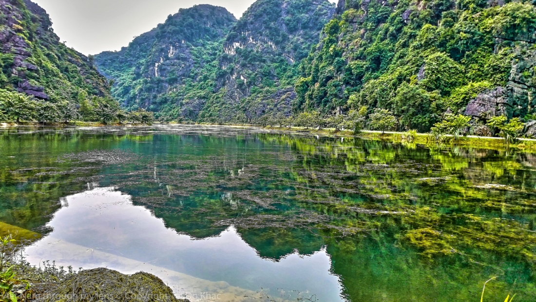
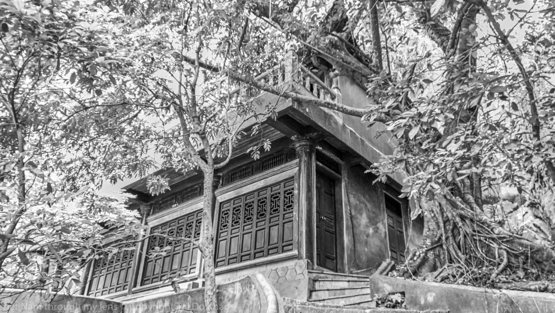
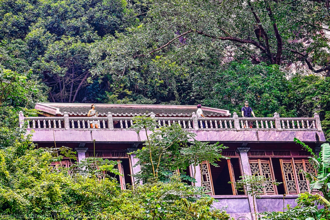
Động Am Tiên nằm trong quần thể di tích cố đô Hoa Lư, nơi vua Đinh Tiên Hoàng từng nuôi hổ báo, xây pháp trường, đồng thời có ngôi chùa Thái hậu Dương Vân Nga tu hành cuối đời.
Trên núi có chùa Am Tiên. Đây cũng là nơi những năm cuối cuộc đời, Thái hậu Dương Vân Nga xuất gia tu hành.
Em và Anh đường đời hai lối mộng Yêu nhớ nhiều rồi cũng vẫn chia xa Thời gian qua dẫu tha thiết mặn mà Đành cam phận chia ra tình hai ngã.
Về đi anh bóng chiều buông trên lá Mây cuộn về, trời cũng đã sắp mưa Có gì đâu chỉ một chút hương thừa Ôm giữ mãi sớm trưa thêm cay đắng.
Hãy quay lưng và lặng thầm bẽn lẽn Dù xé lòng…nước mắt nhớ đừng rơi Không còn nhau và gọi cố nhân rồi Thì chấp nhận chia đôi mình tan vỡ.
Em cùng anh mình đâu ngờ không nợ Năm tháng dài ôm nhớ chỉ buồn thêm Gió thổi ngang chiếc lá rớt bên thềm Mang nước mắt tình em ngày xưa đó.
Cỏ Hoang Tình Buồn
20°16’47“ N 105°54’39“ E
Chùa động Am Tiên được bao quanh 4 bề là núi, tạo ra một thế giới riêng biệt. Phong cảnh nơi đây hùng vĩ, nên thơ nhưng ám một màu u buồn, huyền bí như còn lưu dấn ấn tàn dư của pháp trường năm xưa.
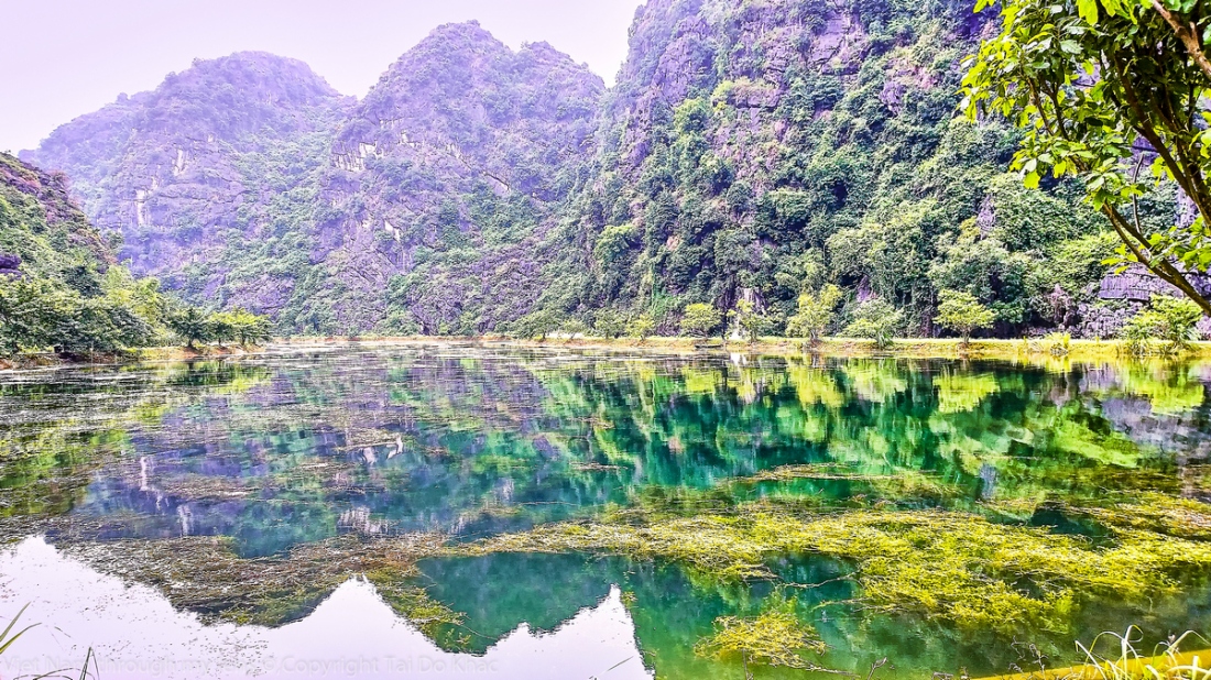
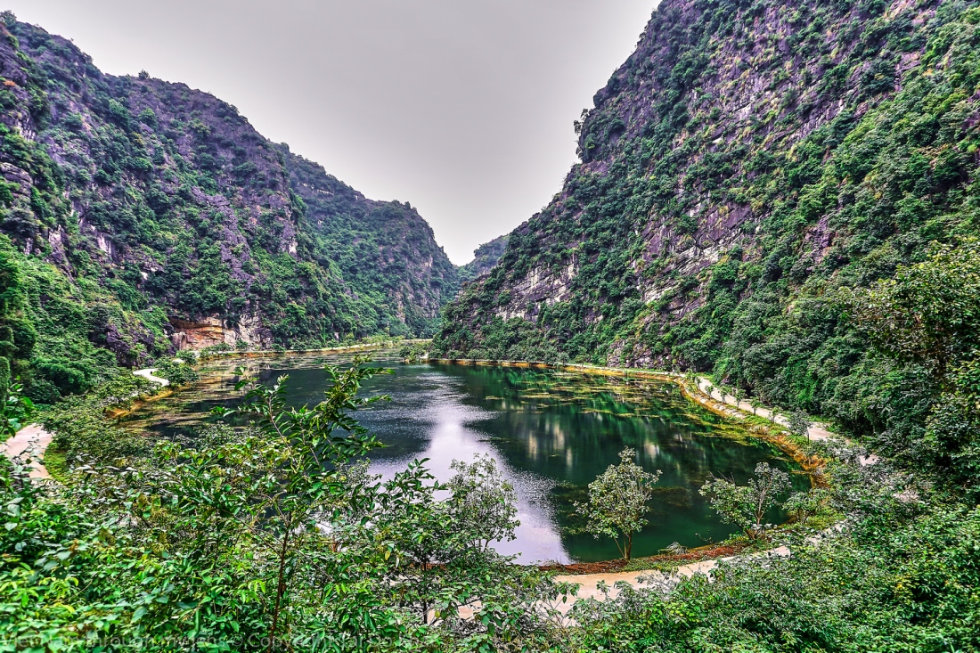
Phần lớn khu vực động Am Tiên là thung lũng ngập nước, được bao bọc xung quanh bởi vách núi đá.
Thu về sông núi bỗng tiêu sơ Cây rũ vườn xiêu, cỏ áy bờ Xử nữ đôi cô buồn tựa cửa Nghe mùa gió lạnh cắn môi tơ
Sương phủ lưng đồi rặng núi xa Thương ôi! Lữ khách nhớ quê nhà Mấy thu mưa gió ngoài thiên hạ Vườn cũ còn chăng cúc nở hoa?
20°16’46“ N 105°54’38“ E
Nhìn xuống ao Am Tiên
Động Am Tiên ở lưng chừng núi, để đến được đây phải leo qua 205 bậc đá qua vách núi. Động có hình giống như miệng con rồng nên còn được gọi là hang rồng.
Đến thời Lý, nhà sư Nguyễn Minh Không đã ở trong hang tụng kinh thuyết pháp, xây thêm các bệ thờ Phật ở trong hang, người đời sau tiếp tục mở rộng cảnh chùa chiền để khách thập phương hành hương đến đó. Hiện tại, hang chính của động Am Tiên vừa là một chùa đá thờ phật và thiền sư Nguyễn Minh Không, vừa là một đền thờ các vị danh nhân thời Đinh như 2 cha con quan Trương Ma Ni và Trương Ma Sơn cùng thái hậu Dương Vân Nga.20°16’55“ N 105°54’52“ E
ao Giải Oan.
Nước ở đây đặc biệt trong xanh, có thể nhìn thấy tận đáy với nhiều rong rêu. Tương truyền nơi đây từng là ao nuôi giải thời xưa.
Gió thì thầm lay nhẹ những hàng cây Lá xào xạc rơi đầy con ngõ vắng Bên song cửa một tâm hồn trĩu nặng Tiếng tơ lòng văng vẳng khúc sầu đau
Đêm khuya rồi mây tím phủ một màu Không gian lặng… tìm nhau trong nỗi nhớ Bên ngực trái dường như đang loạn thở Cứ dập dồn muốn bung vỡ làm đôi
Kỷ niệm yêu dâng cảm xúc bồi hồi Hai miền nhớ thúc thôi vòng tay xiết Muốn ôm trọn trái tim khờ mãnh liệt Như Ngọc Lan tinh khiết tỏa hương nồng
Đêm khuya rồi sao vẫn cứ ngóng trông Trăng rọi khắp… cô phòng…thêm hiu quạnh Khung trời thẳm ngàn sao đang lấp lánh Sương đọng dần buốt lạnh nụ cười hoa
Mắt lim dim nghe những bản tình ca Dòng lệ thắm nhạt nhòa theo lời hát Mùi Hoa Sữa thoảng về thơm ngào ngạt Nhớ thương người… mặn chát cả bờ môi.
Song Linh
Những năm cuối cuộc đời, thái hậu Dương Vân Nga cũng xuất gia tu hành ở chùa Am Tiên. Một bài thơ truyền khẩu khắc được trên tường chùa đã tóm tắt phần nào cuộc đời và sự nghiệp của Hoàng Hậu Dương Vân Nga: Hai vai gồng gánh hai Vua Hai triều hoàng hậu, tu Chùa Am Tiên Theo chồng đánh Tống bình Chiêm Có công với nước, vô duyên với đời.
Tình yêu như nắng, nắng đưa em về, bên giòng suối mơ Nhẹ vương theo gió, gió mang câu thề, xa rời chốn xưa Tình như lá úa, rơi buồn, trong nỗi nhớ Mưa vẫn mưa rơi, mây vẫn mây trôi, hắt hiu tình tôi
Nhìn xuống ao Am Tiên
Tình yêu như giấc mơ Tình yêu như nắng vàng Chợt đến rồi bay vút xa Biết tìm đâu hỡi tình Tình yêu như có cánh,đến trong mơ cùng em Nói với em lời yêu,nói thương em trọn đờiCòn đâu nữa tiếc nuối mà chi cho lòng nhớ.. Chờ em mãi trong những giấc mơ, Dù cho em xa cách chân mây, Lòng anh vẫn nhớ mãi về em bao giờ quêntuyệt tình hoa
Sàng tiền minh nguyệt quang, Nghi thị địa thượng sơn. Cử đầu vọng minh nguyệt, Đê đầu tư cố hương.
Đầu giường ánh trăng rọi, Mặt đất như phủ sương. Ngẩng đầu nhìn trăng sáng, Cúi đầu nhớ cố hương.


 Das Dutzend Austern geht übrigens – pur mit Zitrönchen – für nur 15 Australische Dollar (zehn Euro) über den Tresen.
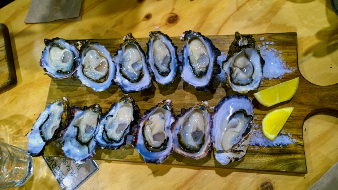


 Dong Van karst plateau Geopark consists of four districts, namely, Meo Vac, Dong Van, Yen Minh, Quan Ba. Located in the North of Ha Giang province – Viet Nam.